Semi-Alcoholic Traverse
A high-alpine beauty of a traverse!
Trail Running Extreme
- Distance
- 24 km
- Ascent
- 2.3 km
- Descent
- 2.2 km
- Duration
- 5-6 hrs
- Low Point
- 1.3 km
- High Point
- 2.2 km
- Gradient
- 24˚

The original Alcoholic Traverse connects Brandywine to Brew Peaks. With changes to access, Brew Peak is more difficult to reach so there are several variations. Connecting Brandywine, Cypress Peak, and Tricouni Peak offers an awesome linkup of alpine scrambling. There are many possible options for directions and route choice so as long as you have a good understanding of the exits, you can really make it your own adventure.
- •
- •
- •
Description
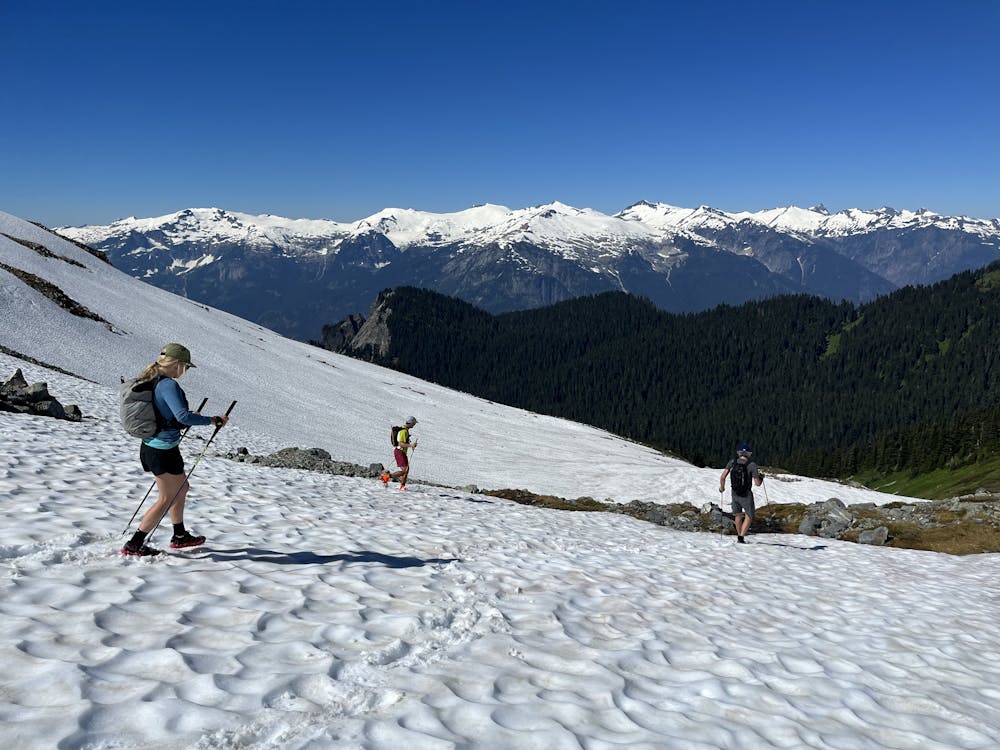
This version started at Brandywine on the hiking trail. This area is well established and leaving a car here is pretty safe. Continue up to the summit via the scramble route, then drop off the backside to hit the ridge out towards Mt. Fee. Follow snow slopes and benches to shortcut the ridge slightly but for the most part you’re pretty close to the crest.
Before reaching Mt. Fee, detour into meadows and snow slopes on the west side of the mountain. This makes for easy travel. The true summit of Fee is lose volcanic 5th class rock and has only been reached a handful of times. Continue onto the dwindling west glacier and around the back of Fee. This glacier gives access back to the ridge crest south of Fee and more easy travel past the headwaters of Shovelnose Creek. This entire section has awesome views of Fee and Cayley.
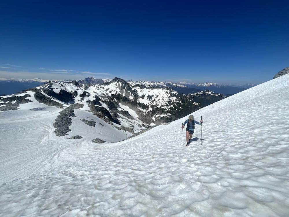
From here, stick generally to the ridge. Some scrambling can be avoided on the left side early on. Eventually the terrain mellows off and becomes more volcanic again. Here you can avoid a few sub-summits by sticking to snow slopes on the right side. These may be scree later on necessitating sticking to the ridge.
Approach Cypress Peak and link into the Standard Route as you arrive at the N Ridge. This is a step of 4th class out of the col then easy cruising to the top (one variation here would be to then exit via the scramble route to the Roe Creek Logging Road).
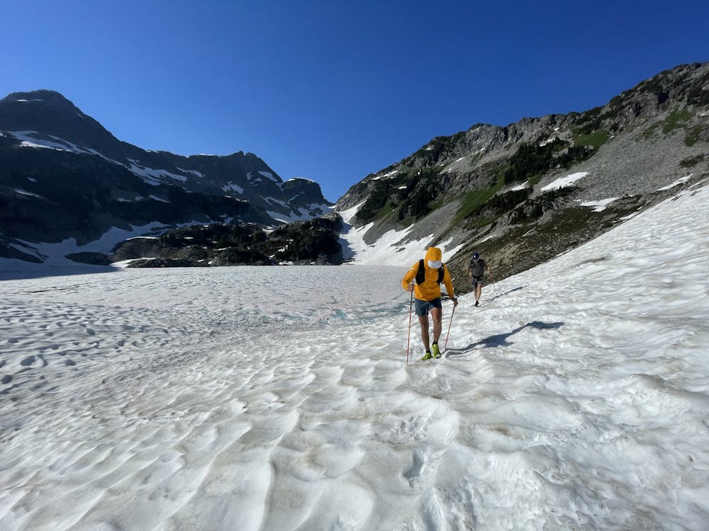
To continue, D escend to the snowfield west of the peak and then follow snow benches on the east side of the divide towards Tricouni Peak. You’re aiming for a big col that looks like a very steep slope. It’s not as steep as it looks but could be later season or if it’s icy.
From the col, traverse snow slopes to the scrambling route up Tricouni and follow it to the 4th class summit block. Down-climb back to where you joined the scramble route and turn left to descend scree into the snow basin to your left. This next section is the navigational crux of the day (and alternative here would be to descend the scramble route out on the Squamish Valley Road side). Scramble up rock slabs to hit the ridge crest and descend to a snowy shoulder (do not continue up the next sub summit towards the lower col). Keep watching left for a somewhat hidden 3rd class gully that drops left off the crest to scree and the snow slopes above Berg Lake. If you haven’t scoped this before, it’s not obvious. This is definitely worth checking out. If you do end up at the lowest col on the ridge, it’s possible to descend scree slopes on the west side of the lake.
From Berg Lake, follow the hiking trail out to Chance Creek FSR!
Depending on where you start and finish, route finding can be more or less difficult. It’s possible to keep this route at entirely third class by skipping the summits. On the south end, you can use 4 trailheads, two on Tricouni: Chance Creek (described) or Squamish Valley/BR12; one on Cypress (Roe Creek); or one on Brew. Check road conditions to make sure you can actually access your trailhead! There is also commonly logging on all these roads.
Both directions are viable as well though N->S is slightly less elevation gain.
You can stick true to the crest or bypass sections of the ridge. Water is generally easy to find off the ridges throughout the route.
It’s best to hit this when the ridges have melted but some snow remains to cover scree. Late season would be drier and slower travel without much glissading.
Difficulty
Extreme
Medium Exposure

The trail contains some obstacles such as outcroppings and rock which could cause injury.
Remoteness
Away from help but easily accessed.