Goats -> Grizzly Bear -> AK DNR
One of the most technical and high-commitment lines on Montana Mountain.
Extreme Mountain Biking
- Distance
- 6.3 km
- Ascent
- 341 m
- Descent
- 341 m
A technical loop filled with rock slabs and wooden skinnies.
Mountain Biking Severe

The Goats Trail is another classic technical downhill trail in the Montana Mountain Trail System. It's one of the higher trails on the mountain, and you can connect from Goats into several different trail options via the connecting trails at mid-mountain.
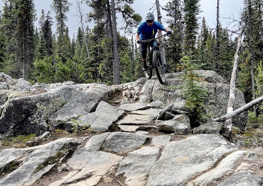

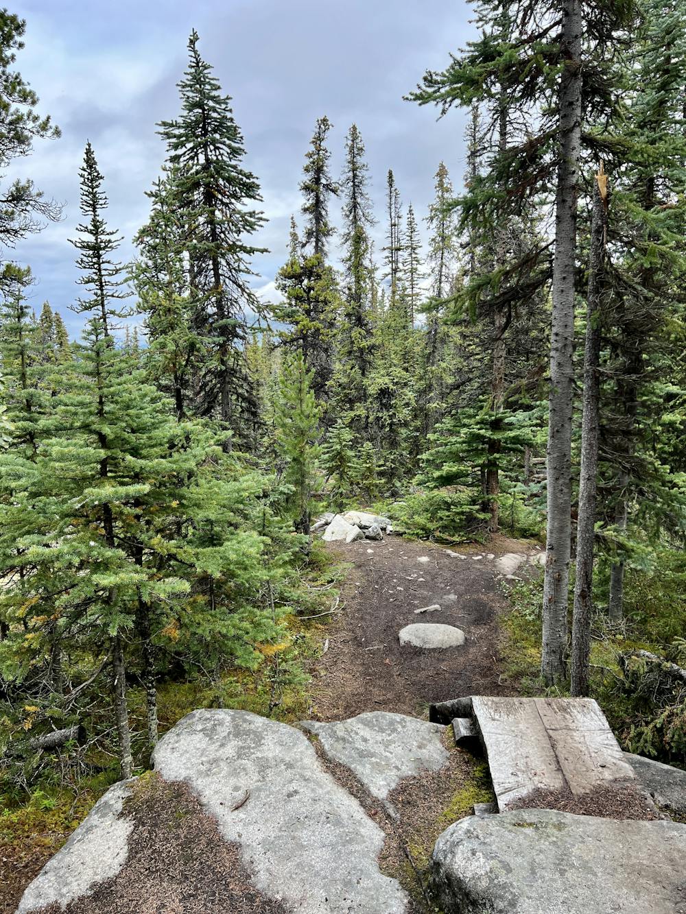
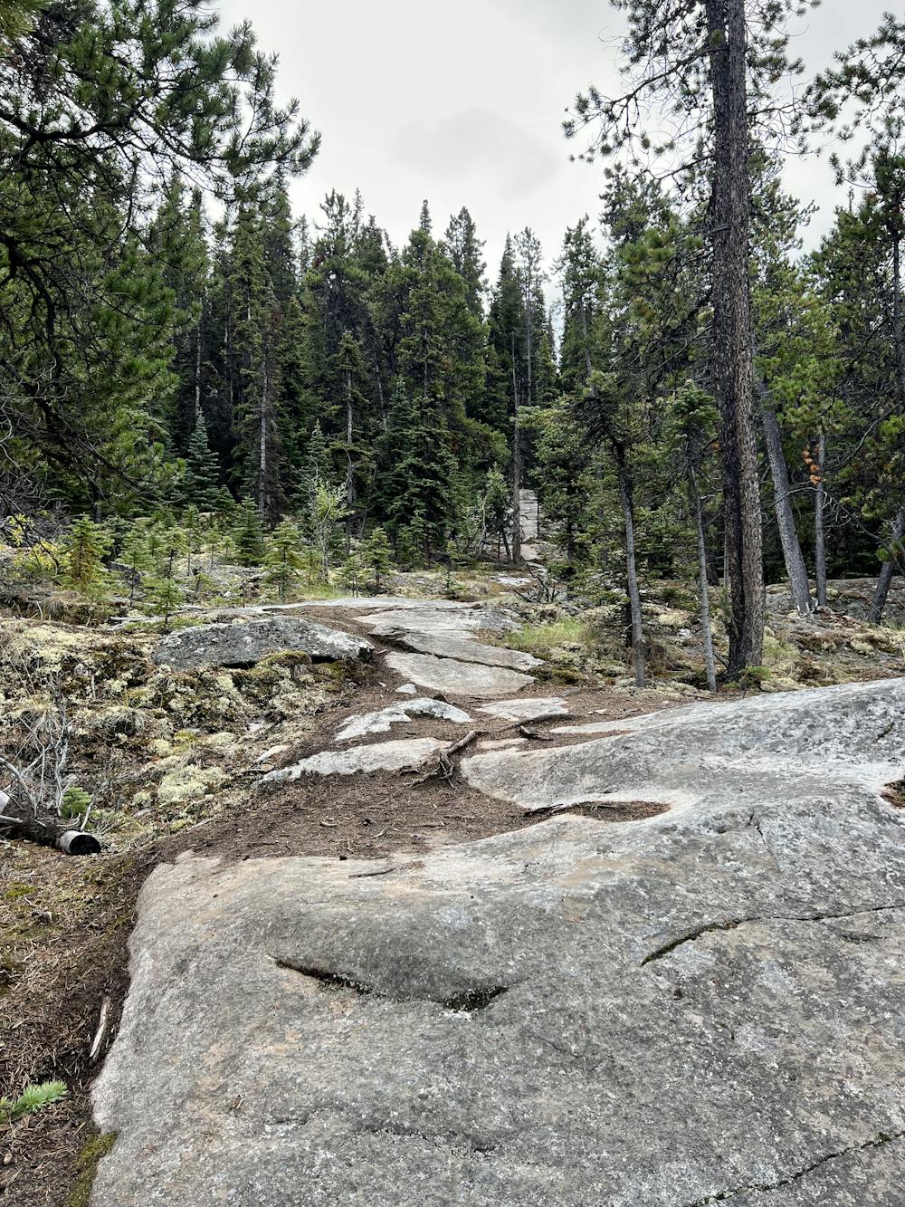
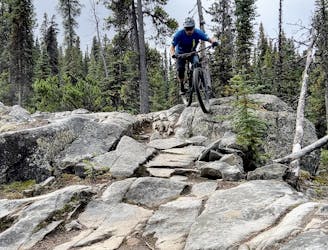
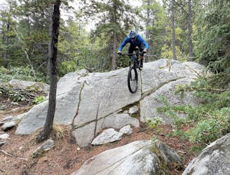
In comparison to Wolverine, the riding on Goats is a bit more committing. A lot of the technical features on the trail will funnel into just one line option, which may or may not have a ride around. There are some fairly big slabs, rock rolls, and rock gardens, and some fantastic steep shots. One of the final rock slabs is a massive feature that rolls through a downhill righthander, dropping through a channel in the rock.
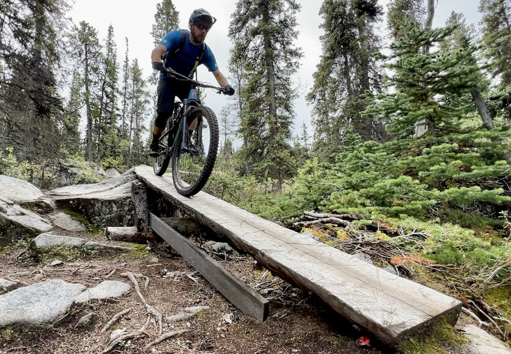
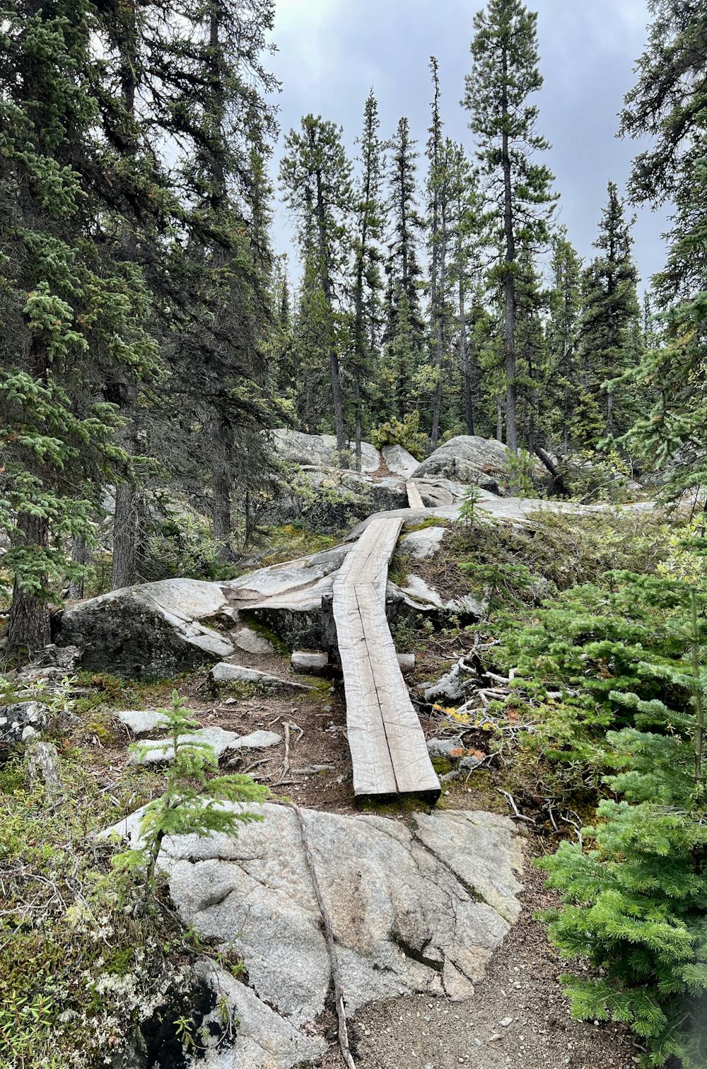
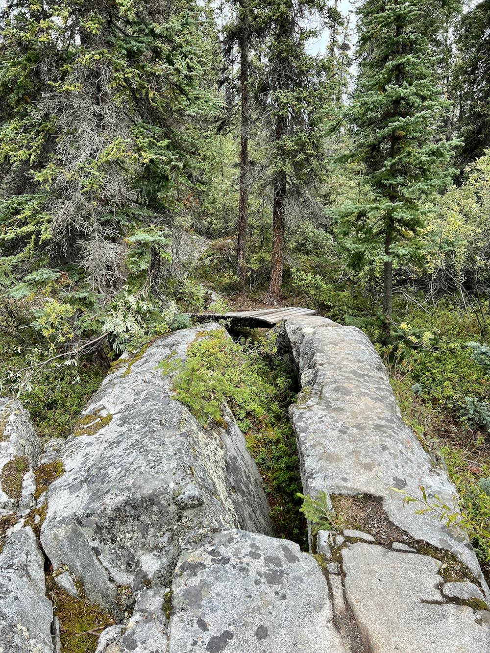
Also, you'll encounter some very narrow mandatory skinnies on this trail, a few of which get a bit far off the ground—you don't want to mess these up! There aren't really any ride-around options for these skinnies. You could potentially walk around them if you want to, but these features function as "squirrel catchers" (as the Canucks like to say), meaning that if you can't ride these skinnies, then maybe you shouldn't be on this trail in the first place.
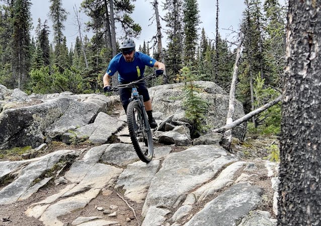
In classic Montana Mountain style, you'll soon find plenty of places where the skinnies and rocks combine. There are skinnies spanning gaps ending in rock rolls, rock rolls that run out on skinnies... the trail building here is simply superb! It's no wonder Carcross has become such a famous mountain bike destination!
The Wolf Trail is a natural continuation below Goats and maintains much the same riding style. The trail is quite a bit loamier and rootier than Goats, but it does end with a fantastic rock slab to finish.
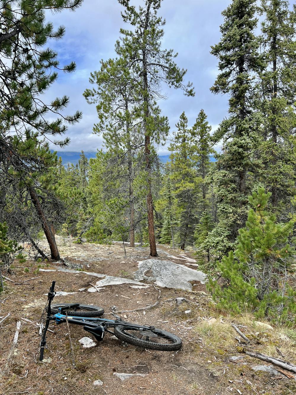
Finally, this ride wraps up on AK DNR, which is simply a mellow flow trail finish that rolls down to the trailhead. Be careful not to overcook these features, as they're pretty small, and the berms aren't very big!
Severe
Widely variable, narrow trail tread with steeper grades and unavoidable obstacles of 15in/38cm tall or less. Obstacles may include unavoidable bridges 24in/61cm wide or less, large rocks, gravel, difficult root sections, and more. Ideal for advanced-level riders.

Some trail sections have exposed ledges or steep ascents/descents where falling could cause serious injury.

Away from help but easily accessed.
One of the most technical and high-commitment lines on Montana Mountain.
Extreme Mountain Biking
Multiple line options and entertaining obstacles make Wolverine a true crowd-pleaser.
Severe Mountain Biking
3.7 km away

An easily-accessible enduro shuttle run with fantastic features and multiple line options.
Severe Mountain Biking
3 routes · Mountain Biking
7 routes · Mountain Biking
10 routes · Mountain Biking