Far West
El Colorado
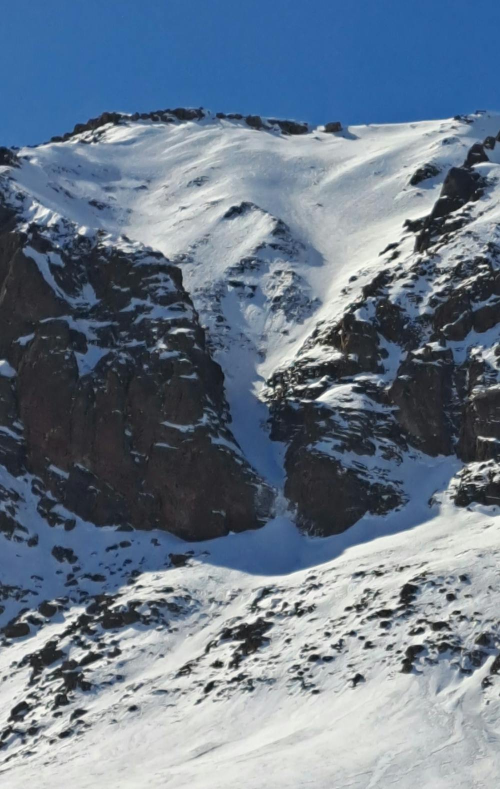
Sector Santa Tere
Probablemente el mejor bowl de la zona central, con un canalon al final que tiene un drop obligatorio de cascada de hielo de ~5 metros dependiendo la temporada
Freeride Skiing Severe
- Distance
- 790 m
- Ascent
- 0 m
- Descent
- 502 m
- Low Point
- 2.4 km
- High Point
- 2.9 km
- Gradient
- 44˚

This is a popular freeride skiing route which is generally considered to be severe. It's not remote, it features medium exposure (e2) and is typically done between July and September. From a low point of 2.4 km to the maximum altitude of 2.9 km, the route covers 790 m, 0 vertical metres of ascent and 502 vertical metres of descent.
Description
Al igual que la descripcion, esta linea no es para timidos. Hay un gran riesgo en esta linea ya que la parte de abajo suele estar lleno de rocas.
Difficulty
Severe
Steep skiing at 38-45 degrees. This requires very good technique and the risk of falling has serious consequences.
Medium Exposure (E2)

As well as the slope itself, there are some obstacles (such as rock outcrops) which could aggravate injury.
Remoteness

Close to help in case of emergency.
Best time to visit
Features
- Bowl
- Cliffs
- Couloir