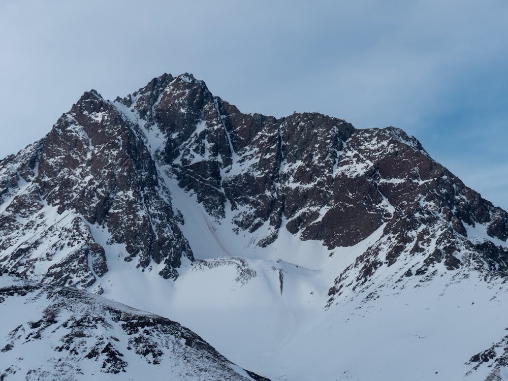
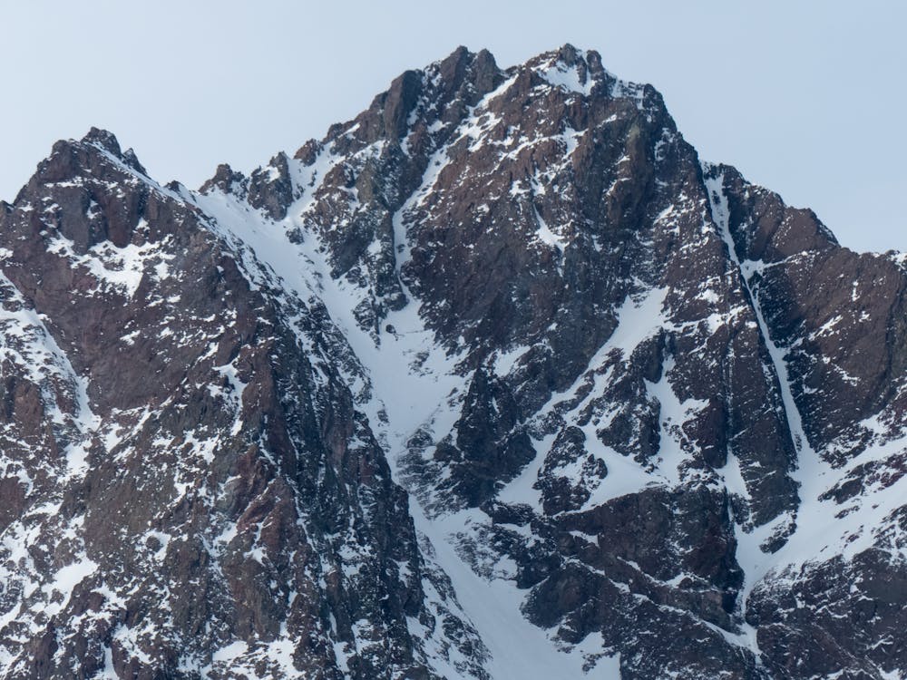
Punta Negra
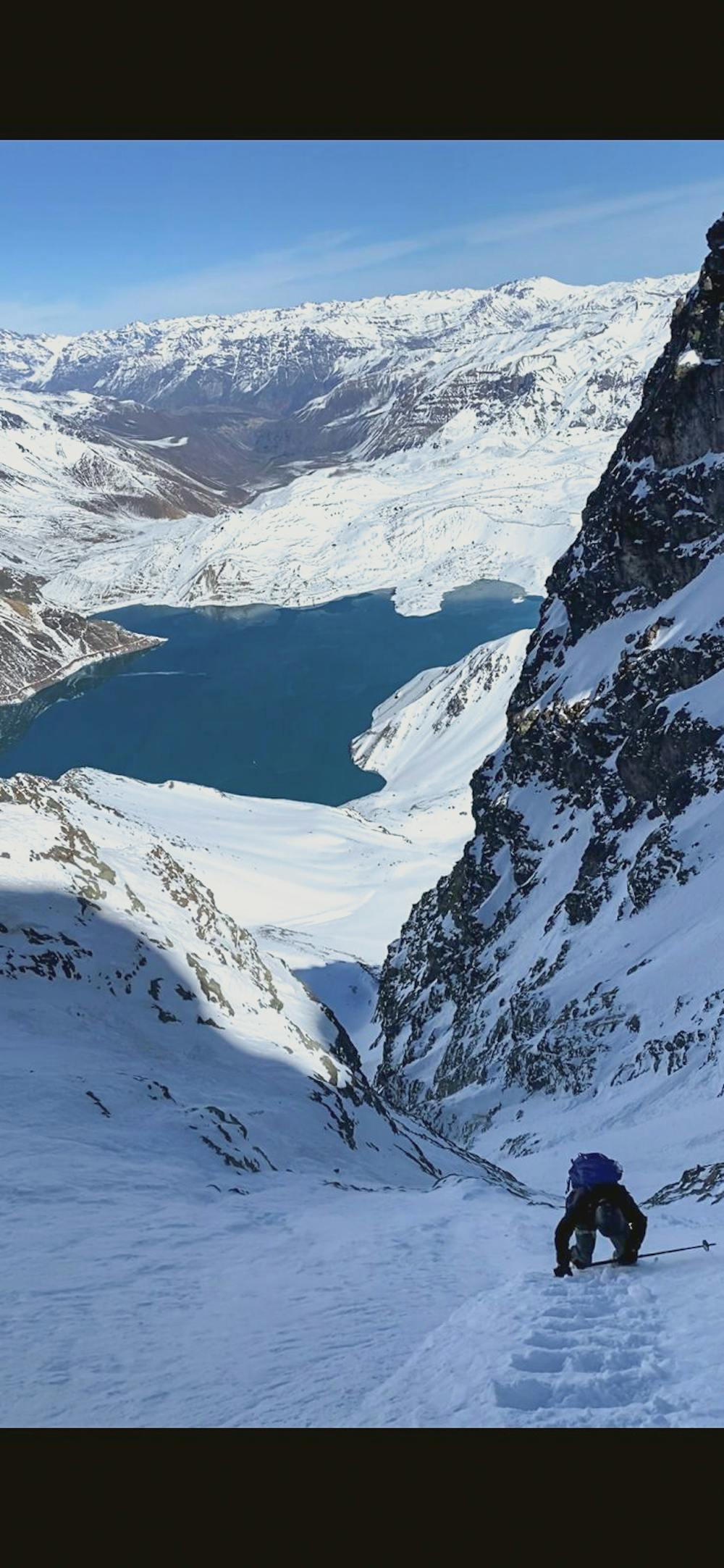
Megaline with an astonishing view of Embalse del Yeso
Ski Touring Extreme
- Distance
- 19 km
- Ascent
- 2 km
- Descent
- 2 km
- Duration
- 1 day +
- Low Point
- 2.5 km
- High Point
- 4.1 km
- Gradient
- 46˚

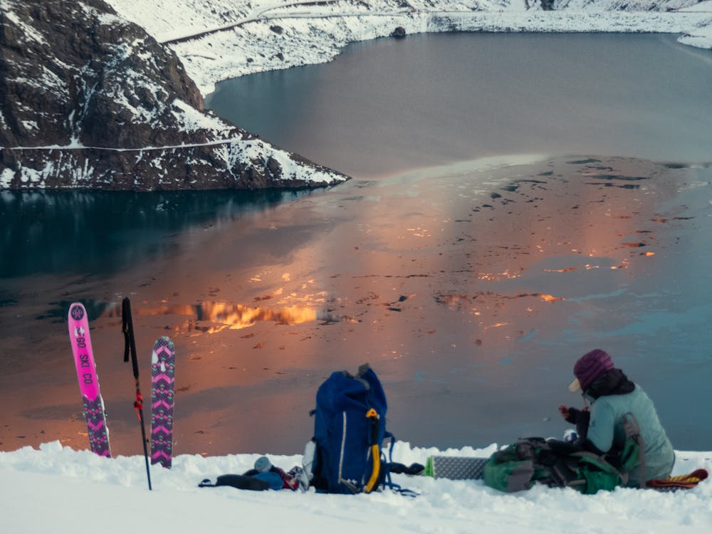
Ascent: Day 1: once you see the Embalse del Yeso, cross the bridge over the reservoir retaining wall, once you get to the snow, skin over the border of the lagoon (depending on the level of water in the reservoir, you might need to climb a moraine) until you will find a valley down Punta Negra. Set camp near a small lagoon, and prepare for tomorrow's mission.
- •
- •
- •
- •
- •
Description
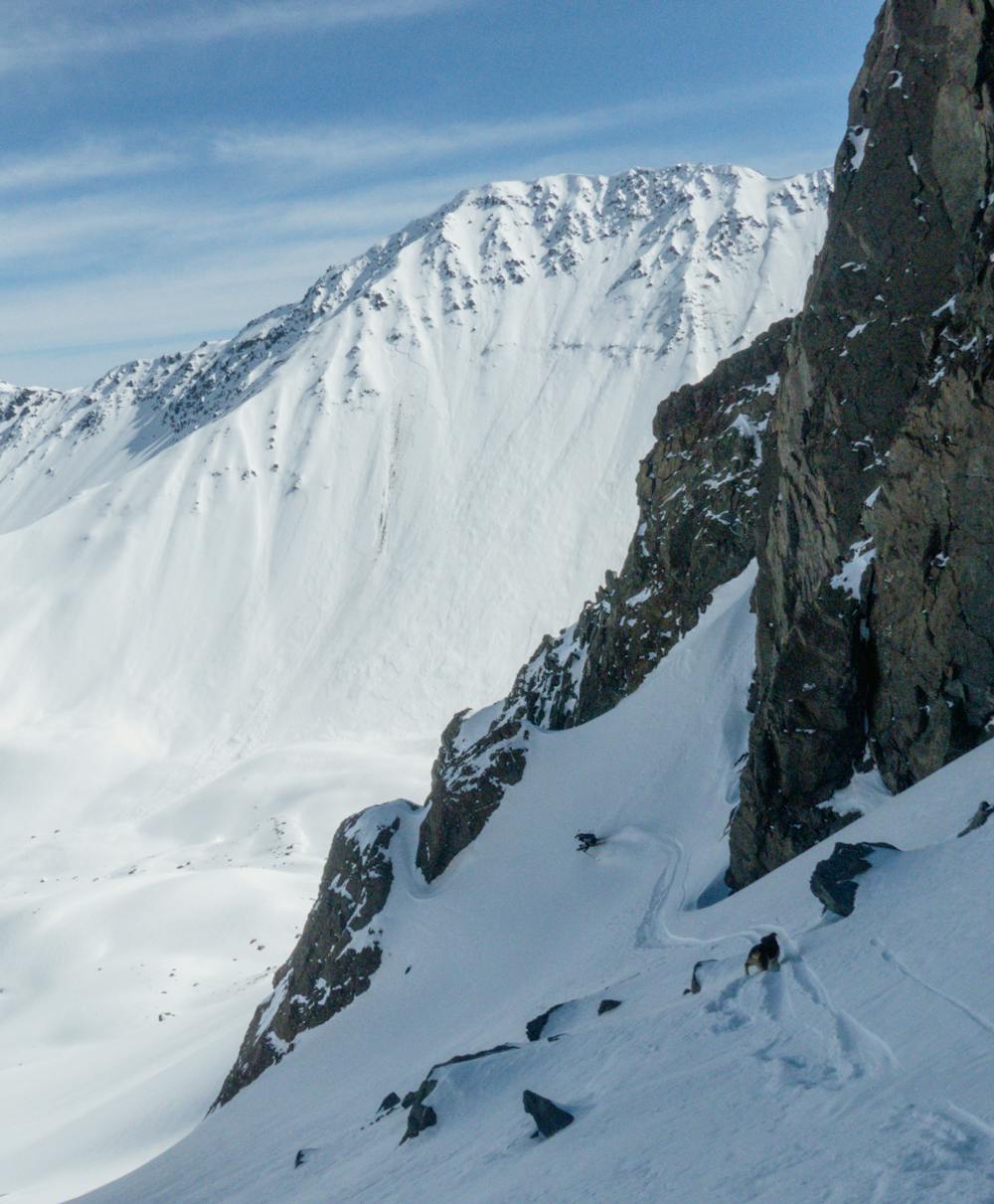
Day 2: Approach by skinning up to this mega line that can be seen from everywhere near the Embalse del Yeso. Then start climbing up until you get to the top of Punta Negra col.
Descent: Descending Punta Negra couloir is an extreme descent that most likely requires previous experience in big mountain and ski mountaineering adventures. From the summit of Punta Negra Col to the base camp, you will be descending 1.400 vertical meters of some of the great and most beautiful steep skiing adventures in Maipo Valley. Be aware of objective risks such as avalanches and rocks falling from the top directly to the couloir.
Follow @andesmagazine on Instagram for more reviews about ski, climbing, and mountaineering routes in the South American Andes. If you need further questions, or local guiding contact us in: https://andesmagazine.com/
Difficulty
Extreme
Extreme skiing terrain above 45 degrees. These routes are reserved for experienced experts.
High Exposure (E3)

In case of a fall, death is highly likely.
Remoteness
Little chance of being seen or helped in case of an accident.
Best time to visit
Features
- Alpine
- Couloir
- Single Descent
- Ski Mountaineering
Equipment required
- Rope
- Skins
- Ice axe
- Crampons