Tisa Walls
Hike around one of the most iconic rock formations in Bohemian Switzerland.
Hiking Severe
- Distance
- 3.4 km
- Ascent
- 106 m
- Descent
- 106 m
- Duration
- 0-1 hrs
- Low Point
- 547 m
- High Point
- 613 m
- Gradient
- 7˚

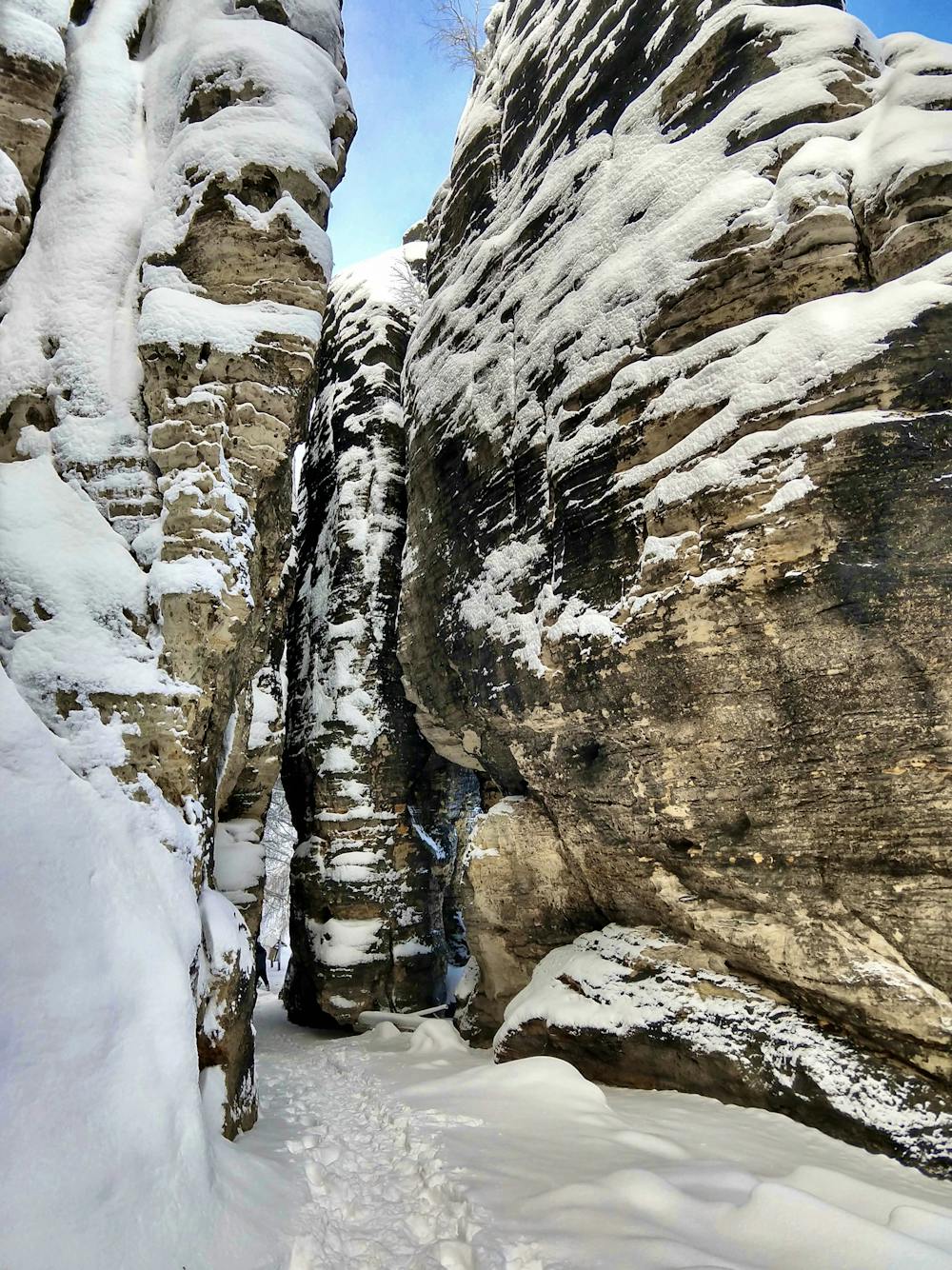
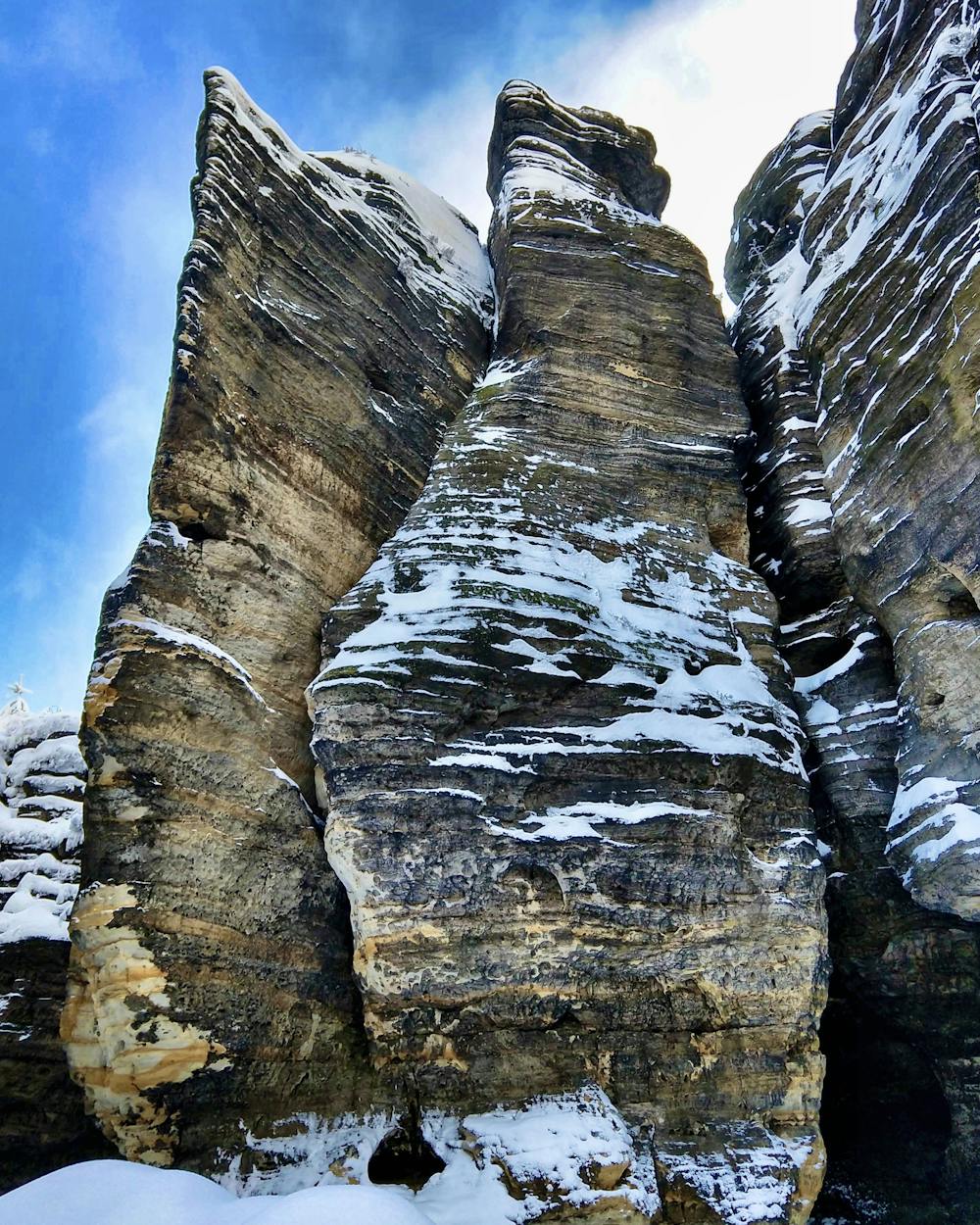
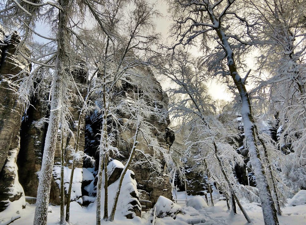
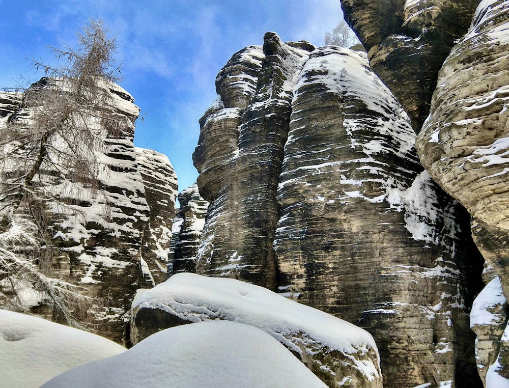
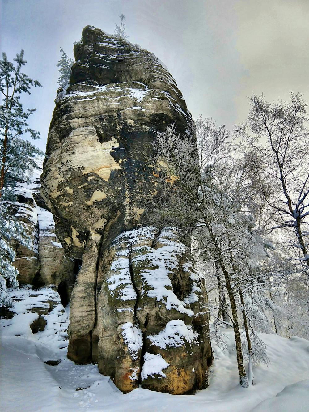
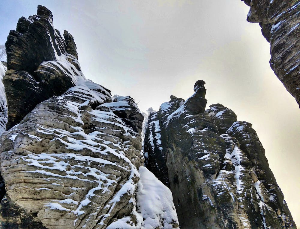
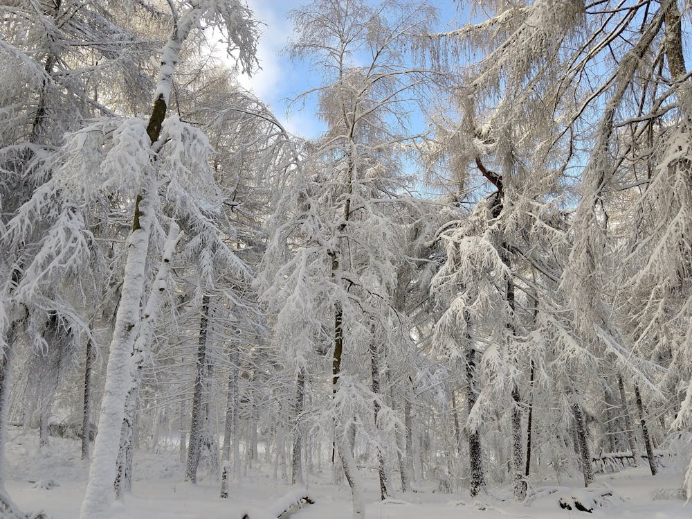
The Tisa Walls, also known as the Tisa Rocks, collectively form one of the most well-known rock formations in Bohemian Switzerland. The sandstone rock formations rise up to 70 meters above the ground, providing awe-inspiring scenery for the hiker, and an attractive challenge for rock climbers. In the warmer months, expect to see climbers on the walls at this popular crag.
- •
- •
- •
- •
- •
- •
- •
- •
- •
Description
"The 'Great Tisa Rocks' begin near the official entrance by a restaurant,” according to Wikipedia. "These consist of a northern and southern array of crags along an otherwise compact plateau. The crags to the west running off at an angle to the northwest are known as the 'Little Tisa Rocks.' They are more heavily dissected.”
From the beginning near the restaurant, an obvious path climbs up the hillside to the base of the wall itself. Here there’s a small hut, and during certain times of the year you may have to pay to access this area. According to tisa.cz, the rates are "30, - CZK adults / 15, - CZK children up to 15 years” which is just over one Euro per adult.
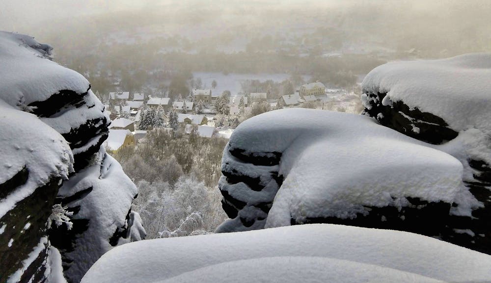
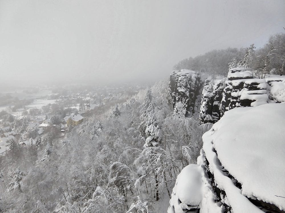
From the hut, you have a variety of hiking options. The route mapped here heads up on top of the walls first, affording beautiful views of the town of Tisa and the Elbe river valley spreading out below. To get from the base to the top of the wall, well-marked paths lead up staircases alternatively carved into the rock itself, or freestanding near the rock and made of metal. Handrails and steps make the ascent relatively non-technical, but at times the well-developed staircase can lead to a slippery slot where the steps have been worn away with traffic and time.
Once on top of the wall, the trail meanders along a relatively flat surface, offering a variety of different perspective and views.
The trail network in this area spreads in all directions, so it’s possible to do a much longer hike than the one mapped here. However, if you’re just out for an hour or two, drop down and loop back around the base of the rocks, gazing in awe as they tower over you. Occasionally, the trail ducks through small tunnels and slots in the rock, keeping the hike interesting and engaging the entire way. Note that the descent off the top to drop down the backside can be sketchier and more treacherous than the ascent up the front. Three or even four points of contact may be required.
Once back to the hut, you can either head back down to your car or tack on an additional loop around the Little Tisa Walls.
Whether you’re merely looking for a saunter to a beautiful viewpoint or prefer a challenging rock climbing foray, Tisa Walls offers a flavor of adventure suitable for just about anyone.
Sources: https://en.wikipedia.org/wiki/TisaRocks http://www.tisa.cz/en/vismo/zobrazdok.asp?idorg=101301&idktg=1003&n=tisa-walls&archiv=1
Difficulty
Severe
Hiking challenging trails where simple scrambling, with the occasional use of the hands, is a distinct possibility. The trails are often filled with all manner of obstacles both small and large, and the hills are very steep. Obstacles and challenges are often unexpected and can be unpredictable.
High Exposure

Some trail sections have exposed ledges or steep ascents/descents where falling could cause serious injury.
Remoteness

Away from help but easily accessed.
Best time to visit
Features
- Picturesque
- Family friendly
- Forestry or heavy vegetation