Bibi Run
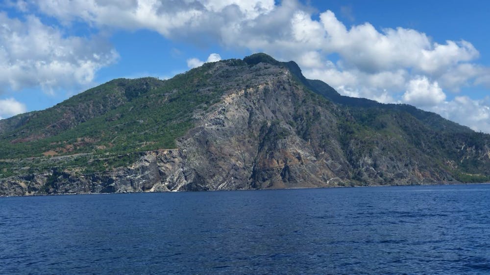
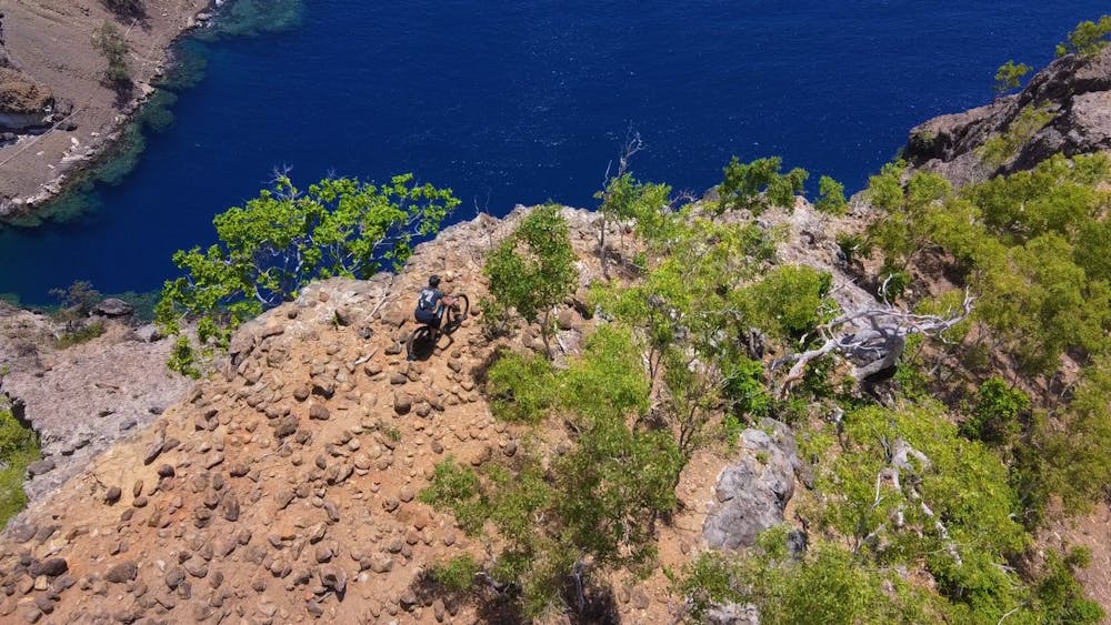
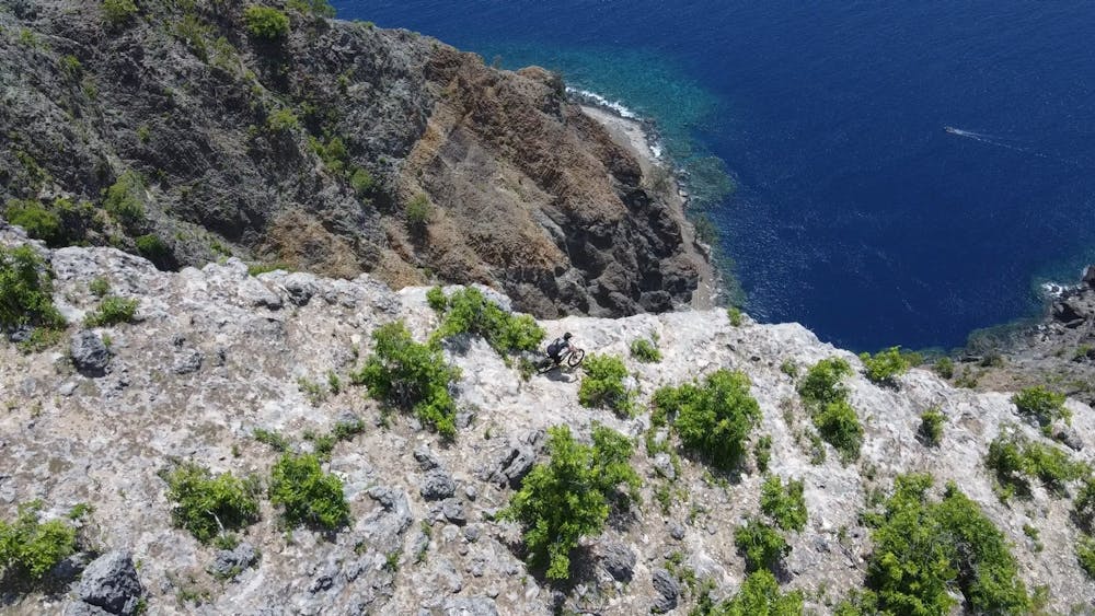
Ponta Aromacao cliff line on Atauro Island. Can be a Hike or Ride. Watch the ledge!
Mountain Biking Extreme
- Distance
- 2.8 km
- Ascent
- 96 m
- Descent
- 628 m
- Duration
- -1-0 hrs
- Low Point
- 6 m
- High Point
- 538 m
- Gradient
- 21˚

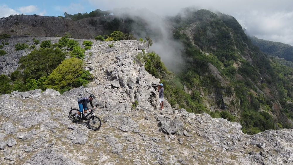
The run follows the prominent Ridgeline of Mt Lamiri, the highest mountain on Atauro Island. We think it's probably only possible in the dry season.
- •
- •
- •
- •
- •
- •
- •
Description
You'll need to get a boat to the small beach about 800m to the West of the ridge (Point Aromauco). From there, follow the water pipe up the first rock band and then gradually traverse to the ridge.
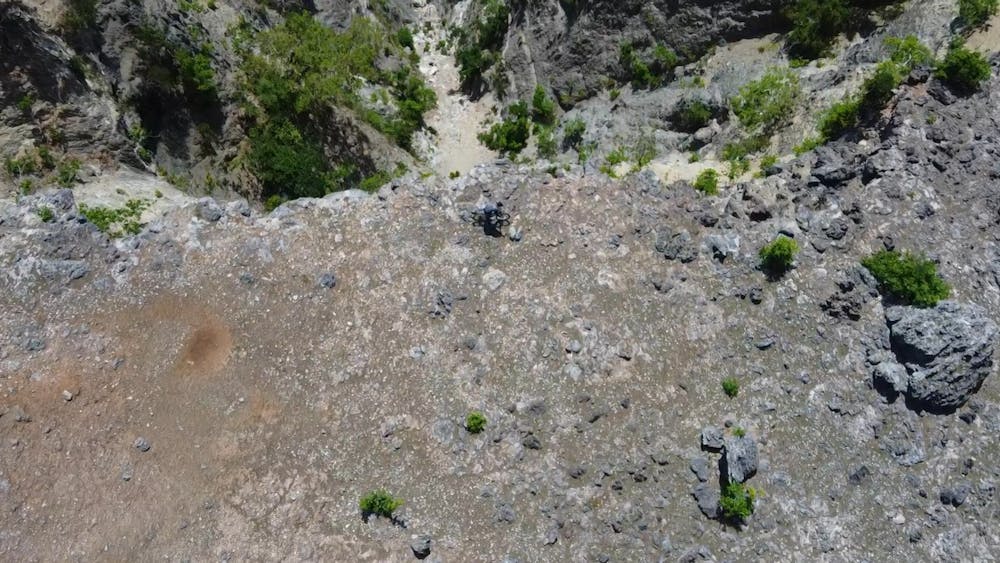
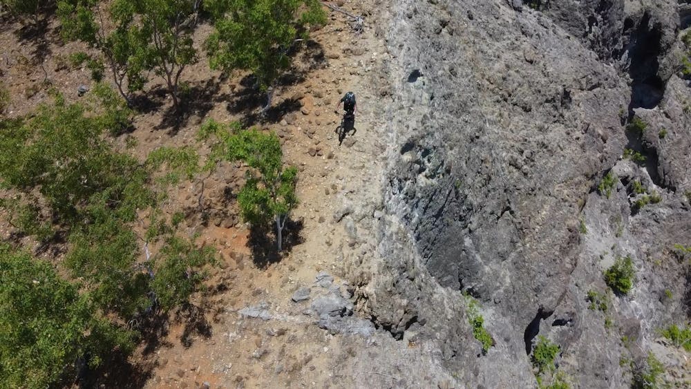
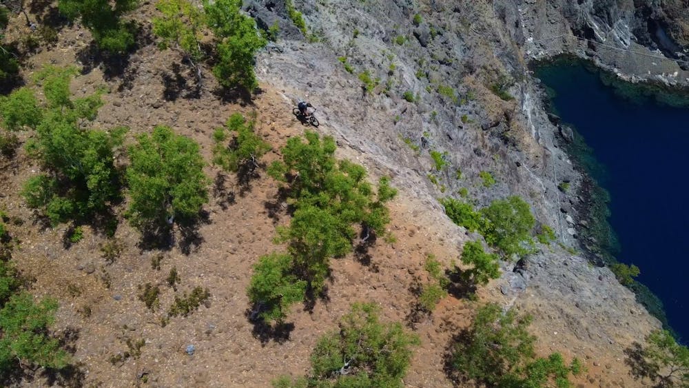
There is no trail for riding or hiking. The riding is made difficult by the small "baby head boulders" in many places. In addition, the run crosses a number of volcanic rock bands, all of which are very difficult to ride at all. Falling off the ledge is "not an option".
We started at a little above 500m. We assessed the riding above this was not great without a trials bike. Beyond the tree line, it may be possible on foot but not on bike.
Difficulty
Extreme
Very steep, difficult, narrow singletrack with widely variable and unpredictable trail conditions. Unavoidable obstacles could be 15in/38cm tall or greater, and unavoidable obstacles with serious consequences are likely to be present. Obstacles could include big rocks, difficult root sections, drops, jumps, sharp switchbacks, and more. Ideal for expert-level riders.
Extreme Exposure

Some trail sections are extremely exposed where falling will almost certainly result in serious injury or death.
Remoteness
In the high mountains or remote conditions, all individuals must be completely autonomous in every situation.
Best time to visit
Features
- Hike a bike
- Picturesque