2 m away
Quilotoa Lakeshore Hike

Hike down to the shores of the sparking blue lake in Quilotoa Crater
Moderate Hiking
- Distance
- 3.4 km
- Ascent
- 402 m
- Descent
- 402 m
Hike a rugged trail that circumnavigates the rim of the spectacular Quilotoa Crater.
Hiking Difficult

Quilotoa is a beautiful water-filled volcanic crater high in the mountains of Ecuador. The lake was formed roughly 800 years ago following the last catastrophic eruption, and it now measures about 3 kilometers wide and an astounding 250 meters deep. Set at an elevation of 3,500 meters above sea level (11,482 feet), the upper rim of the crater rises to about 12,704 feet above sea level. While the crater itself is understandably gorgeous, the views of the surrounding mountains will also take your breath away!
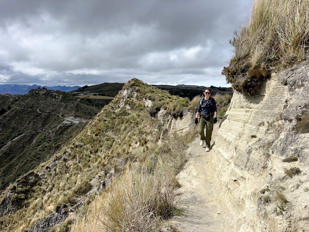
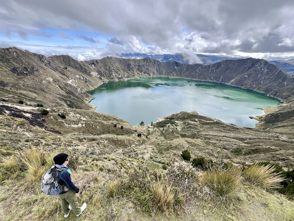
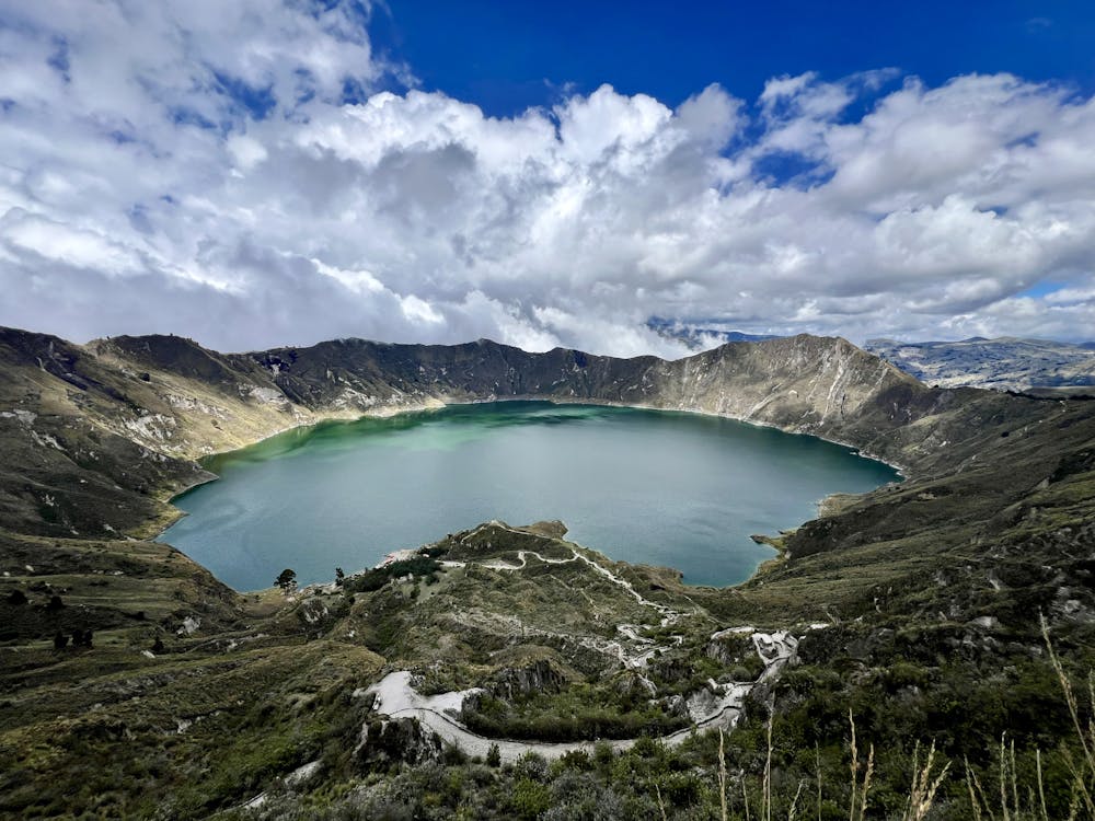
This uniquely beautiful natural formation is a burgeoning tourist attraction, with restaurants and hostels clustering on the southwestern corner of the crater rim. A hiking trail circumnavigates the rim of the caldera, but the hike shown here drops straight down to the lakeshore.
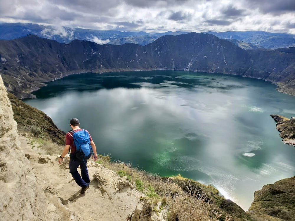
While somewhat steep, the hike down to and back from the lakeshore is well-maintained and is more of a narrow road with stair steps than a hiking trail. Lamas and other animals frequently make the journey, and it's a very popular tourist hike.
Once down at the lakeshore, there are several ways to enjoy the beauty of the lake. While you can sit and simply bask in the natural beauty, you can also rent a kayak for one of the most beautiful paddles of your life! Or, you can pay for a ride on a small motorboat out into the middle of the lake. The choice is entirely up to you—just make sure to save energy for the slog back out of the crater! There's only one way to go from here: straight up.
Sources: https://en.wikipedia.org/wiki/Quilotoa https://notyouraverageamerican.com/hike-quilotoa-crater/ https://talesfromthelens.com/quilotoa-crater-loop-hiking-day-trip-ecuador/
Difficult
Hiking trails where obstacles such as rocks or roots are prevalent. Some obstacles can require care to step over or around. At times, the trail can be worn and eroded. The grade of the trail is generally quite steep, and can often lead to strenuous hiking.

Some trail sections have exposed ledges or steep ascents/descents where falling could cause serious injury.

Away from help but easily accessed.
2 m away
Hike down to the shores of the sparking blue lake in Quilotoa Crater
Moderate Hiking