Dent d'Oche
Bernex
You can't call yourself a local until you've climbed this peak.
Hiking Extreme
- Distance
- 7.5 km
- Ascent
- 1 km
- Descent
- 1 km
- Duration
- 3-4 hrs
- Low Point
- 1.2 km
- High Point
- 2.2 km
- Gradient
- 20˚

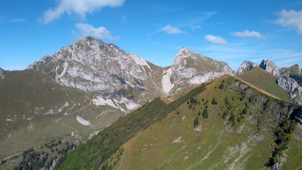
Ask a local for advice on hiking itineraries, and this one will definitively come up. If it doesn’t, you’re not talking to a local. For most locals, it’s where they transitioned from easy family hikes to more challenging ones that require some climbing, and it’s one they’ll keep coming back to until their last hiking days. Although the hike is short, it’s also steep from the start, gets fairly technical before reaching the refuge, and the climb down will require your full attention. Do not let the crowds of clueless, poorly-equipped, and sometimes very unfit hikers (especially during the summer) fool you—this is an alpine hike and should be treated as such, especially in less than ideal weather conditions.
- •
- •
- •
- •
- •
- •
Description
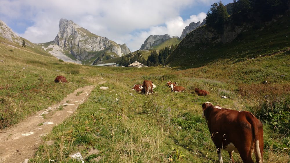
The hike starts by following a trail through the forest before reaching a meadow where the slope gets gentler. Shortly thereafter, you’re at the chalet d’Oche. There, catch your breath if needed, because now it’s only getting steeper.
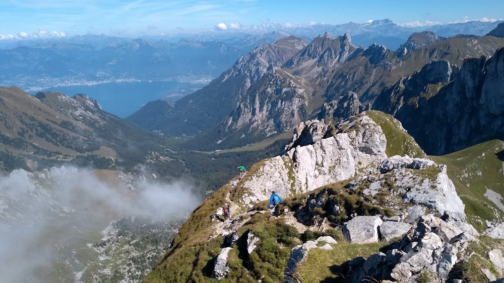
After a series of switchbacks you’ll reach Col de Rebollion and a few minutes later, it will be time for some easy climbing/scrambling. Steps and chains have been bolted in the rock over the years to make the most hazardous parts less challenging, but do not be surprised to see people bail on the climb there; the chimney, in particular, can be intimidating for an inexperienced hiker.
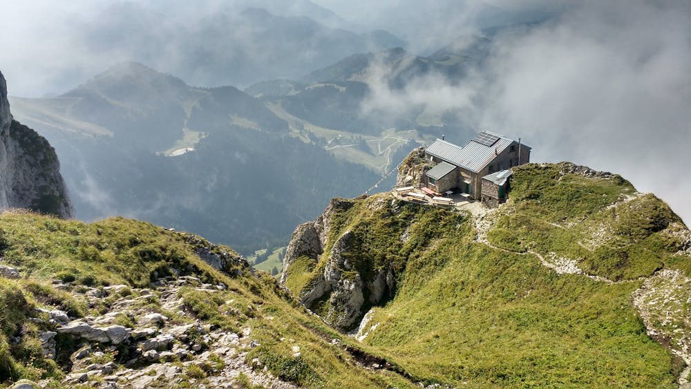
Once you’ve reached the refuge, the trail gets easier but will still require some easy slab climbing.
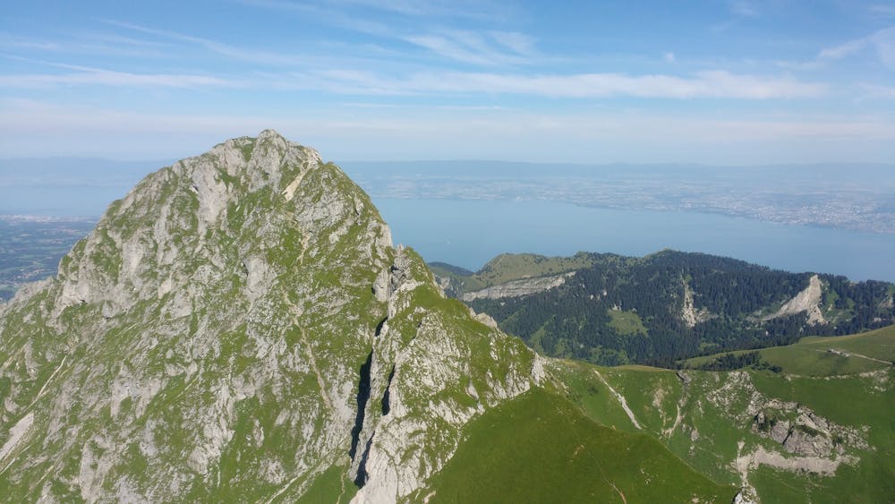
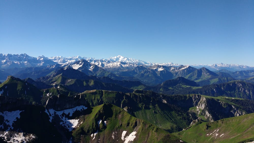
At the top, enjoy the panoramic view of the lake and surrounding peaks before the climb down.
The path continues to the east, first by following the ridge, and then with a steep technical scramble (keep an eye out for ibexes) until col de Planchamp. The most technical parts are equipped with chains, making the trail way safer than it used to be (a fall would still prove to be deadly, though).
Once you’ve reached the valley, you can directly make your way back to chalet d’Oche (feel free to stop for drinks and cheese) and then return to the trailhead, or you can consider extending your hike a bit depending on how you feel and the time of day. Popular options: Château d’Oche, lac de Darbon, lac de la Case,Pointe de Pelluaz.
Difficulty
Extreme
Scrambling up mountains and along technical trails with moderate fall exposure. Handholds are necessary to navigate the trail in its entirety, although they are not necessary at all times. Some obstacles can be very large and difficult to navigate, and the grades can often be near-vertical. The challenge of the trail and the steepness of the grade results in very strenuous hiking. Hikes of this difficulty blur the lines between "hiking" and "climbing".
Extreme Exposure

Some trail sections are extremely exposed where falling will almost certainly result in serious injury or death.
Remoteness

Close to help in case of emergency.
Best time to visit
Features
- Alpine
- Wildlife
- Picturesque
- Summit Hike
- Forestry or heavy vegetation
Equipment required
- Rope