6.2 km away
Rhône River Loop
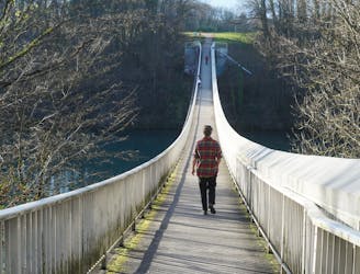
Follow the wide and winding river Rhône through Canton Geneva’s most accessible nature reserve.
Easy Hiking
- Distance
- 13 km
- Ascent
- 302 m
- Descent
- 302 m
Climb high for spectacular views of the city and surrounding mountain ranges.
Hiking Moderate

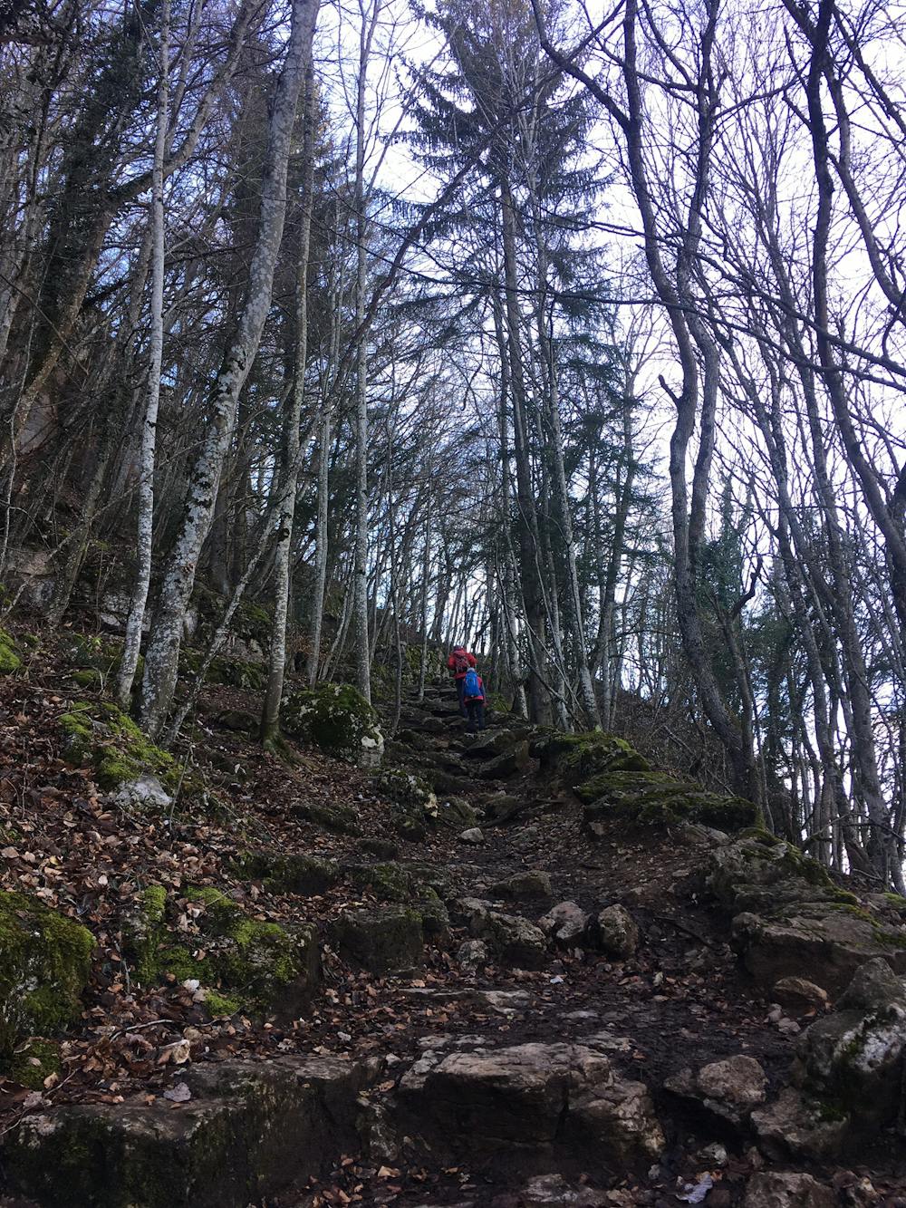
Nicknamed “Geneva’s Balcony,” Mont Salève stands 1,379m above the glitzy swiss city, just 20 km from the centre. Climb up a steep rambling path through thick woodland, past the quaint little village Monnetier, and eventually, you will come to Salève’s summit, where you’ll meet the less adventurous visitors who took the cable car up to the top.
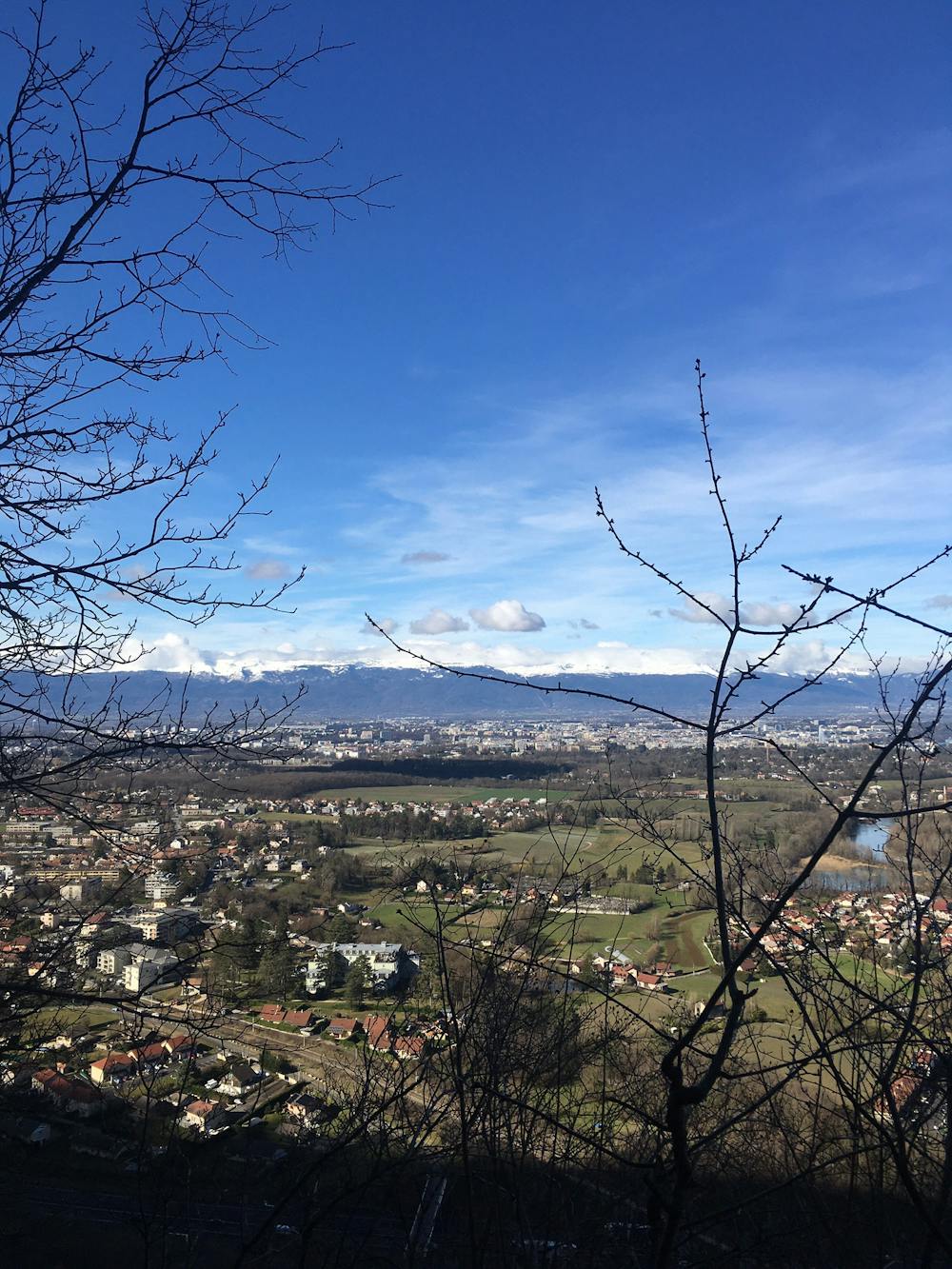
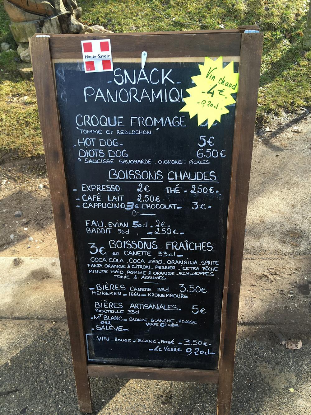
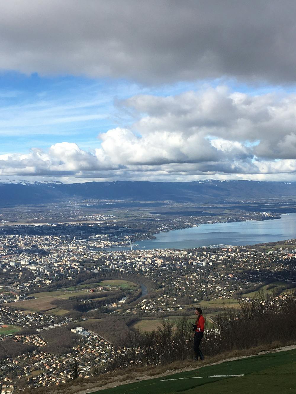
Stop at the snack hut for a Croque Fromage (5 euros) and cafe o'leit (€2.50), before continuing on another 15 minutes to the observation platform, where you can watch paragliders take flight, and admire Geneva, as it feels like you are holding the city in the palm of your hand. In the same gaze you can see the white peaks of the Alps, the city’s tall, elegant buildings surrounded by green country pastures, and not to forget Lake Geneva, so immensely big you really wonder if you’re at the sea. The spectacle gets more dazzling, with the quirky Jet d'Eau fountain in the middle of the lake spitting high into the air, and Mont Blanc in the distance piercing the clouds in the sky.
Mont Salève technically lies just over the border in France, but it can be easily reached from Geneva’s city centre, by taking the number 8 bus direction Veyrier. Get on at Geneva train station and ride 25 minutes all the way to the end of the line (tickets cost 3 euros). Once off the bus follow the red signposts to the Le Salève Cable Car (telepherique) station (Route du Téléphérique, 74100, Etrembières, France). To the left of the ticket sales building, spot the green signpost with a series of hikers routes. Follow the arrow for the 5th sign, “Mont Salève 2.5 hours." The ticket sales officer assured me the walk up only takes 1.5 hours for a semi-decent hiker, and he was right!
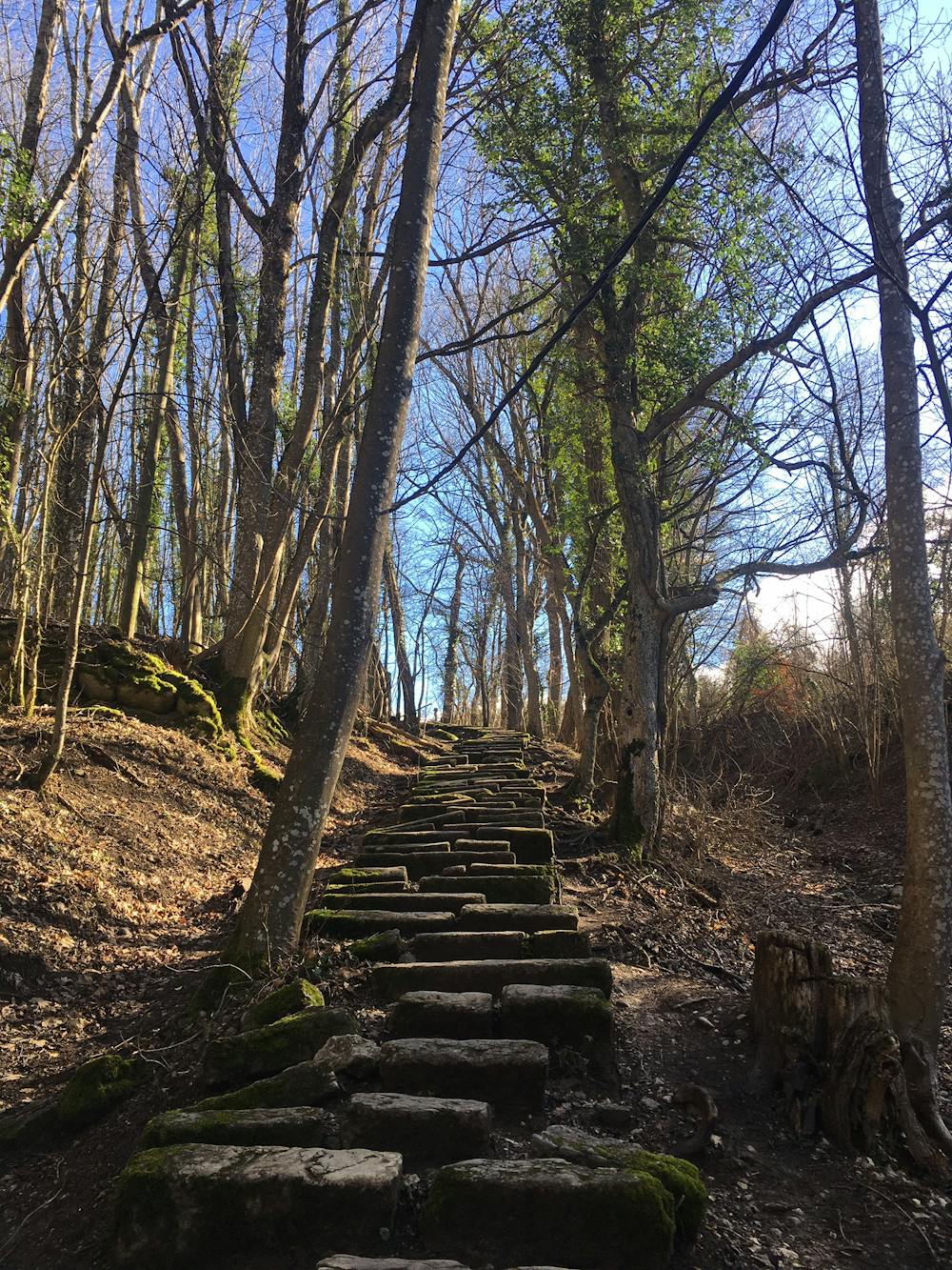
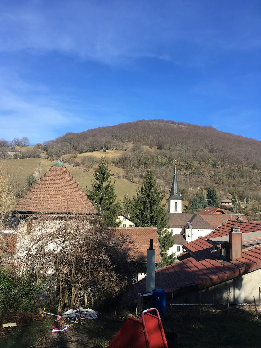
The signs lead you through the village and over a bridge across a motorway and up a steep winding path through a woodland. It takes a while for the noise of the roaring cars below to drop away, and the air around you to be filled only with the sound of birds chirping. You’ll pass through a carpark next to a church, skimming the edge of a quiet, quaint little french village, before disappearing into the forest once again. The further you climb the steeper the path gets, and railings are not always provided, so be sure to wear decent walking shoes, and take care, especially on the way back down!
Sources http://www.geneva.info/saleve/ https://thingstodoingeneva.ch/a-guide-to-hiking-up-the-saleve/ https://www.timeout.com/switzerland/things-to-do/le-saleve
Moderate
Hiking along trails with some uneven terrain and small hills. Small rocks and roots may be present.

The path is on completely flat land and potential injury is limited to falling over.
Close to help in case of emergency.
6.2 km away
Follow the wide and winding river Rhône through Canton Geneva’s most accessible nature reserve.
Easy Hiking
4 routes · Hiking