Roc et Lac de Tavaneuse
Portes du Soleil
An accessible summit and lake combination.
Hiking Difficult
- Distance
- 8 km
- Ascent
- 1 km
- Descent
- 999 m
- Duration
- 3-4 hrs
- Low Point
- 1.1 km
- High Point
- 2.1 km
- Gradient
- 22˚

This hike has a bit of everything without requiring too much of an effort.

- •
- •
- •
Description
After starting on a steep old road until les Serranants, you'll quickly enjoy the flora of a beautiful alpine meadow, slowly making your way up to Pas de Savolaire.
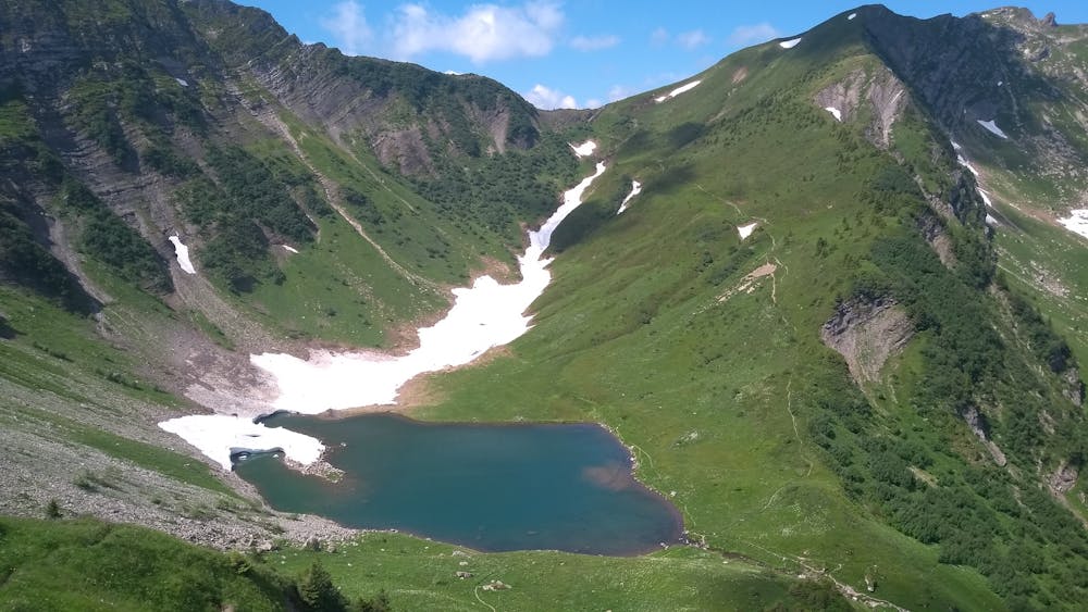
From there, start enjoying the view while making your way to the summit by following the ridge line. Some parts are exposed but shouldn't require the use of hands. The peak offers little (comfortable) room to sit and relax on busy days, but it does grant a bird's eye view on the lake below.
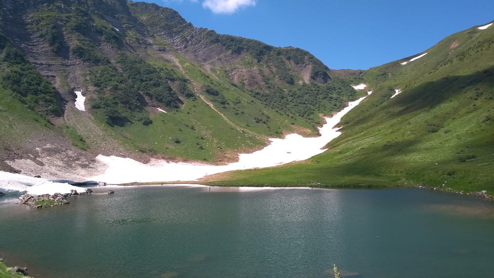
Make your way there by again following the ridge line until Col de Tavaneuse, where the trail gets trickier for 100-200m, before reaching the lake on a gentler trail.
The descent to the car park can become time consuming on muddy days (and with the nearby waterfalls, there are a lot of muddy days!) but is not too difficult.
Unfortunately, the only drawback of this hike is the absence of refuges on the route, so you'll have to stop at Abondance for after-hike drinks.
Difficulty
Difficult
Hiking trails where obstacles such as rocks or roots are prevalent. Some obstacles can require care to step over or around. At times, the trail can be worn and eroded. The grade of the trail is generally quite steep, and can often lead to strenuous hiking.
Medium Exposure

The trail contains some obstacles such as outcroppings and rock which could cause injury.
Remoteness
Away from help but easily accessed.
Best time to visit
Features
- Wildlife
- Picturesque
- Summit Hike
- Wild flowers
- Water features
- Forestry or heavy vegetation