Col de La vanoise from Pralognan
Pralognan-la-Vanoise
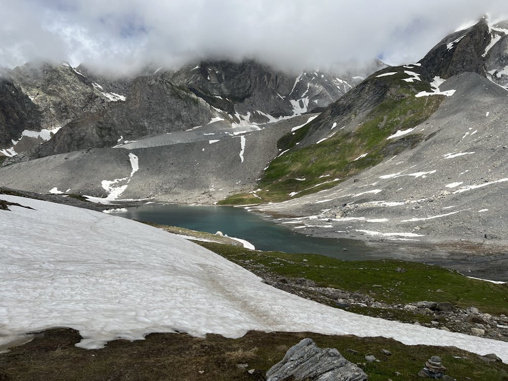
Vanoise Massif
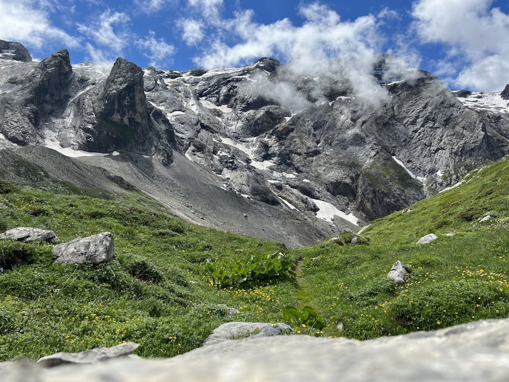
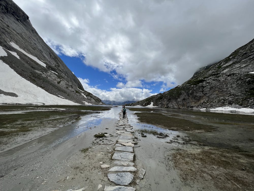
Beautiful hike up to col de la vanoise
Hiking Moderate
- Distance
- 13 km
- Ascent
- 685 m
- Descent
- 1 km
- Duration
- 3-4 hrs
- Low Point
- 1.7 km
- High Point
- 2.5 km
- Gradient
- 12˚

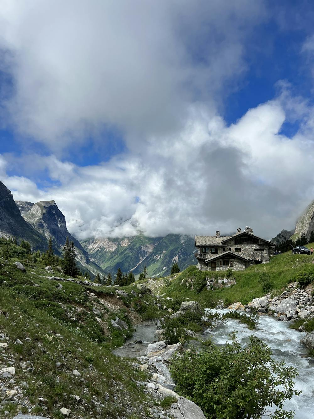
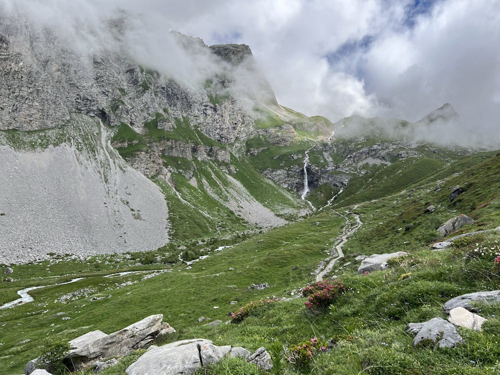
Located in the heart of the Vanoise massif, this route is a good introduction to discover the first National Park created in France and goes around the Aiguille de la Vanoise.
- •
- •
- •
- •
- •
- •
- •
- •
Description
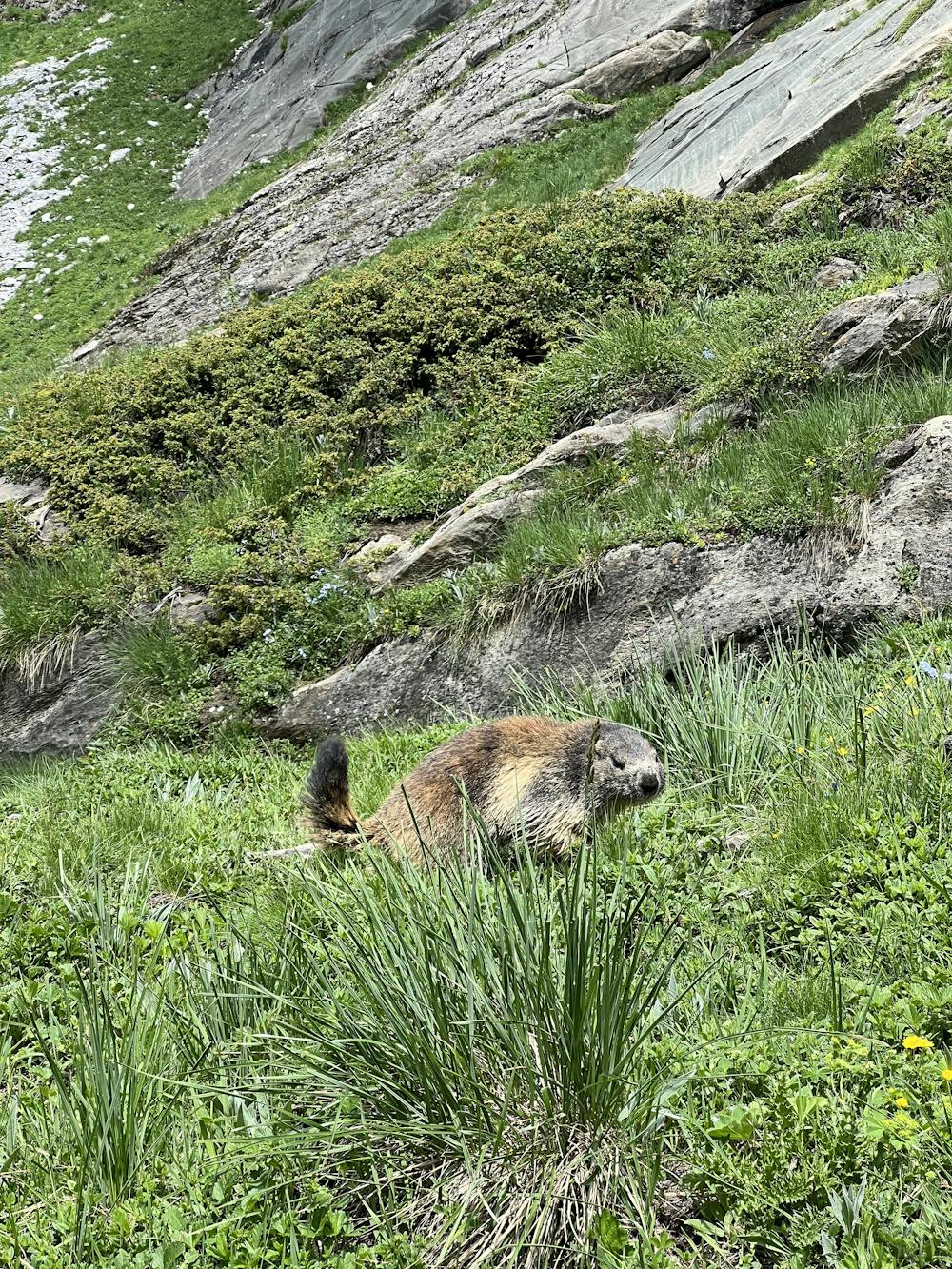
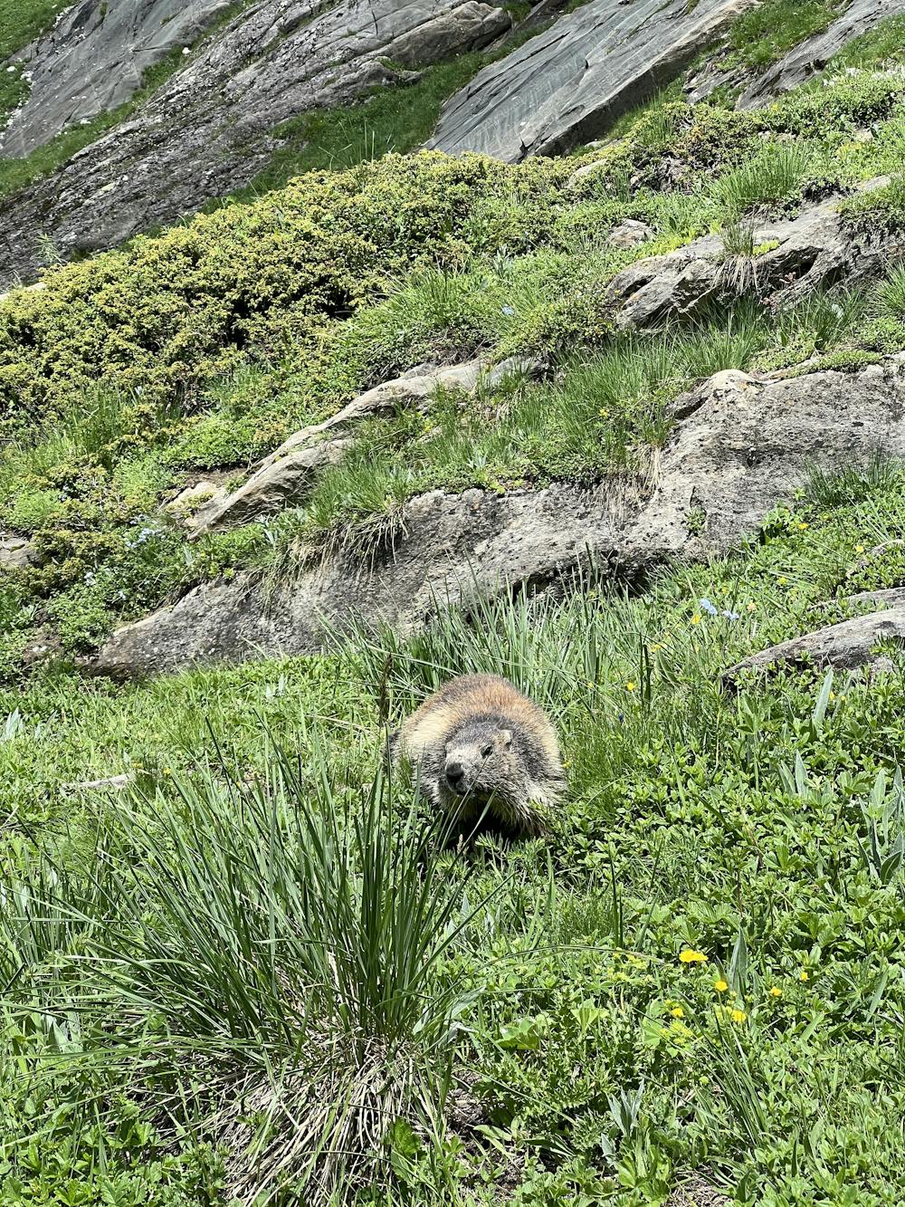
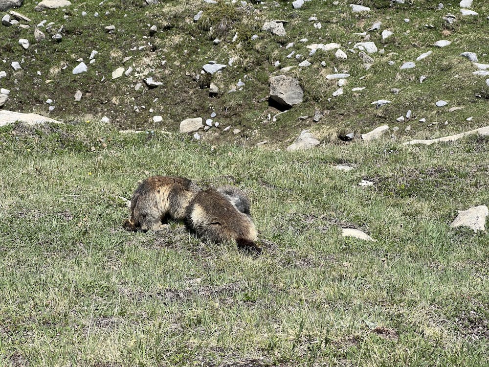
At the beginning of summer (June) you will have no trouble coming across ibexes, marmots and perhaps chamois.
The best is to park at the Fontanettes car park, above Pralognan-la-Vanoise, but you can also leave from Pralognan.
It's probably best to take the lift up to the Barmettes and from there follow directions towards col de Moriond.
Difficulty
Moderate
Hiking along trails with some uneven terrain and small hills. Small rocks and roots may be present.
Low Exposure

The path is on completely flat land and potential injury is limited to falling over.
Remoteness
Close to help in case of emergency.
Best time to visit
Features
- Wildlife
- Picturesque