4 routes · Mountain Biking
The most scenic leg of the Tour du Mont Blanc past two spectacular alpine lakes and lush terrain.
Also in Haute-Savoie, France
Mountain Biking Moderate
The Tour du Mont Blanc, also known as the TMB, is one of the most popular long-distance hikes in the world. The route circles the entire Mont Blanc Massif, which rises to a height of 4,808 meters above sea level—the highest point in Western Europe and the European Union. The hiking route covers "a distance of roughly 170 kilometres (110 mi) with 10 kilometres (6.2 mi) of ascent/descent and passes through parts of Switzerland, Italy and France,” according to Wikipedia.
While the TMB doesn’t climb to the summit of Mont Blanc, the route climbs up and over numerous high alpine passes, providing stunning views in all directions! Thanks to a well-developed system of huts, along with towns and hotels along the route, there are numerous options for staying overnight and resupplying as you journey around the loop.
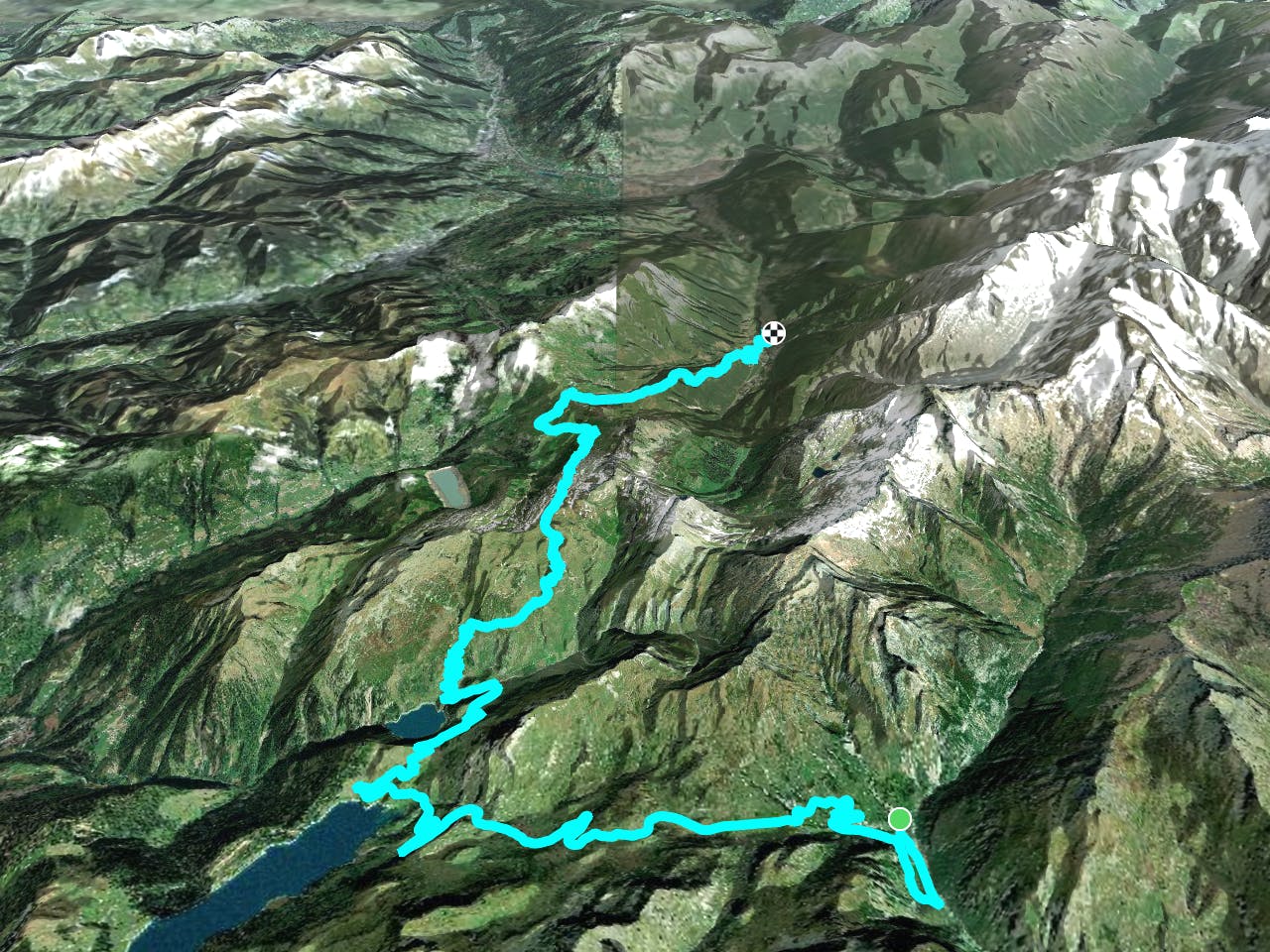
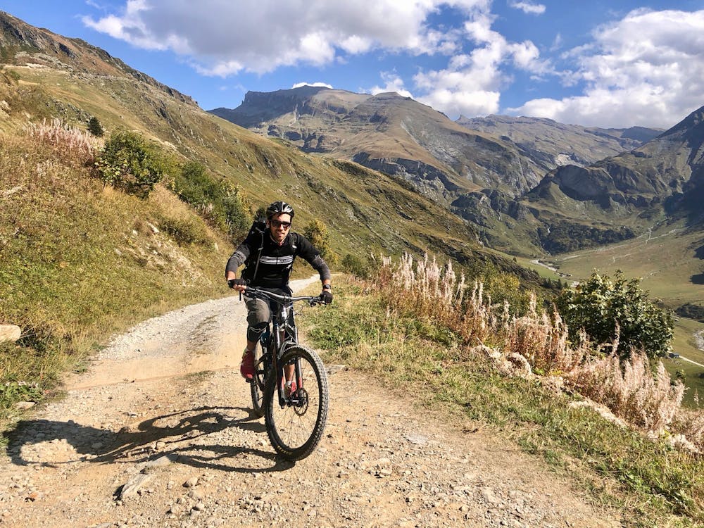
Unlike the hiking version of the TMB, the mountain biking version of this route isn’t nearly as well defined. Instead, riders can choose from numerous route variants. For this variant we tried to optimise for maximum time in the saddle, and minimum time carrying your bike. This means the tour has several longer segments of paved road, particularly on the climbs.
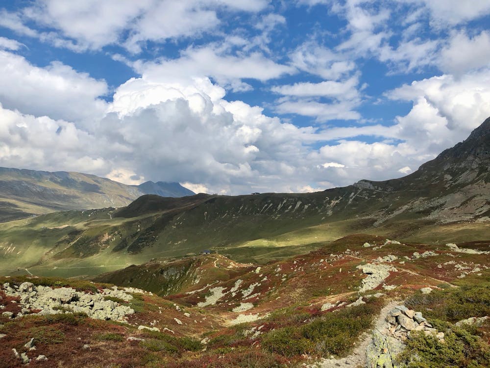
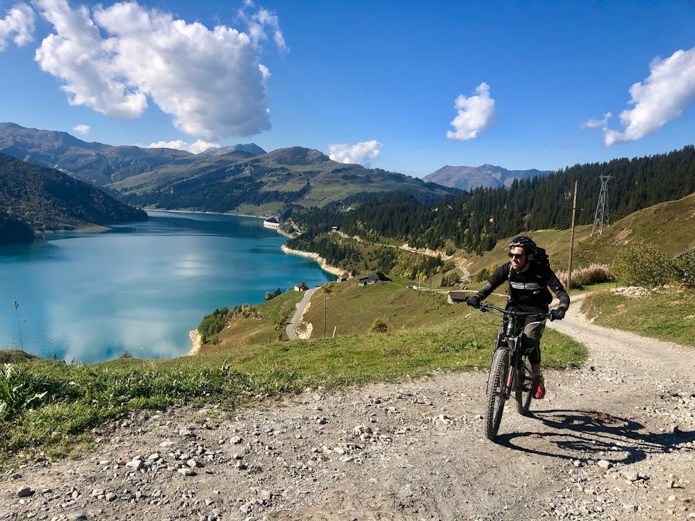
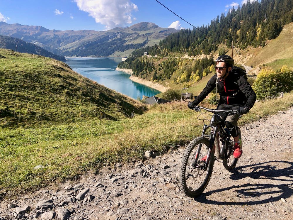
This section of the tour starts in Les Chappieux, and is arguably the most scenic and beautiful leg of the tour. Start by daybreak in the picturesque alpine village Les Chappieux, and continue on the road through the valley.
The first big climb of the day to Cormet de Roseland is on paved road. This stretch of road is a favourite for sports cars, so ride carefully.
At the top of the climb, at Cormet de Roseland, there's a small roadside stall selling drinks, sandwiches, and local cheese. Stock up on supplies if you don't have enough.
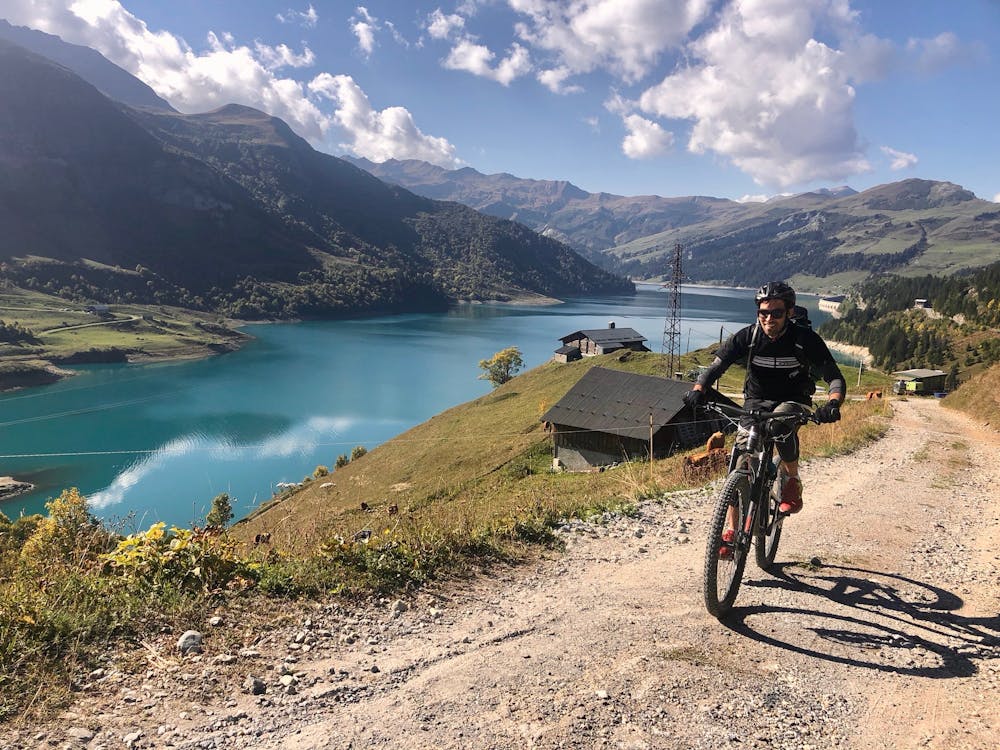
Past the col, you'll get your first view of the magnificent Lac de Roseland. To the west, you can see the hydroelectric dam.
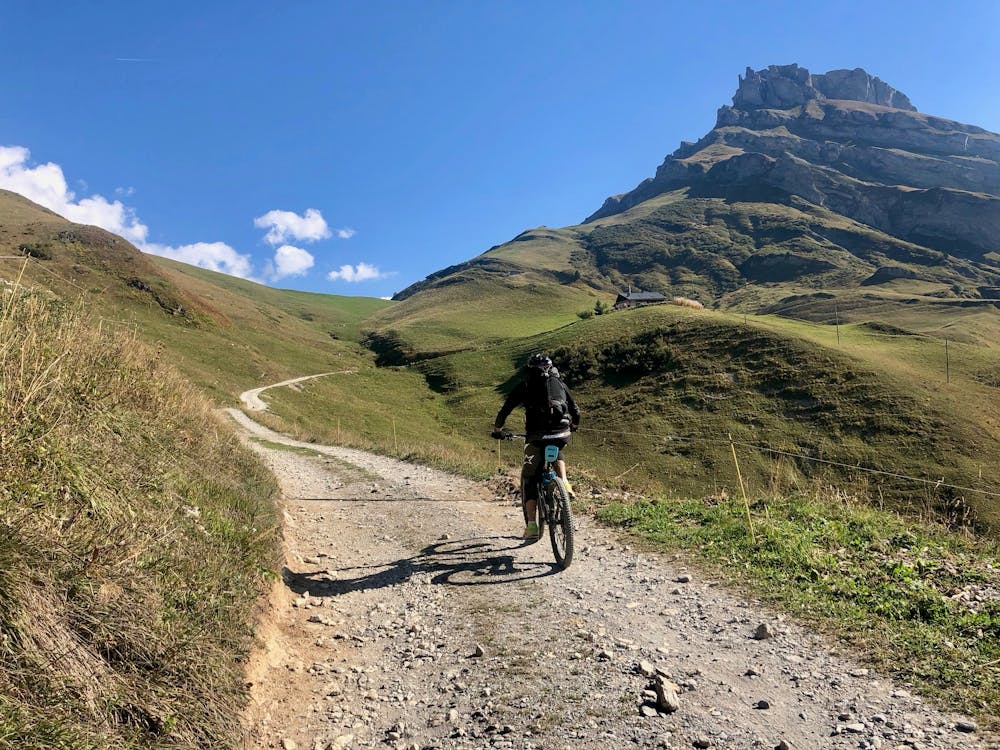
The route down to the lake continues on paved road to the bottom. From there you have a short climb over the ridge at the Col de Sur Fretes, to the view of the second pristine lake on this segment, the Lac de la Gittaz.
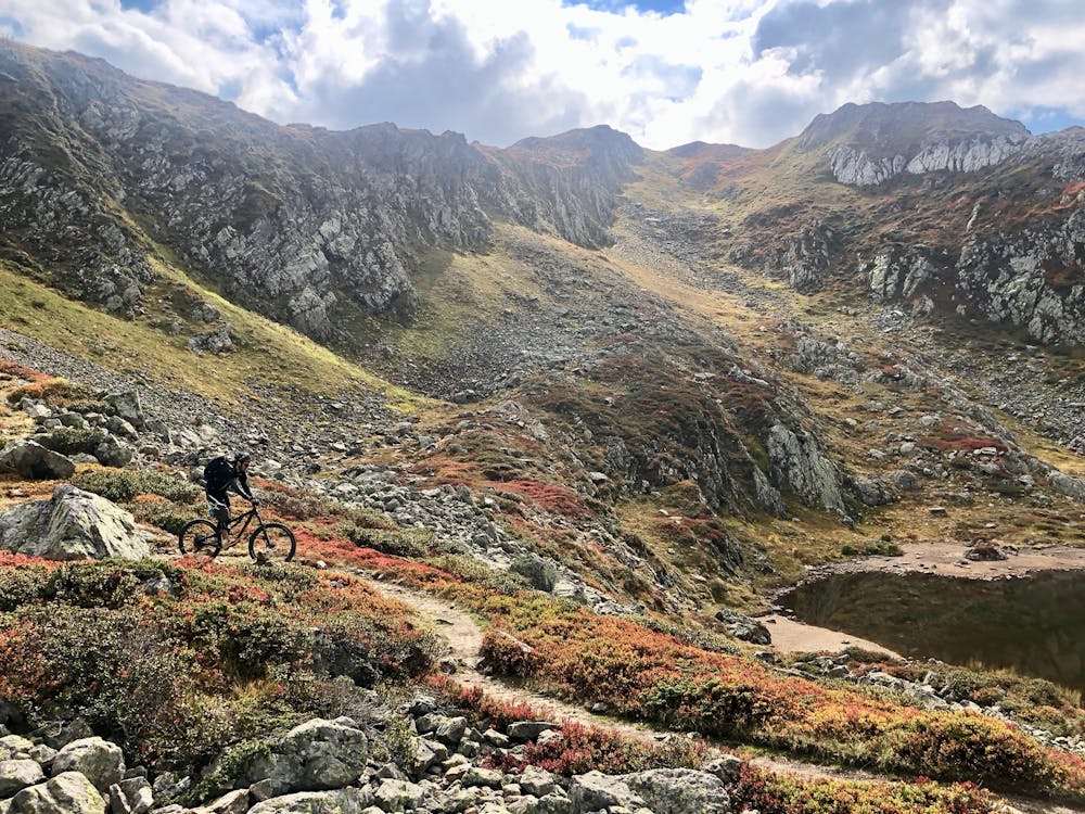
Follow the singletrack down to the valley floor right next to the lake, then get ready for a few hundred metres of switchbacks on gravel road. After a brief traverse, you'll start the next climb up to the Col de la Gittaz. The path is quite rutted out in places and you'll likely need to carry for a few sections.
You can celebrate at the top—the climbing is mostly over for today!
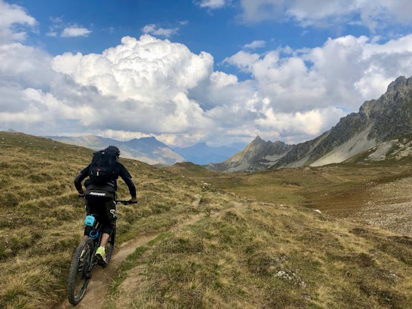
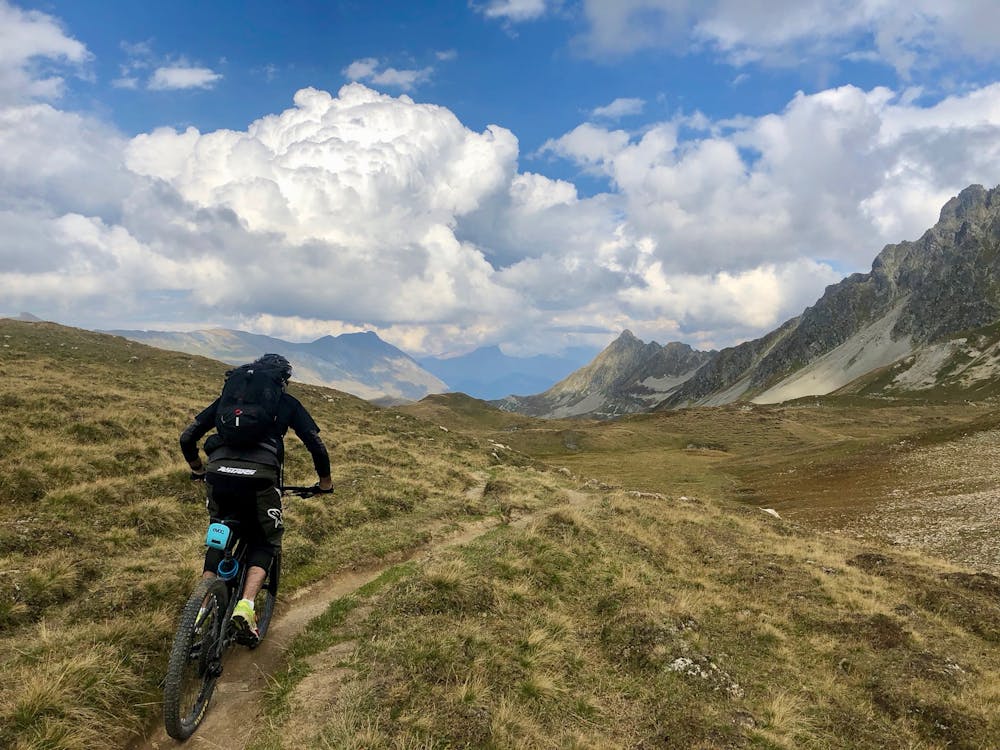
The descent follows the Tour du Mont Blanc hiking trail, which is mostly good singletrack, but is rutted out in places. Parts of this descent get quite technical, with large, loose rocks on the trail.
Another brief climb takes you to the top of the ski resort. From here, you'll start the long descent down to Contamines. The descent is long and very fast along the 4X4 access trails leading up to the lift stations.
Moderate
Mostly stable trail tread with some variability, with unavoidable obstacles 8in/20cm tall or less. Other obstacles such as rock gullies and steep sections may exist. Ideal for lower intermediate riders.

The path is on completely flat land and potential injury is limited to falling over.

Away from help but easily accessed.
4 routes · Mountain Biking