Le Moriond
Pralognan-la-Vanoise
Vanoise Massif
One itinerary, two starting options, one commitment: the natural side! Experienced hikers will find a suitable playground in this itinerary.
Resort Ski Touring Difficult
- Distance
- 3.3 km
- Ascent
- 590 m
- Descent
- 37 m
- Duration
- 2-3 hrs
- Low Point
- 1.5 km
- High Point
- 2 km
- Gradient
- 34˚
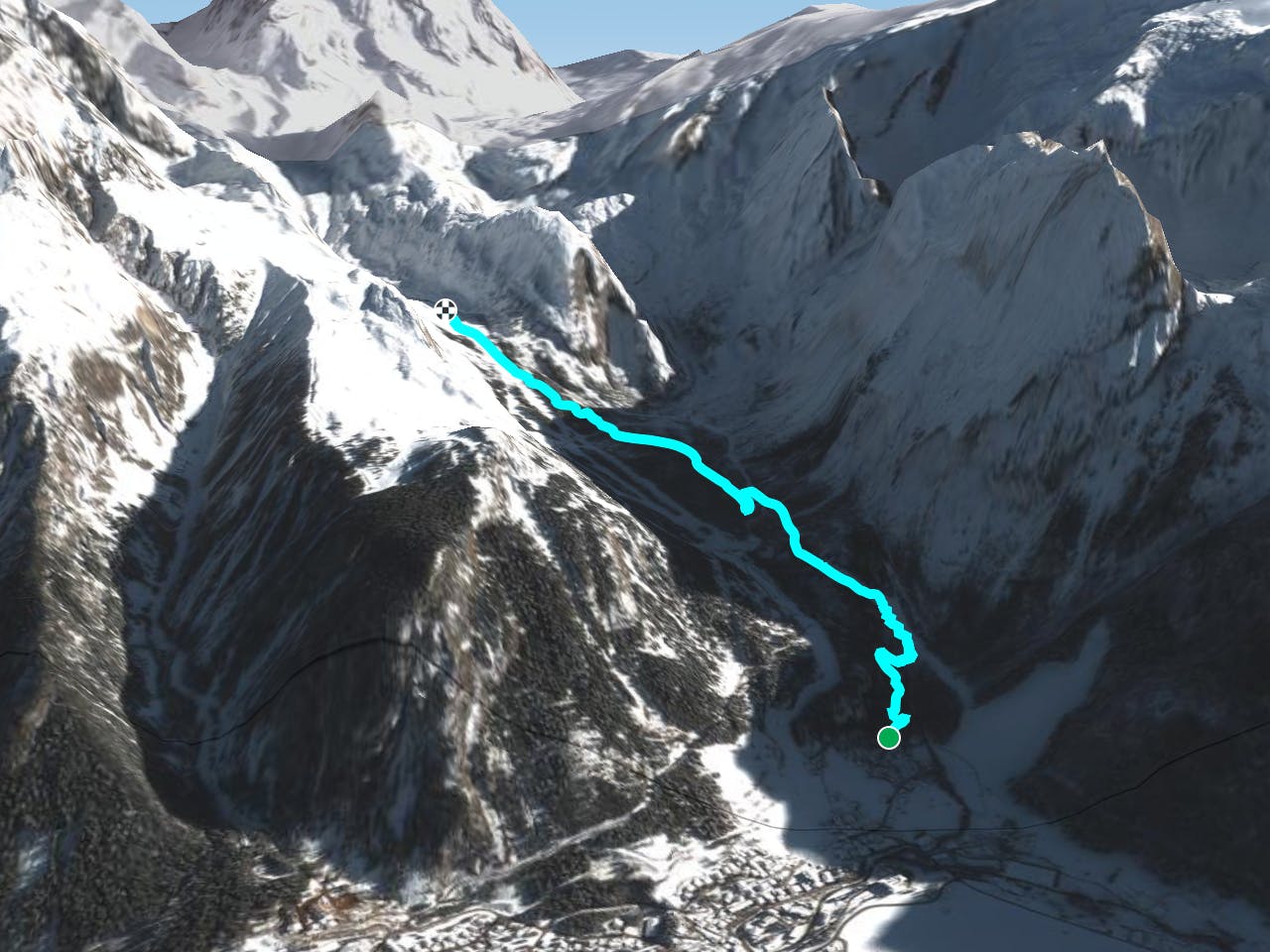
This is a popular resort ski touring route which is generally considered to be difficult. It's an unknown remoteness, it features unknown exposure and is typically done in an unknown time of year. From a low point of 1.5 km to the maximum altitude of 2 km, the route covers 3.3 km, 590 vertical metres of ascent and 37 vertical metres of descent.
Description
This trail allows you to access the exit of the Barmettes ski area.<br/><br/>For more information: <a href="https://skitouring.decathlon.fr" target="blank">skitouring.decathlon.fr</a>
Difficulty
Difficult