Le Belvédère to la Thuile
La Rosière
La Thuile & La Rosière
A simple traverse up and down pistes, linking resort to resort across the border
Also in Aoste, Italy
Ski Touring Easy
- Distance
- 18 km
- Ascent
- 1.2 km
- Descent
- 1.2 km
- Duration
- 7-8 hrs
- Low Point
- 1.5 km
- High Point
- 2.4 km
- Gradient
- 16˚

This was another bad weather day for us, with 100km N winds at 2500m, so remaining high avalanche risk. A proper mountain agenda was not on the cards. In better conditions you would probably want to do a different previous day, ending up in Bourg St Maurice, then from there following the valley to the N, past Les Chapieux, then over the Col de Seigne, into Val Veny and down to La Palud. But in the conditions that we had that was not even considered. It felt like enough of a challenge to do what we did. It would also be good, in different circumstances, to construct a route further to the E, up onto the Rutor Glacier, descending to la Thuile past the Defeyyes Hut. This has particularly fine views of the S side of Mt Blanc.
- •
- •
- •
- •
Description
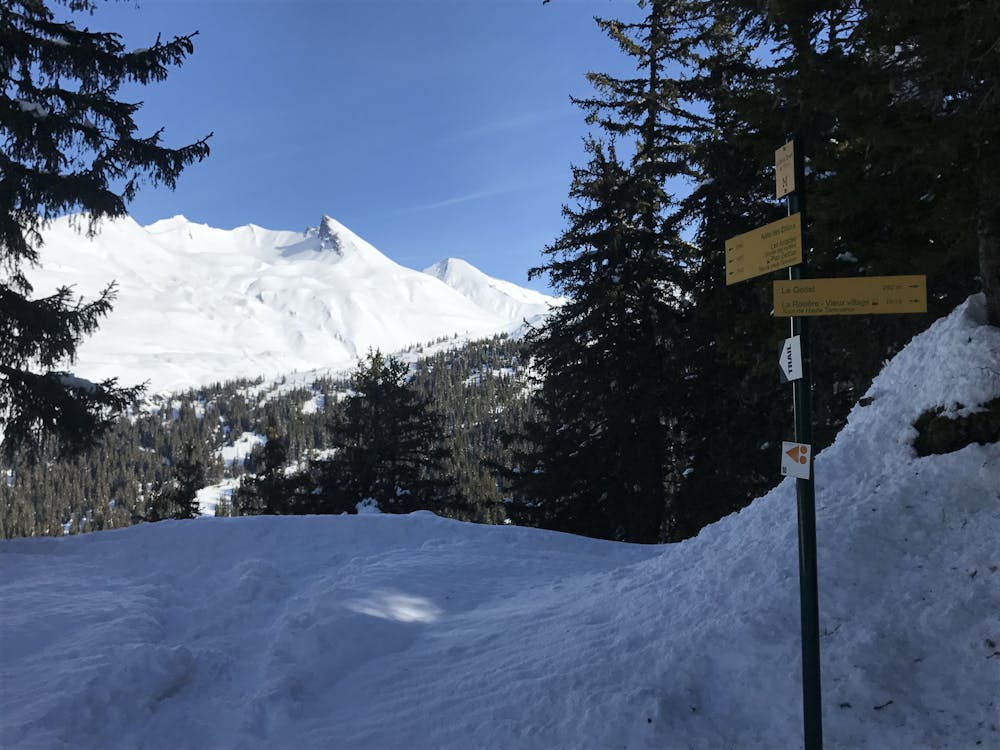
From Le Belvédère take the line of the summer footpath up a ridge to la Rosière. Follow the pistes to the Col de la Traversette at 2380m. A short descent the far side, then further piste skinning, brings you up to your high point for the day at 2430m. From here it is a gentle run down on pistes to the E and N of the col de Petit St Bernard, taking you down to the village of la Thuile.
Difficulty
Easy
Wide gentle slopes at around 20 degrees or less.
Low Exposure (E1)

Exposure is limited to that of the slope itself. Getting hurt is still likely if the slope is steep and/or the snow is hard.
Remoteness
Close to help in case of emergency.
Best time to visit
Features
- Single Descent
Equipment required
- Skins