Rodalben Felsenwanderweg Trail
A fabulous loop route with miles and miles of twisty, curvy, up and down singletrack through gorgeous, dense forest.
Mountain Biking Difficult
- Distance
- 42 km
- Ascent
- 1.3 km
- Descent
- 1.3 km
- Duration
- 4-5 hrs
- Low Point
- 249 m
- High Point
- 387 m
- Gradient
- 7˚

Rodalben is one of the official routes of the Mountainbikepark Pfälzerwald. The Mountainbikepark features 20 well-marked cross country routes through the Naturpark Pfälzerwald, one of the largest contiguous forests in Germany.
- •
- •
- •
Description
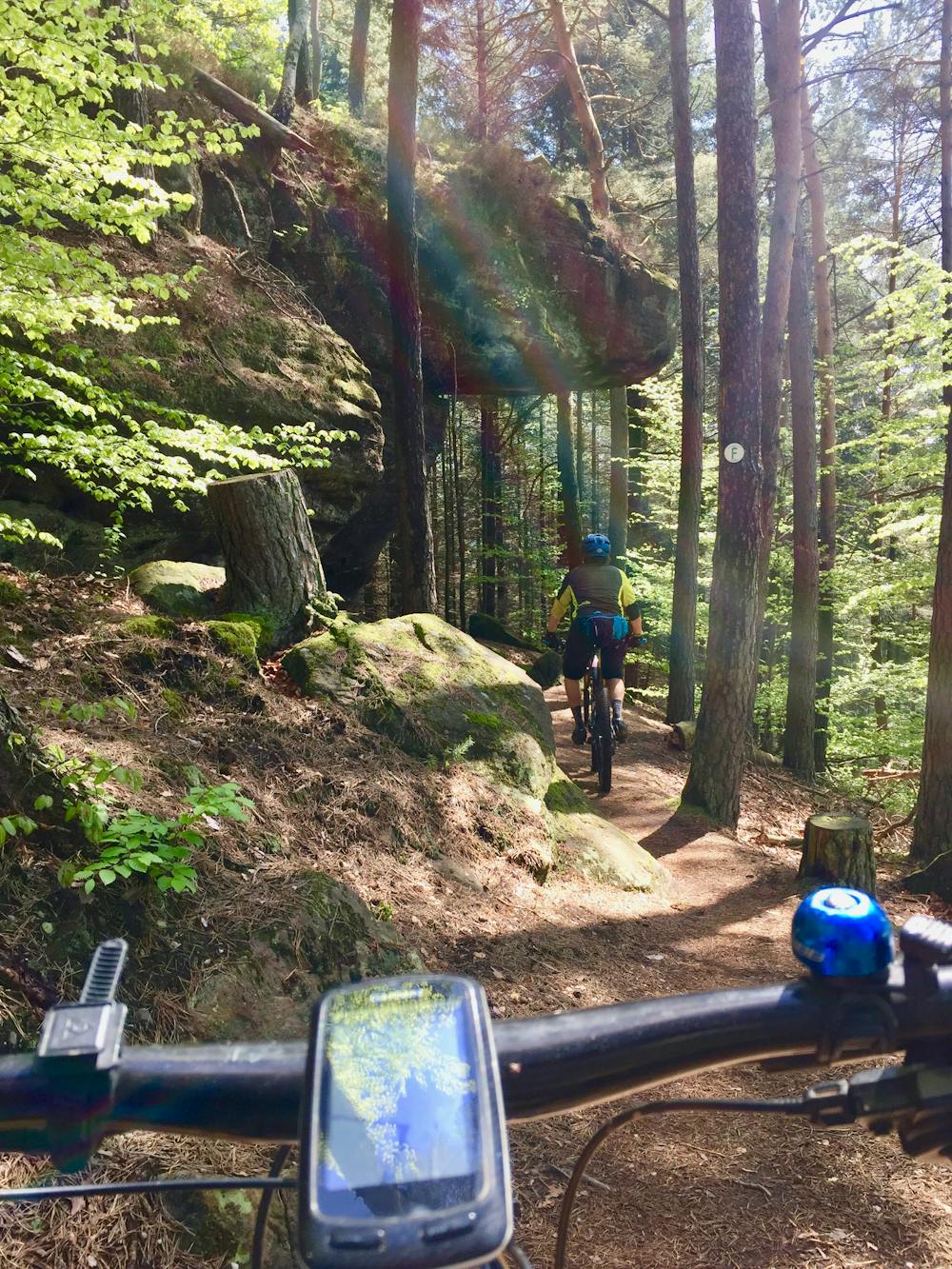
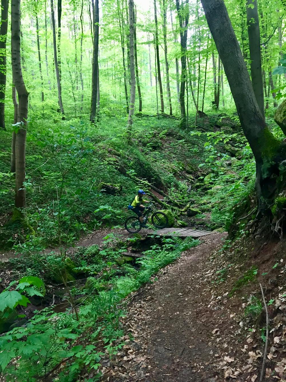
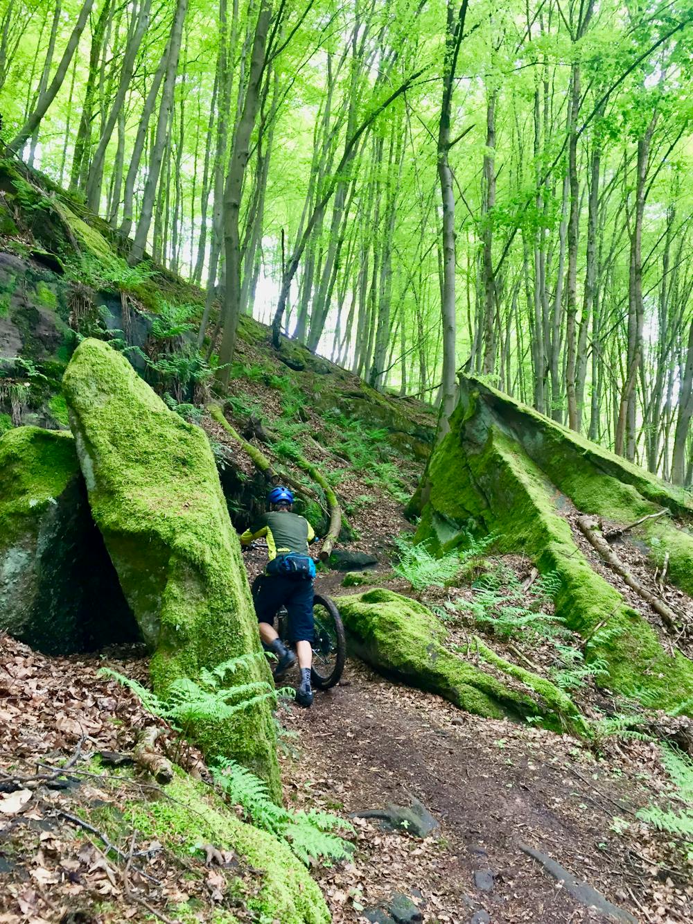
This is a really fabulous loop through the lush, dense Palatinate forest. You will be spoiled by the ever-changing views from the trail as it winds past rocky outcrops through a beautiful forest, sometimes with a peek over the town. The entire route runs near cliff sides. You will definitely get a sense of being in an enchanted forest on this ride.
The majority of this route follows excellent natural singletrack with only the odd cross-over of doubletrack or road. There are moderate, individual climbs and downhill runs, as the route undulates significantly. This is by far the best trail in the area!
The trail itself isn't super technical like you would expect from a downhill trail at a bike park, but don't let that fool you: there are plenty of techy sections that require maneuvering through or past rocks, through narrow spaces, over bouldery rock gardens, and, at times, the gradient is steep up and down. Expect plenty of roots, which can be particularly slippery during wet conditions.
Due to the length of the ride, and with more than 1,000m of undulating climbing, this route is a pretty physically-demanding mountain bike ride. A good level of fitness is required to complete this route. Take some sarnies, and plenty of water, for a little picnic halfway around, as there are some beautiful areas to stop underneath rock outcrops.
Note: "Felsenwanderweg," when translated to English means "Rock Trail."
Difficulty
Difficult
Mostly stable trail tread with some variability featuring larger and more unavoidable obstacles that may include, but not be limited to: bigger stones, roots, steps, and narrow curves. Compared to lower intermediate, technical difficulty is more advanced and grades of slopes are steeper. Ideal for upper intermediate riders.
Low Exposure

The path is on completely flat land and potential injury is limited to falling over.
Remoteness

Away from help but easily accessed.
Best time to visit
Features
- Technical
- Picturesque
- Singletrack
- In the forest
- Wet-weather friendly
- Drops
- Roots
- Rock Rolls
- Rock Gardens
- Wooden Feature