Harzer Brocken Tour
From Wernigerode via the beautiful Harzer forests up to the Brocken and back via the Drei Annen Hohne and the Zilliertalbachsperre.
Mountain Biking Moderate
- Distance
- 49 km
- Ascent
- 1.2 km
- Descent
- 1.2 km
- Duration
- 4-5 hrs
- Low Point
- 238 m
- High Point
- 1.1 km
- Gradient
- 7˚

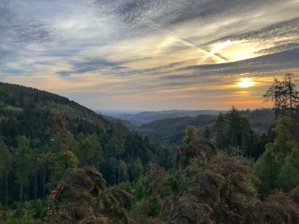
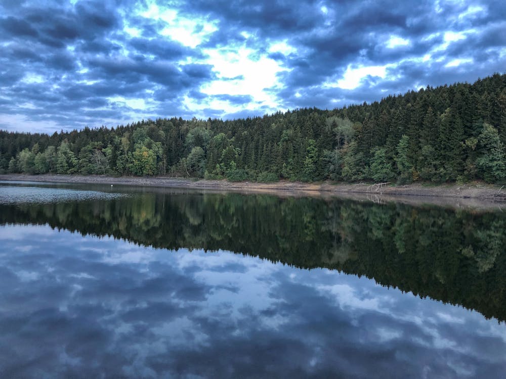
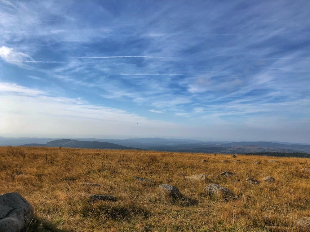
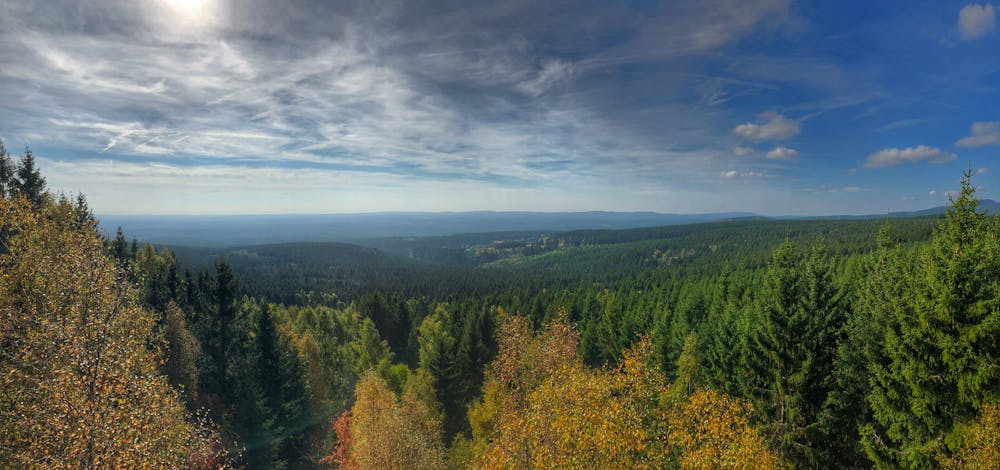
Those who do not know this route yet or only a part of it has not yet experienced in the Harz mountains should definitely experience this route, as it contains many classic experiences of the Harz mountains. The almost 50 kilometres long route leads over 1200 metres altitude difference through beautiful deciduous and coniferous forests of the Harz up to the Brocken. One is surrounded by trees and at morning or evening hours one can observe with luck, hunting and songbirds as well as deer and foxes. In these hours you have the possibility to watch breathtaking sunrises or sunsets. Along the way there are some information boards about local vegetation and local animal species. The Brocken is always well signposted as a destination. If I have reached the top of the mountain, the visibility is 50-100 km if the weather is good. It is especially recommendable to reach this in the early morning, so that one has to share the routes on the top with a few hikers. On the way back, it is almost exclusively downhill to the Drei Annen Hohne, which offers further good perspectives over the forests. Once you have arrived at the Zillierbach dam, you can take a last rest and enjoy the view over the lake before heading to Wernigerode.
- •
- •
- •
- •
- •
Description
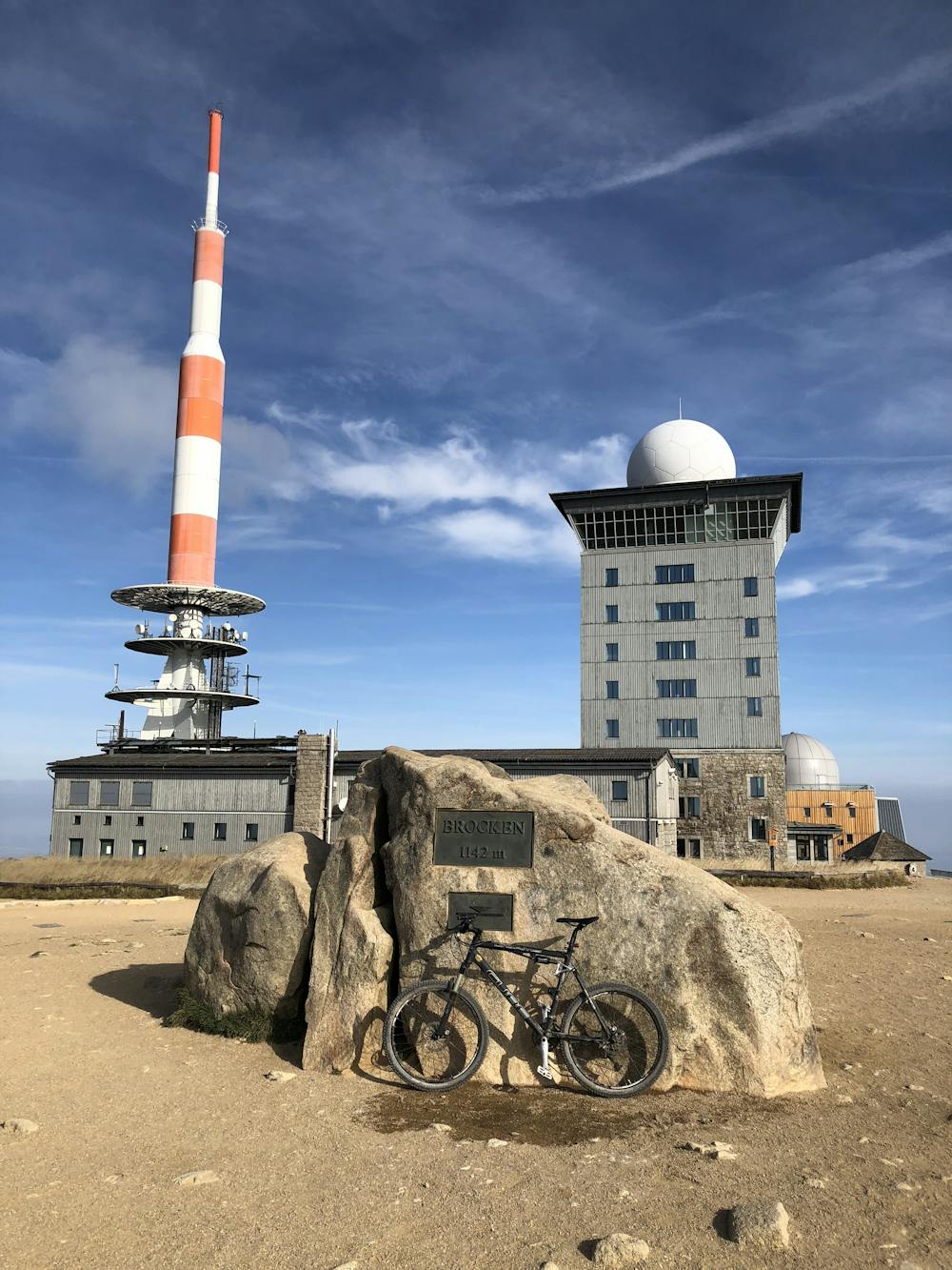
This path is suitable for advanced beginners with the appropriate stamina and is therefore the goal of every mountain bike beginner in the region. Not only because this is a wonderful day trip for the body, but also because one is full of beautiful, natural impressions and experiences, which for me comes along with great peace. For the Brocken it is recommended to bring thicker clothes due to the standard temperature differences of 5-10 degrees to the valley and differences in the wind speed of often more than 10 knots. You should always check the weather forecast of the mountain station and never underestimate the wind. Since the Brocken with its large, significant antennas is already visible from a long range, the visibility during the day can usually also be estimated from the valley.
Routes like these have inspired me to travel more in the Harz Mountains by mountain bike and to always explore new ways and connect them to beautiful routes via special points. I hope that you will share this assessment and continue to ride.
Difficulty
Moderate
Mostly stable trail tread with some variability, with unavoidable obstacles 8in/20cm tall or less. Other obstacles such as rock gullies and steep sections may exist. Ideal for lower intermediate riders.
Medium Exposure

The trail contains some obstacles such as outcroppings and rock which could cause injury.
Remoteness
Away from help but easily accessed.
Best time to visit
Features
- Flow
- Hike a bike
- Road sections
- Rock Rolls