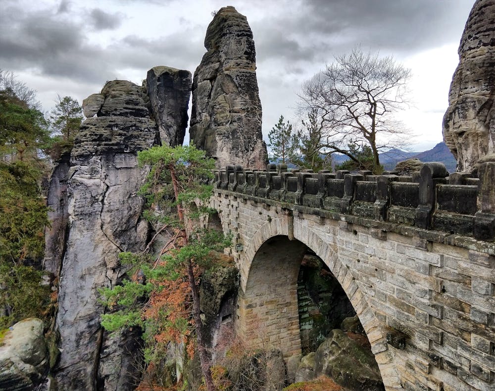
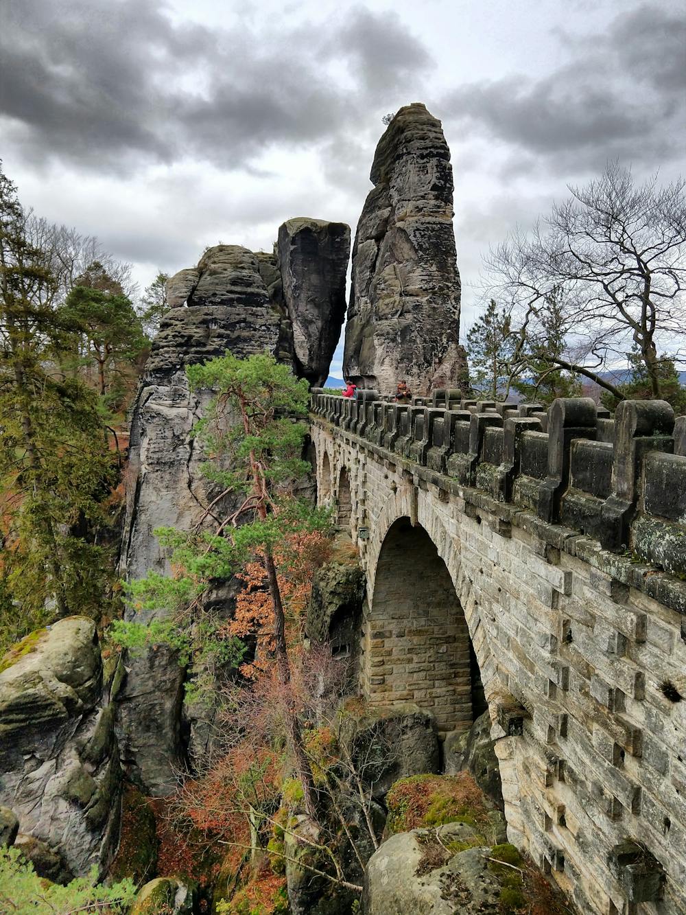
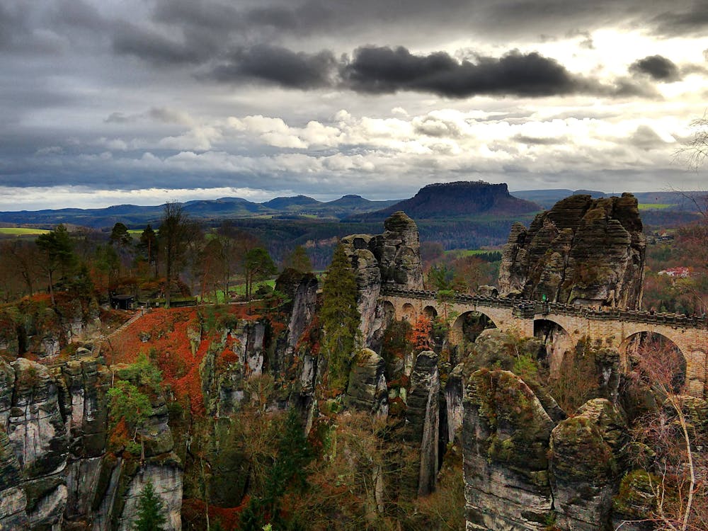
Bastei Bridge
Choose to hike to the most famous natural attraction in Saxon Switzerland.
Hiking Difficult
- Distance
- 2.6 km
- Ascent
- 170 m
- Descent
- 170 m
- Duration
- 0-1 hrs
- Low Point
- 115 m
- High Point
- 272 m
- Gradient
- 9˚

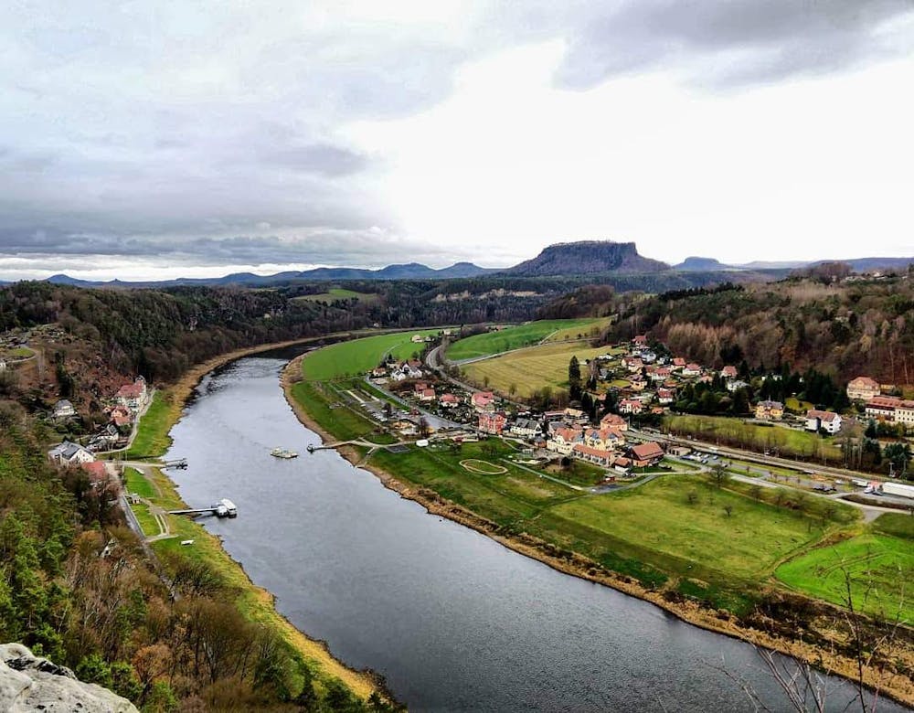
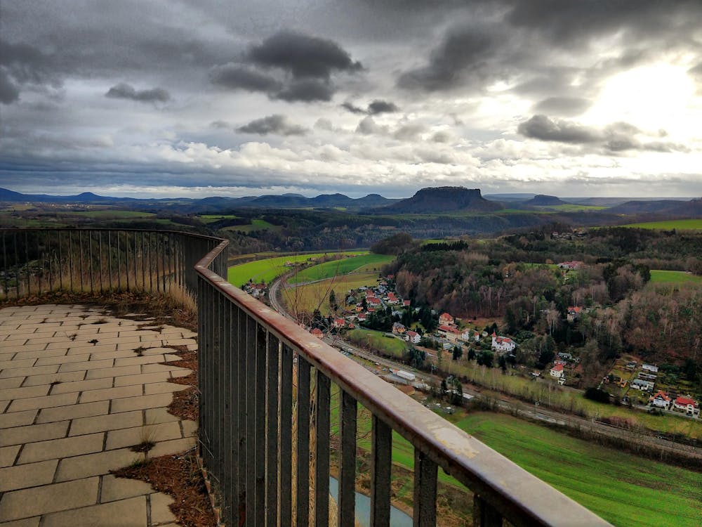
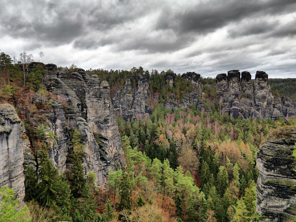
"Bastei is the most famous rock formation in Saxon Switzerland, Germany,” writes Saechsische-Schweiz.de. "Bastei and the Bastei Bridge are the highlights of the German Saxon Switzerland National Park area.”
- •
- •
- •
- •
- •
- •
- •
- •
- •
Description
This area is a famous tourist attraction, and has been for over 200 years. "In 1824, a wooden bridge was constructed to link several rocks for the visitors,” according to Wikipedia. "This bridge was replaced in 1851 by the present Bastei Bridge made of sandstone.”
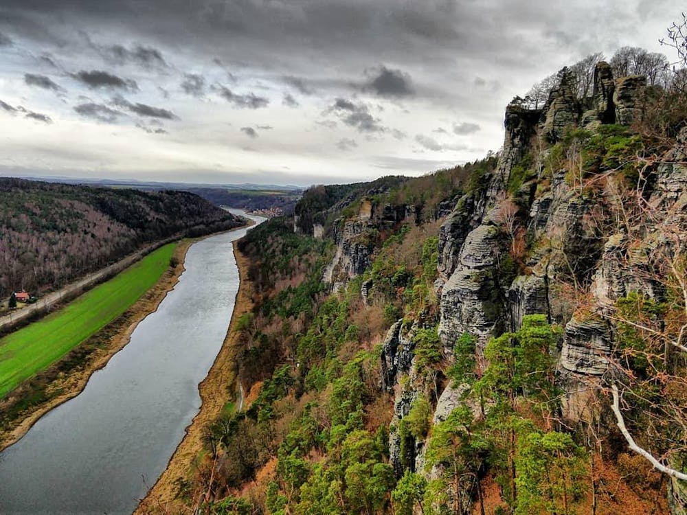
Before it was a tourist attraction, these rock formations were home to military installations over the centuries. You can still reach the remnants of an ancient stone castle on the ridge top.
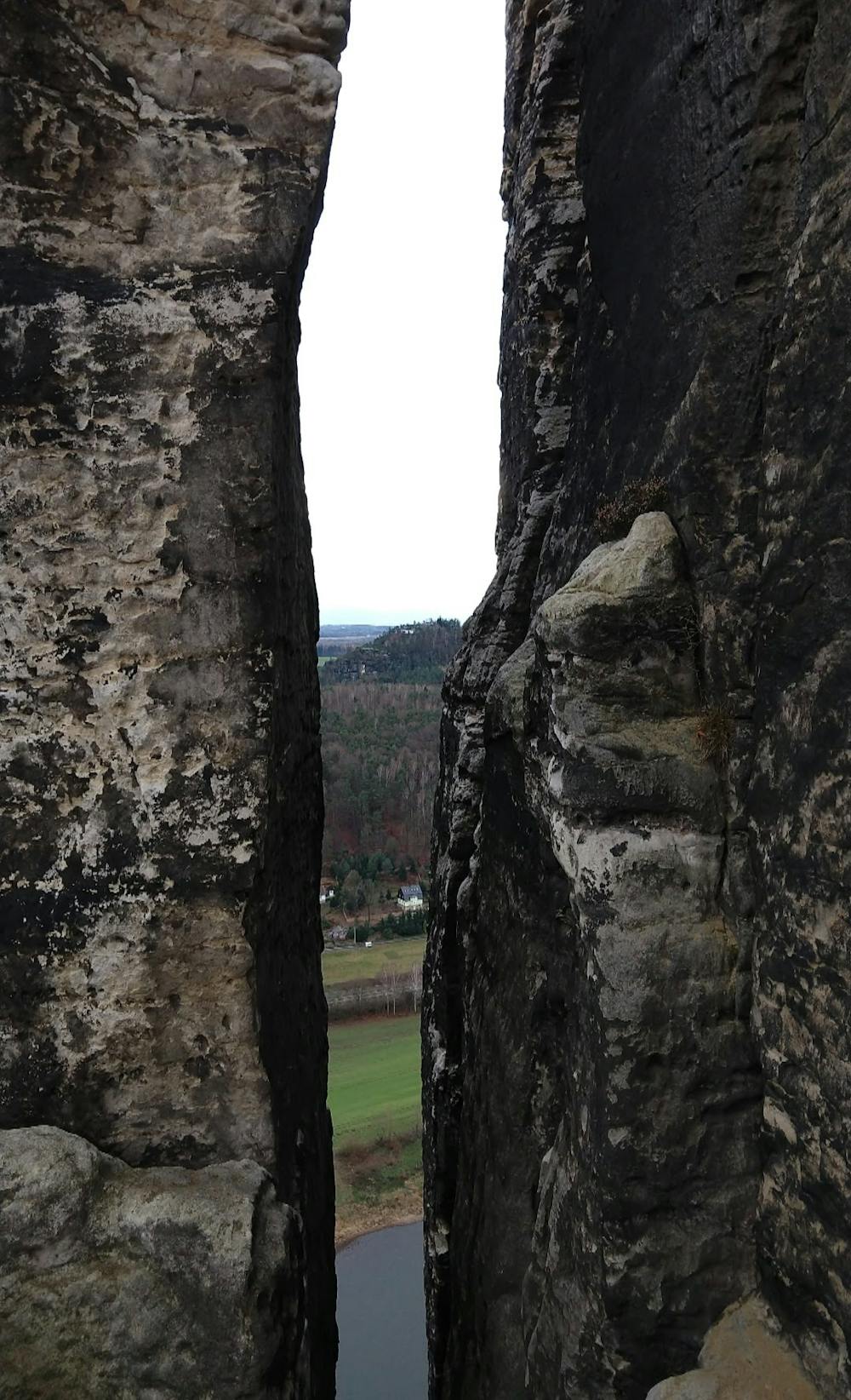
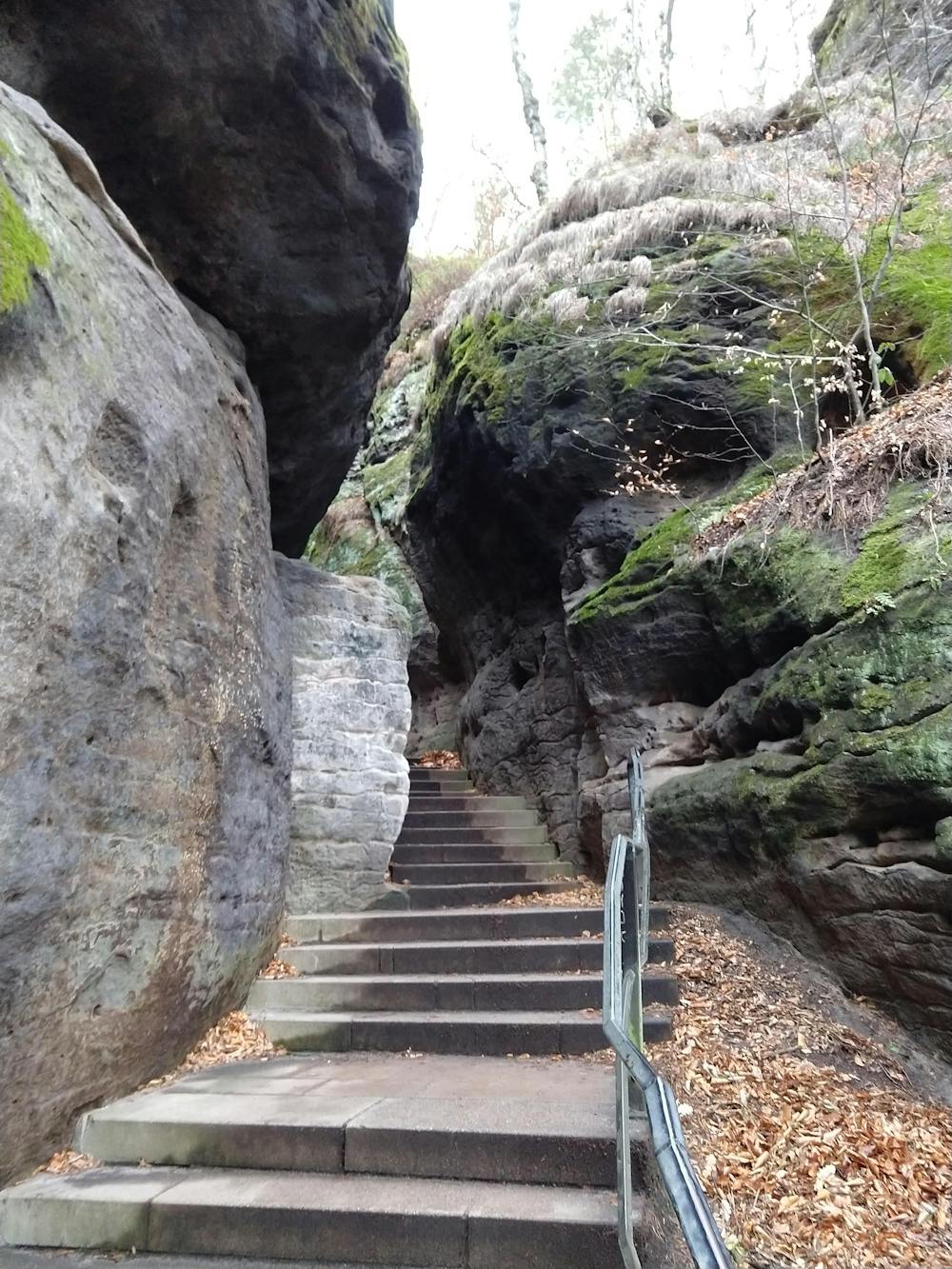
While you can drive up to the top of the ridge and hop out of your car to quickly check out the bridge, why drive when you can hike? The hike mapped here begins in the small town of Rathen, climbing all the way up to the top of the ridge. The climbing path indicated here is wide and well-developed. From water bars to minimize erosion, to steps and handrails, the “trail" like a highway up the hillside. However, this climb can be quite steep at times, and in the upper reaches, when you reach the rock formations, steep stone steps are carved into the sandstone to lead you higher up the ridge. Over time these steps have eroded significantly, and they can sometimes be tough to ascend.
During the climb, several viewpoints offer sweeping panoramas of the Elbe river valley. Be sure to pack a camera!
The bridge itself is truly a sight to behold. The effort that went into constructing a sandstone bridge of this stature in the mid-1800s must have been massive. The bridge’s position is so improbable that you won’t be able to resist snapping dozens of photos!
The return route mapped here offers some variety, with a narrow and steeper singletrack descent down the hillside. This alternative descent option will also take you away from the crowds of tourists—a welcome break after the throngs at the bridge.
Sources: https://en.wikipedia.org/wiki/Bastei https://www.saechsische-schweiz.de/en/region/highlights/bastei-bridge.html
Difficulty
Difficult
Hiking trails where obstacles such as rocks or roots are prevalent. Some obstacles can require care to step over or around. At times, the trail can be worn and eroded. The grade of the trail is generally quite steep, and can often lead to strenuous hiking.
Medium Exposure

The trail contains some obstacles such as outcroppings and rock which could cause injury.
Remoteness

Close to help in case of emergency.
Best time to visit
Features
- Historical
- Picturesque
- Forestry or heavy vegetation