6 routes · Hiking
A boardwalk by the national park visitor center, with spots to fish and look out over Biscayne Bay.
Hiking Easy

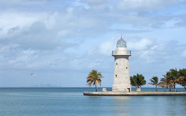
You can’t see much of Biscayne National Park without getting on a boat. Upon entering the park on the mainland, you can go into the visitor center and learn about the exemplary marine environment, but you can’t see much of it for yourself without entering the water or crossing it to get to one of the keys. The exception is Jetty Trail, which is a path along the water beginning from the visitor center. You can enjoy this trail even if you don’t take a boat ride, or you can take a stroll while you’re waiting to board.
Jetty Trail begins as a boardwalk wrapping around the park’s small marina. It then turns to a gravel path on the rock jetty that extends into the bay. The boardwalk and jetty are popular places for fishing, picnicking, or just relaxing on one of the benches and enjoying the views. There are also a few informative signs about the surrounding nature, like mangrove trees lining the jetty, and the barnacle communities on the rocks. You can also see many kinds of birds, and you might spot fish or even dolphins in the water.
Easy
Walking along a well-kept trail that’s mostly flat. No obstacles are present.

The trail contains some obstacles such as outcroppings and rock which could cause injury.

Close to help in case of emergency.
6 routes · Hiking

63 routes · Alpine Climbing · Hiking