Pat Sin Leng Hike
Beautiful Hike in the end rolling, if you start from Taipo
Hiking Difficult
- Distance
- 17 km
- Ascent
- 1.1 km
- Descent
- 1.1 km
- Duration
- 5-6 hrs
- Low Point
- 51 m
- High Point
- 614 m
- Gradient
- 16˚
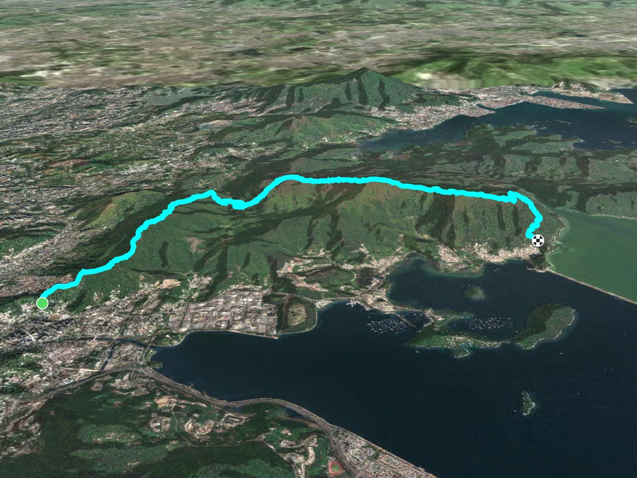
This is a popular hiking route which is generally considered to be difficult. It's not remote, it features high exposure and is typically done between September and April. From a low point of 51 m to the maximum altitude of 614 m, the route covers 17 km, 1061 vertical metres of ascent and 1063 vertical metres of descent.
Description
Beautiful hike, best to be well prepared
Difficulty
Difficult
Hiking trails where obstacles such as rocks or roots are prevalent. Some obstacles can require care to step over or around. At times, the trail can be worn and eroded. The grade of the trail is generally quite steep, and can often lead to strenuous hiking.
High Exposure

Some trail sections have exposed ledges or steep ascents/descents where falling could cause serious injury.
Remoteness

Close to help in case of emergency.
Best time to visit
Features
- Summit Hike
- Dog friendly
- Wild flowers
- Forestry or heavy vegetation