4.1 km away
Tai Long Wan Beach
A perfect hike and beach combination.
Moderate Hiking
- Distance
- 11 km
- Ascent
- 449 m
- Descent
- 449 m
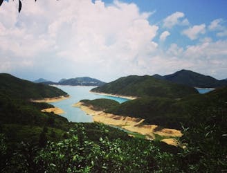
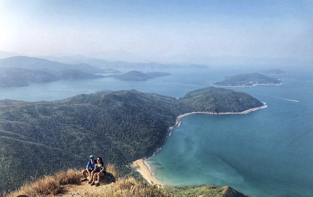
The longest hike in this guidebook, Sharp Peak is surrounded by turquoise waters, small fishing villages, and white sand beaches. You’ll easily forget you’re in one of the busiest cities in the world.
Hiking Difficult

Even though Sharp Peak hike’s starting point is further away from Hong Kong’s city centre, it’s still easily accessible via public transportation. Like most of Hong Kong’s hikes, there are many routes to choose from for this trail, but the most accessible one is the Pak Tam Au loop as the bus from and to Sai Kung Pier stops right by the trailhead.
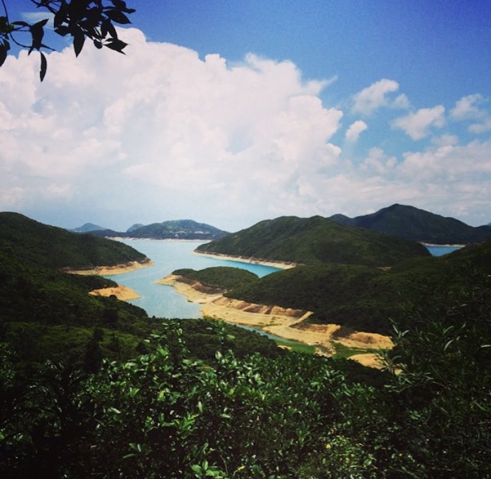
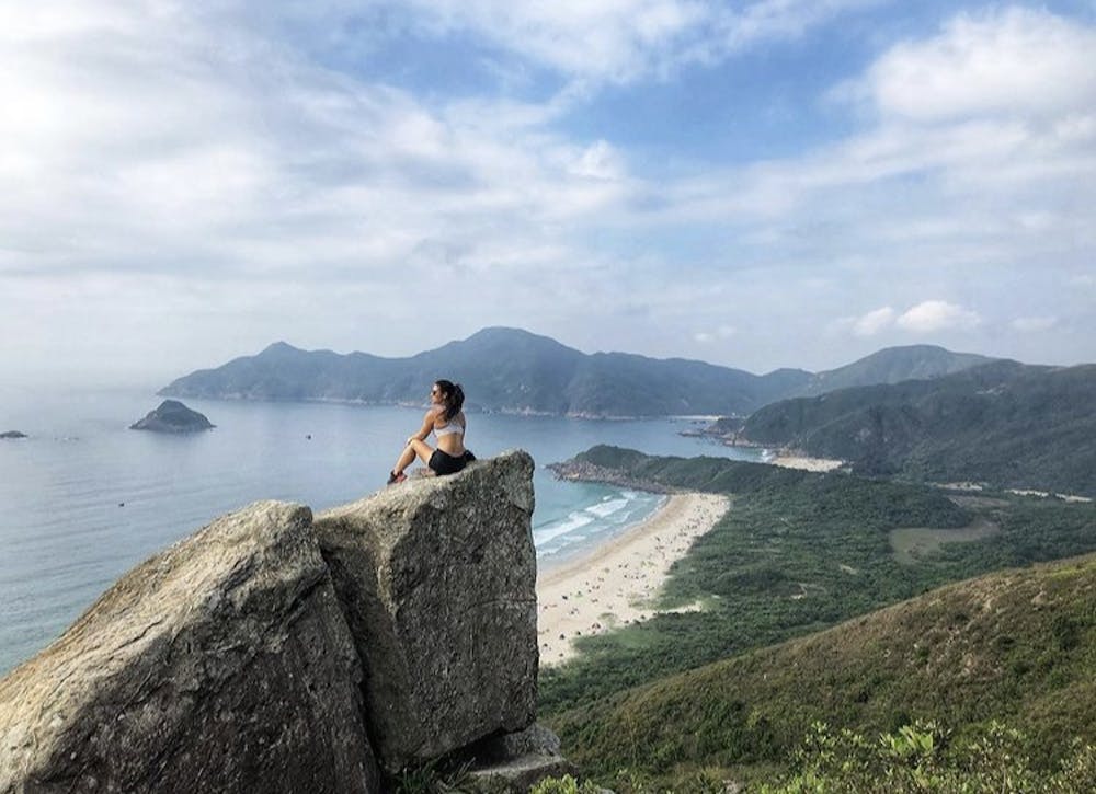
Enjoy the paved, mostly flat trail as you warm up your legs. About an hour into the hike, you’ll reach the clearly marked Sheung Luk Stream. For an added short loop and a cool down, turn off the track and walk down the stream towards the Sai Kung rockpools, where you can cliff-jump off the 6-metre-high rocks into the fresh water.
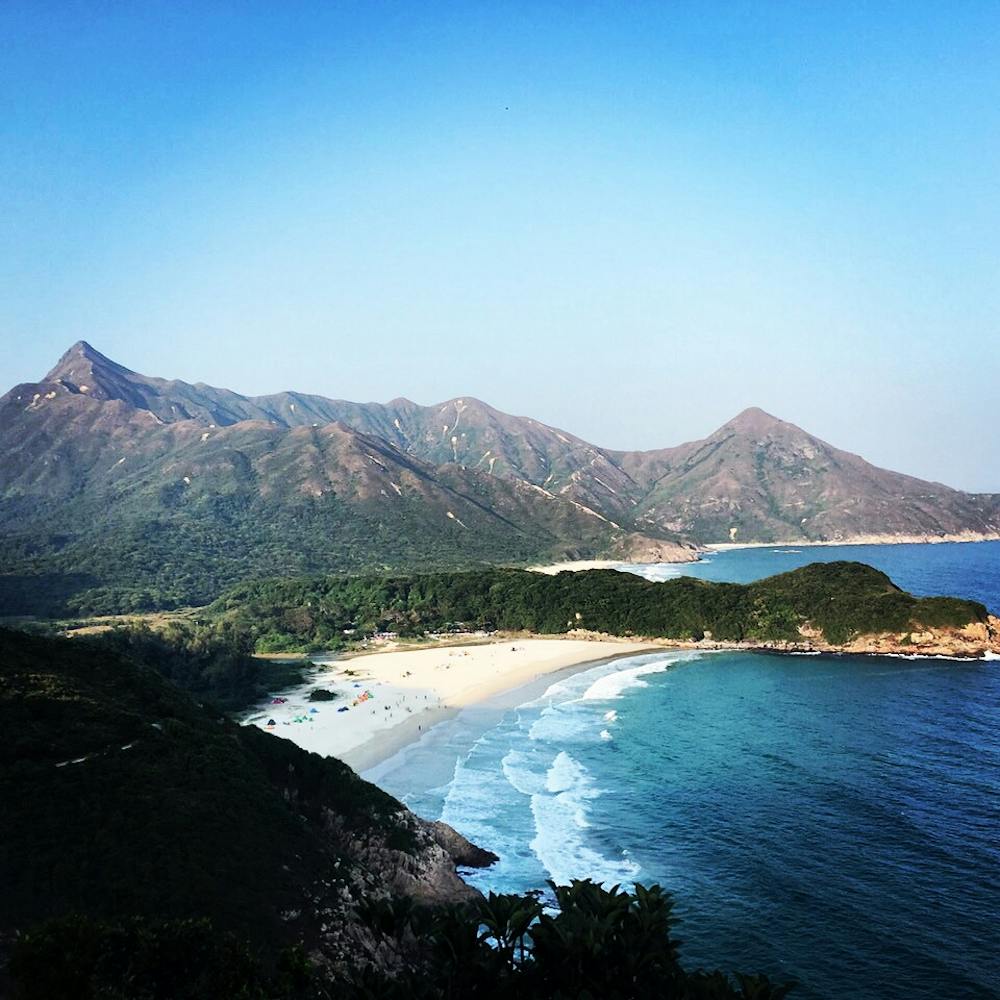
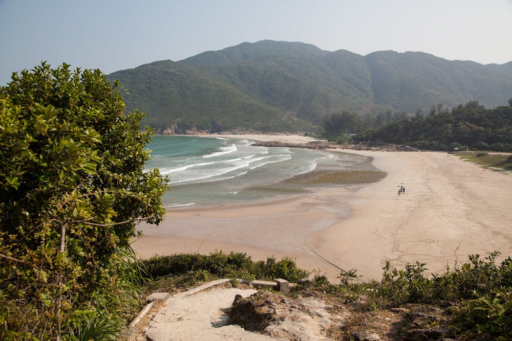
Back en route, you’ll quickly reach the iconic Ham Tin and Tai Wan Beaches, where you have an amazing view of Sharp Peak in the background. Once you reach the far end of Tai Wan Beach, you will see multiple routes that all lead you up to Sharp Peak.
Then it’s all uphill. The final section to the top is rocky and requires a bit of bouldering – but it’s nothing precarious or requiring specific skills. The effort is worth it, as dramatic mountain ridges, outlying green islands, expansive turquoise waters all mesmerise you from the high vantage point.
On your way back, you have the option of shortening your return journey by catching one of the speedboats from Ham Tin Beach back to Sai Kung Town, where you can catch a bus to the city. Enjoy a different perspective of the peak you just climbed as you glide away over the water.
Difficult
Hiking trails where obstacles such as rocks or roots are prevalent. Some obstacles can require care to step over or around. At times, the trail can be worn and eroded. The grade of the trail is generally quite steep, and can often lead to strenuous hiking.

Some trail sections have exposed ledges or steep ascents/descents where falling could cause serious injury.

Away from help but easily accessed.
4.1 km away
A perfect hike and beach combination.
Moderate Hiking

6 routes · Hiking

8 routes · Hiking