
50 routes · Freeride Skiing · Ski Touring
A staggeringly beautiful ski tour which also serves up some exciting, fast skiing.
Ski Touring Difficult

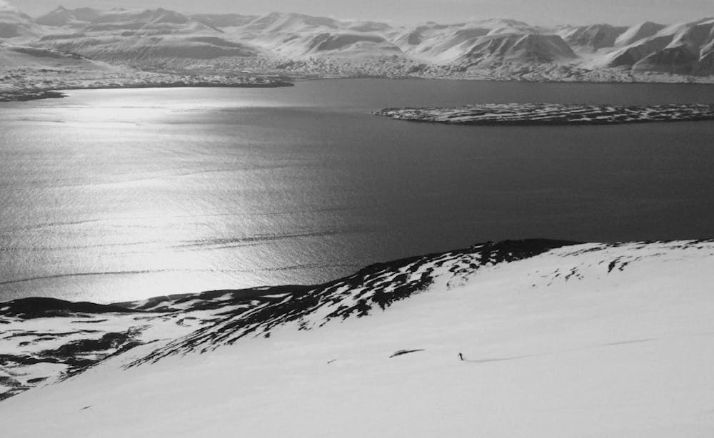
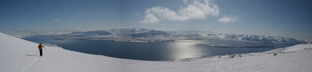
Even by local standards Kaldbakur is an incredibly well positioned peak and provides commanding views over the Troll Peninsula, Akureyri Harbour and Eyjafjörður fjord. It is easy to climb and the ski down is mainly mellow enough that you can focus on the scenery and not worry too much about route finding.
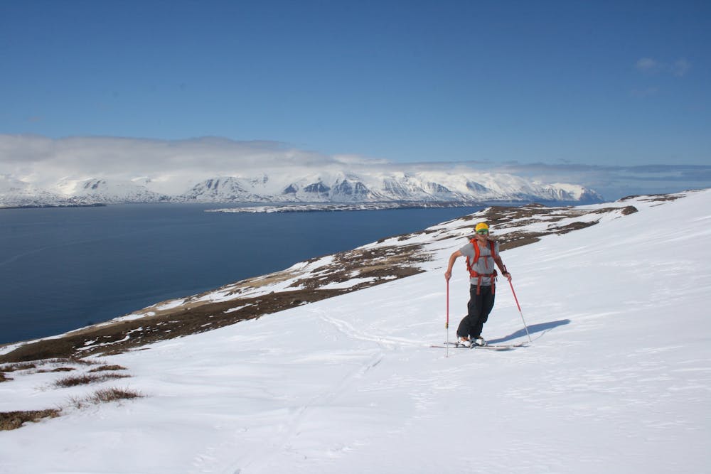
Drive to the tiny village of Greivik and continue north-west to a small parking area just after a stream. From here skin north, picking the line of least resistance to reach the blunt south-east ridge of Kaldbakur and then follow this easily to the summit. The exact line of ascent doesn't matter particularly, and the line marked here should only be a rough guide rather than a fixed route.
The summit is utterly stunning and enjoys expansive 360 degree views. There is a small cairn on the summit and a summit book to sign.
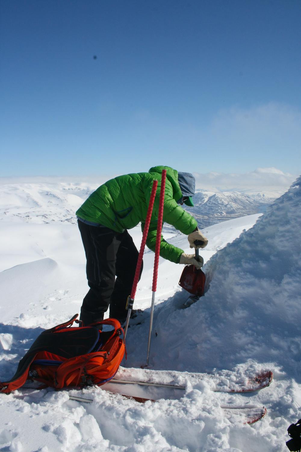
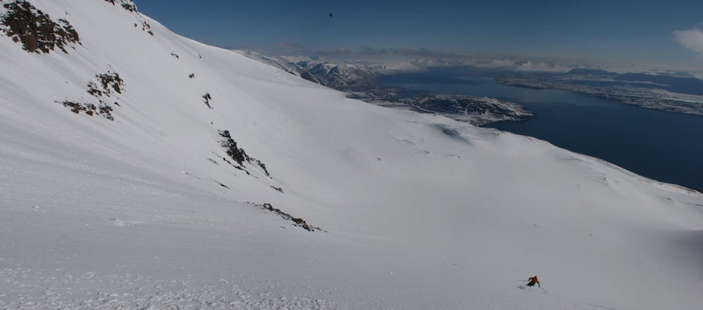
Whilst it is possible (and thoroughly enjoyable) to descend via the ascent route, an even better and more exciting way off the mountain is to ski the couloir and face immediately south of the summit.
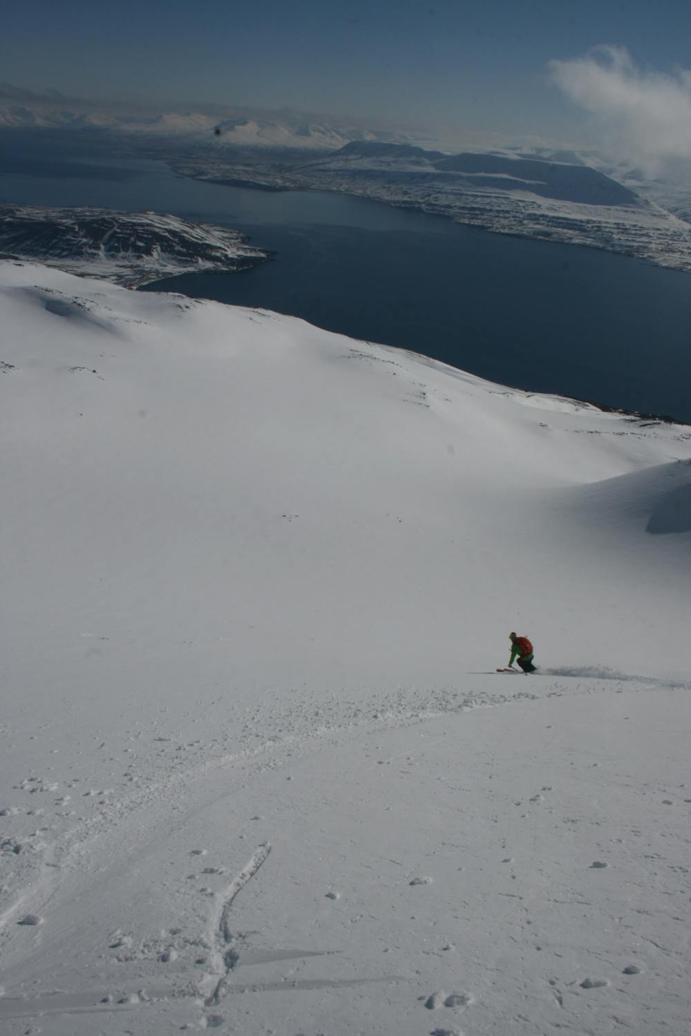
There may be a cornice above the couloir but once in the skiing is exciting without being technical and leads down onto a huge fan-shaped face below. Ski this and then descend mellower slopes below, drifting skier's left throughout.
As with the ascent route, there are countless options for the ski down and all provide straightforward, fun skiing with a wonderful backdrop. Whichever line you choose remember that you will need to end up back at the car or face a walk along the road to get back to it - this tour is wonderfully quiet but that does mean that hitch hiking back to the car is not really an option!
On the way back to Akureyri there are several short roadside tours for those with some energy left.
Difficult
Serious gradient of 30-38 degrees where a real risk of slipping exists.

Exposure is limited to that of the slope itself. Getting hurt is still likely if the slope is steep and/or the snow is hard.

Little chance of being seen or helped in case of an accident.
50 routes · Freeride Skiing · Ski Touring