Reykjahóll, Northwest Iceland
Easy hike through the small forest above Varmahlíð village
Hiking Easy
- Distance
- 1.9 km
- Ascent
- 53 m
- Descent
- 52 m
- Duration
- 0-1 hrs
- Low Point
- 55 m
- High Point
- 99 m
- Gradient
- 4˚

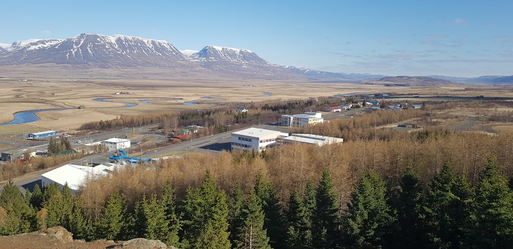
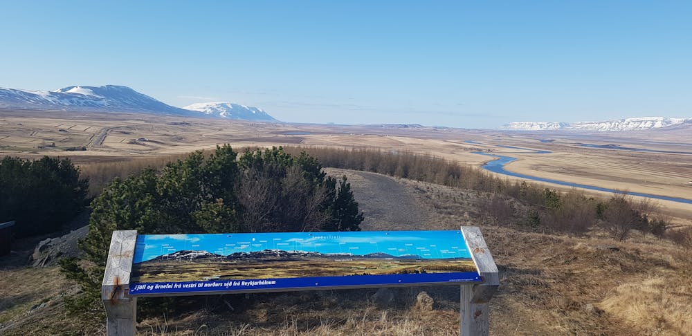
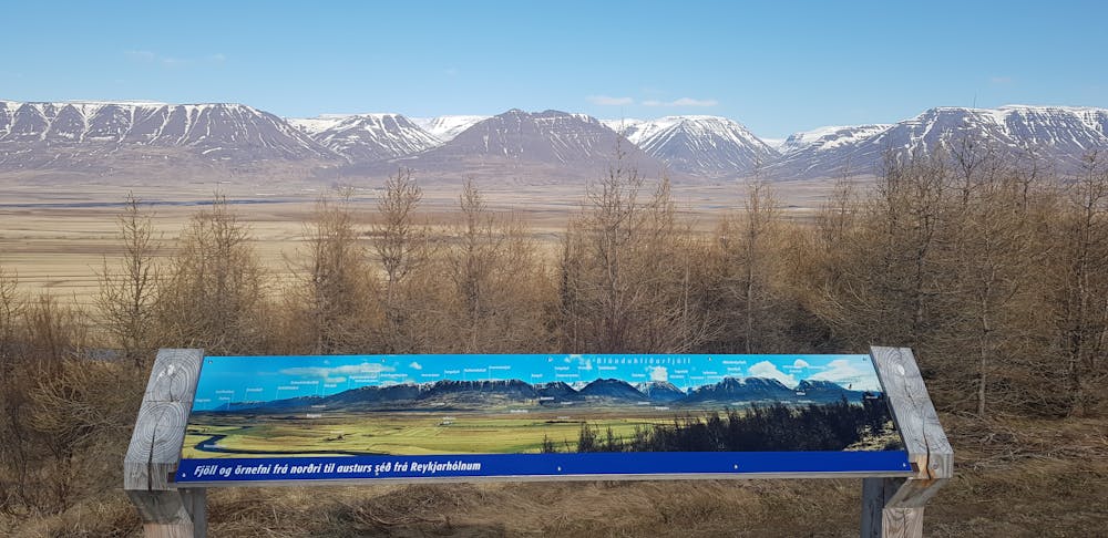
Þægileg ganga í gegnum skóg fyrir ofan Varmahlíð með fallegu útsýni yfir Skagafjörð. Á leiðinni eru bekkir þar sem tilvalið er að tilla sér og fá sér hressingu eða einfaldlega njóta náttúrunnar. Leiðin er hringur sem endar við upphafsstað. GPS upphafspunktur við íþróttavöllinn: 65.551717, -19.451903
- •
- •
- •
Description
English: A convenient and simple track through a forest close to Varmahlíð. It is a well maintained, easy path with a slight incline leading to a lookout point on top of the hill overlooking Skagafjördur. On the path you will find benches to sit down to enjoy the nature or your refreshments. The path ends at the starting point.
Difficulty
Easy
Walking along a well-kept trail that’s mostly flat. No obstacles are present.
Low Exposure

The path is on completely flat land and potential injury is limited to falling over.
Remoteness
Close to help in case of emergency.
Best time to visit
Features
- Picturesque
- Family friendly
- Forestry or heavy vegetation