15 routes · Hiking
Scenic hike, with great view over Skagafjörður bay.
Hiking Moderate

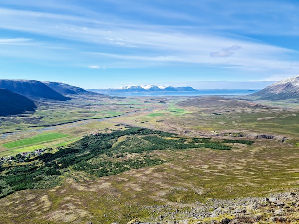
Gönguleið með frábæru útsýni yfir Gönguskörð, Sauðárkrók og út á Skagafjörð. Ekið út af Þverárfjallsvegi, nr 744 við gönguleiðaskiltið vestan við bæinn Skarð og ekið upp ca 300m norðan við Hraksíðuá. Á leiðinni eru hlið sem mikilvægt er að loka aftur. Við upphafsreit er upplýsingaskilti um gönguleiðina á íslensku. Gengið er eftir stikaðri leið að vörðu á Einhyrning suðaustast á Tindastóli, 795 m.y.s. Falleg og skemmtileg leið með góðu útsýni yfir Sauðárkrók og fjörðinn.
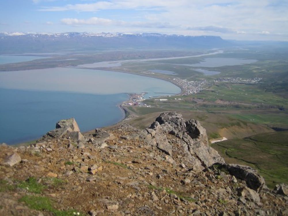
English: At the starting point you find a Information sign for the trail, the text is only in Icelandic. The trail is easily visible and marked with white sticks. On the way you have a great view over the town Sauðárkrókur, the bay and the higher you climb over the valleys of Skagafjörður and the surrounding mountains. After the steady climb up the mountain, the last elevation is the steepest up to the peek of Einhyrningur. When reaching the peek of Einhyrningur you are rewarded with an amazing view over Skagafjörður in all directions. At the top you will find a guestbook, where you can leave your names and date of your hike.
Moderate
Hiking along trails with some uneven terrain and small hills. Small rocks and roots may be present.

Some trail sections have exposed ledges or steep ascents/descents where falling could cause serious injury.

Away from help but easily accessed.
15 routes · Hiking