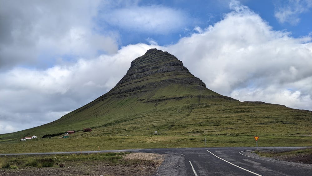
Kirkjufell
A short, steep and exposed climb up Kirkjufell
Hiking Extreme
- Distance
- 4.5 km
- Ascent
- 402 m
- Descent
- 402 m
- Duration
- 1-2 hrs
- Low Point
- 13 m
- High Point
- 404 m
- Gradient
- 16˚

This is a popular hiking route which is generally considered to be extreme. It's not remote, it features extreme exposure and is typically done between June and September. From a low point of 13 m to the maximum altitude of 404 m, the route covers 4.5 km, 402 vertical metres of ascent and 402 vertical metres of descent.
Description
Only a short hike but steep and with 3 short rock climbing sections and lots of exposure. Fantastic summit views.
Difficulty
Extreme
Scrambling up mountains and along technical trails with moderate fall exposure. Handholds are necessary to navigate the trail in its entirety, although they are not necessary at all times. Some obstacles can be very large and difficult to navigate, and the grades can often be near-vertical. The challenge of the trail and the steepness of the grade results in very strenuous hiking. Hikes of this difficulty blur the lines between "hiking" and "climbing".
Extreme Exposure

Some trail sections are extremely exposed where falling will almost certainly result in serious injury or death.
Remoteness

Close to help in case of emergency.
Best time to visit
Features
- Picturesque
- Summit Hike