Muni La
Traverse of the Muni La pass
Also in Jammu and Kashmir, India
Hiking Severe
- Distance
- 71 km
- Ascent
- 3.1 km
- Descent
- 2.5 km
- Duration
- 1 day +
- Low Point
- 2.9 km
- High Point
- 5.5 km
- Gradient
- 10˚

This is a popular hiking route which is generally considered to be severe. It's extremely remote, it features high exposure and is typically done in undefined. From a low point of 2.9 km to the maximum altitude of 5.5 km, the route covers 71 km, 3109 vertical metres of ascent and 2523 vertical metres of descent.
- •
- •
- •
- •
Description
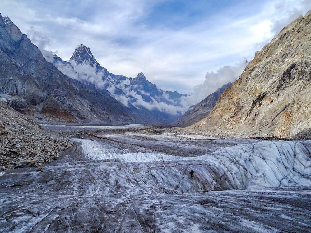
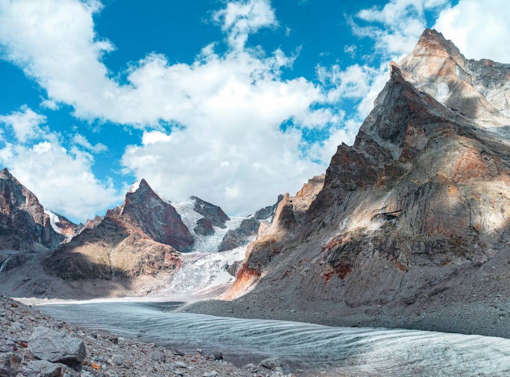
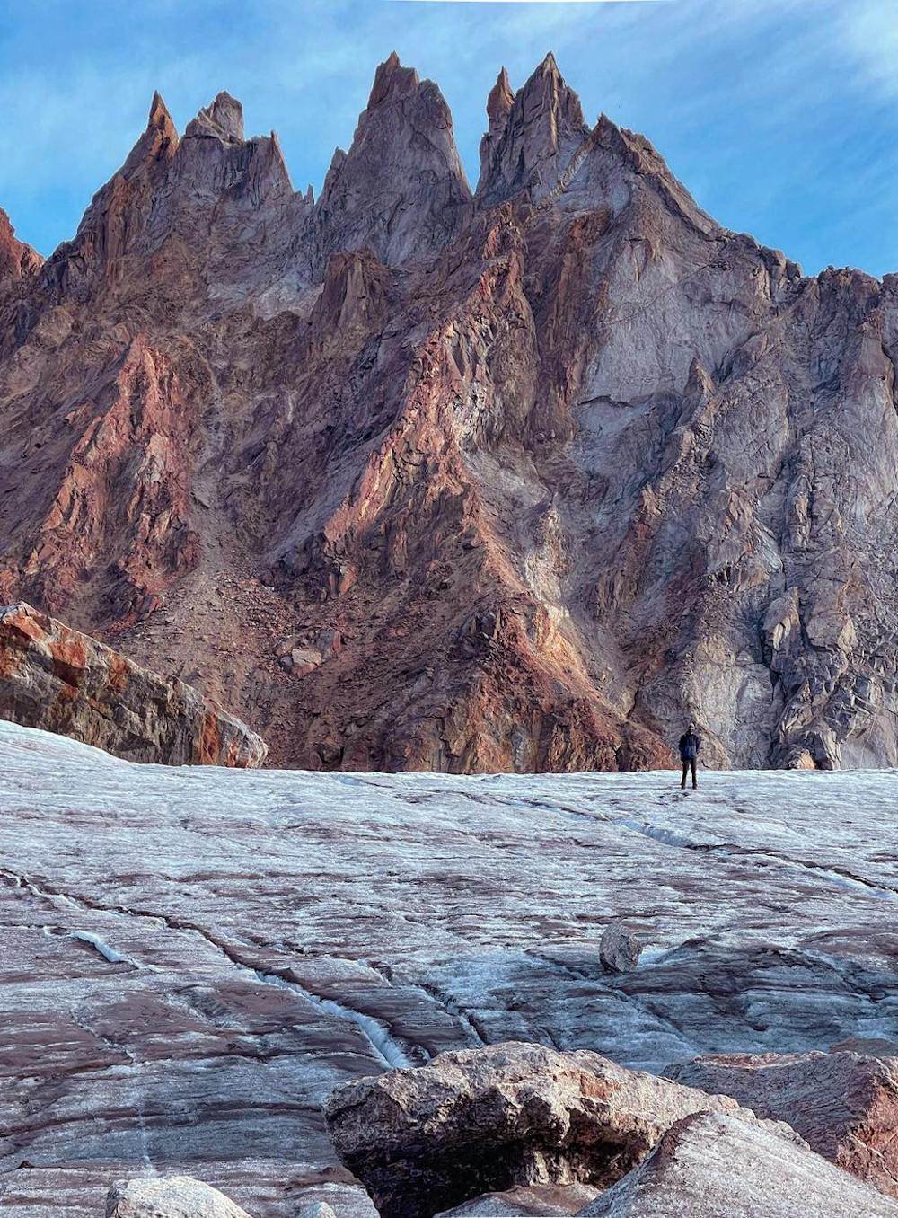
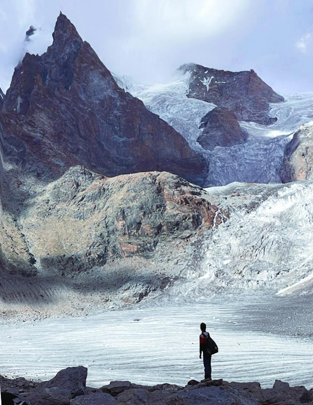
Muni La is an old, forgotten glaciated pass with mind-bending views of many 6000m, spiky peaks. It starts from Dharlang valley in Kishtwar and ends at Sani near Padum in Zanskar.
Difficulty
Severe
Hiking challenging trails where simple scrambling, with the occasional use of the hands, is a distinct possibility. The trails are often filled with all manner of obstacles both small and large, and the hills are very steep. Obstacles and challenges are often unexpected and can be unpredictable.
High Exposure

Some trail sections have exposed ledges or steep ascents/descents where falling could cause serious injury.
Remoteness

In the high mountains or remote conditions, all individuals must be completely autonomous in every situation.
Best time to visit
Features
- Picturesque