Peak 6012m fast hike
Beginner 6000m mountain.Dome Shape Summit
Hiking Difficult
- Distance
- 5.4 km
- Ascent
- 1.1 km
- Descent
- 8 m
- Duration
- 2-3 hrs
- Low Point
- 4.9 km
- High Point
- 6 km
- Gradient
- 20˚

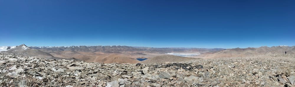
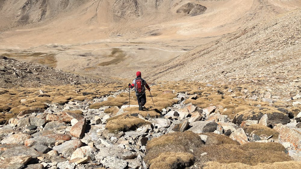
A round trip up and down the starting point is possible with pre acclimatisation to 5500m. The estimated round trip time shall be 9-11hours with the above condition. Any 4wheeler with descent ground clearance can ply till the starting point with little offroading.Water source shall be available in flowing form on 600m upwards from the starting point.For hand pump water source get the details from the locals or the best option is to carry your own 20ltr jars of water till the starting point only if you wish to make a stay on the way. The route shall start with steep ascent for the initial 2.2-2.4km whilst the gradient will gradually decline to 5degrees to cover rest of the distance with beautiful panoramas to unfold with every step. A comfortable stay can be pitched and optional ice climbing can be explored on the adjacent icefields alongside the route. Entire route shall be through rubbles and moraine. The top 400m is windy and the summit pans a view overlooking Tsokar Lake with the opposite views of Tsumdo village and Mentok Range. Rabbits is a very common sighting here.
- •
- •
Difficulty
Difficult
Hiking trails where obstacles such as rocks or roots are prevalent. Some obstacles can require care to step over or around. At times, the trail can be worn and eroded. The grade of the trail is generally quite steep, and can often lead to strenuous hiking.
Medium Exposure

The trail contains some obstacles such as outcroppings and rock which could cause injury.
Remoteness

Little chance of being seen or helped in case of an accident.
Best time to visit
Features
- Alpine
- Wildlife
- Picturesque
- Summit Hike
- Dog friendly
- Water features
- Family friendly