Peak 6128m
Prior Acclimatisation Advised
Hiking Extreme
- Distance
- 7 km
- Ascent
- 1.5 km
- Descent
- 0 m
- Duration
- 3-4 hrs
- Low Point
- 4.7 km
- High Point
- 6.1 km
- Gradient
- 20˚

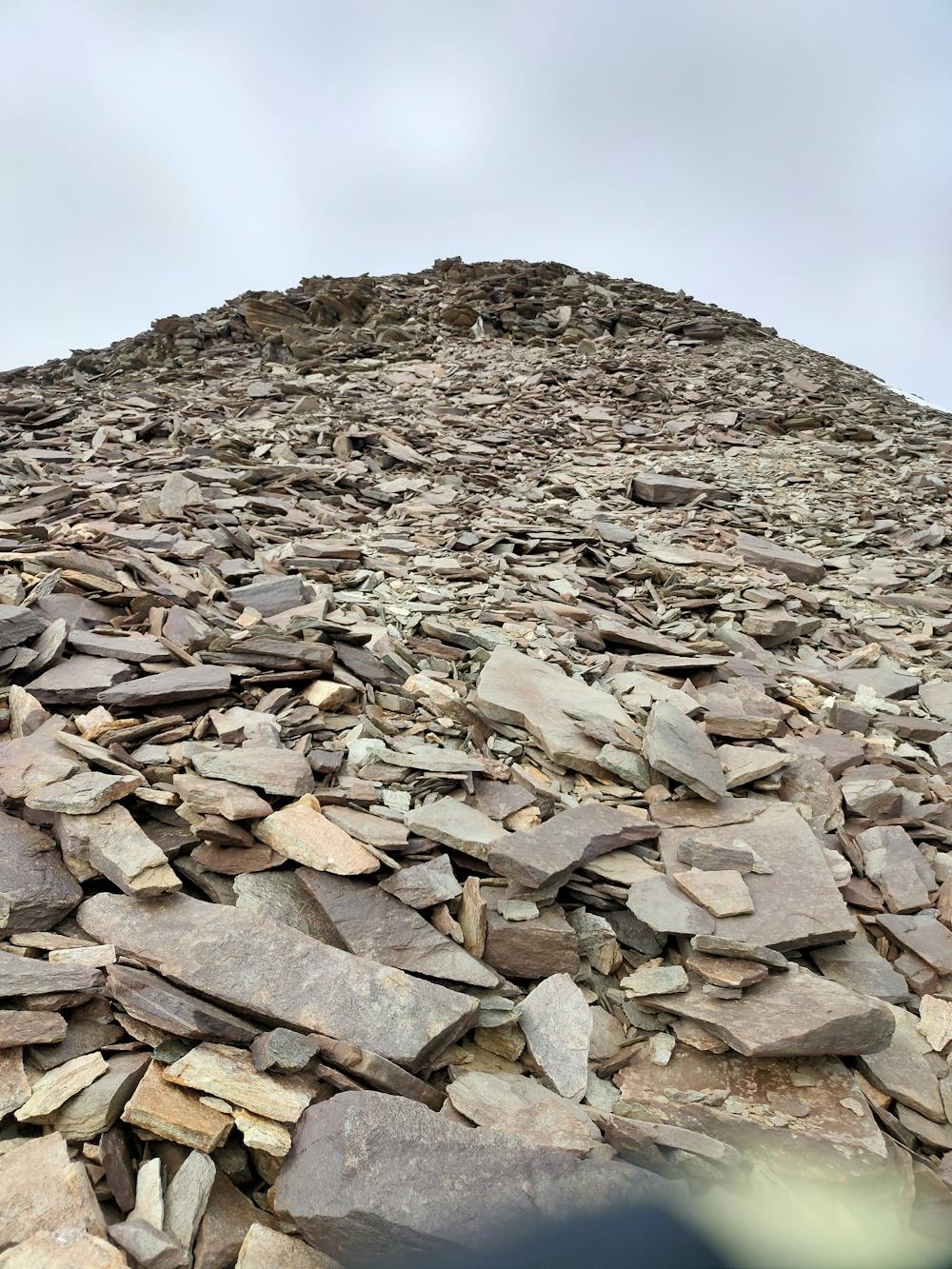
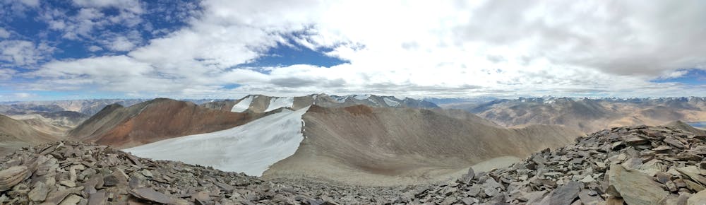
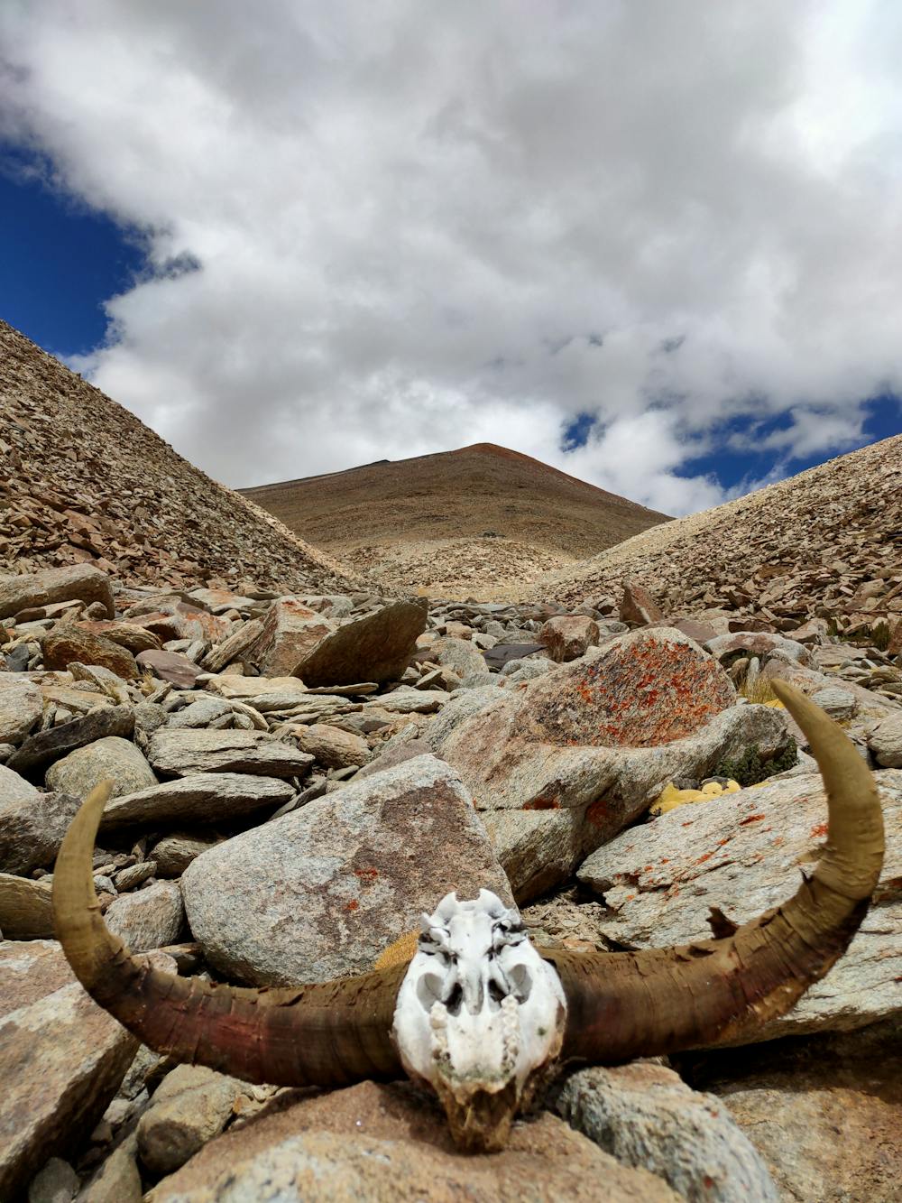
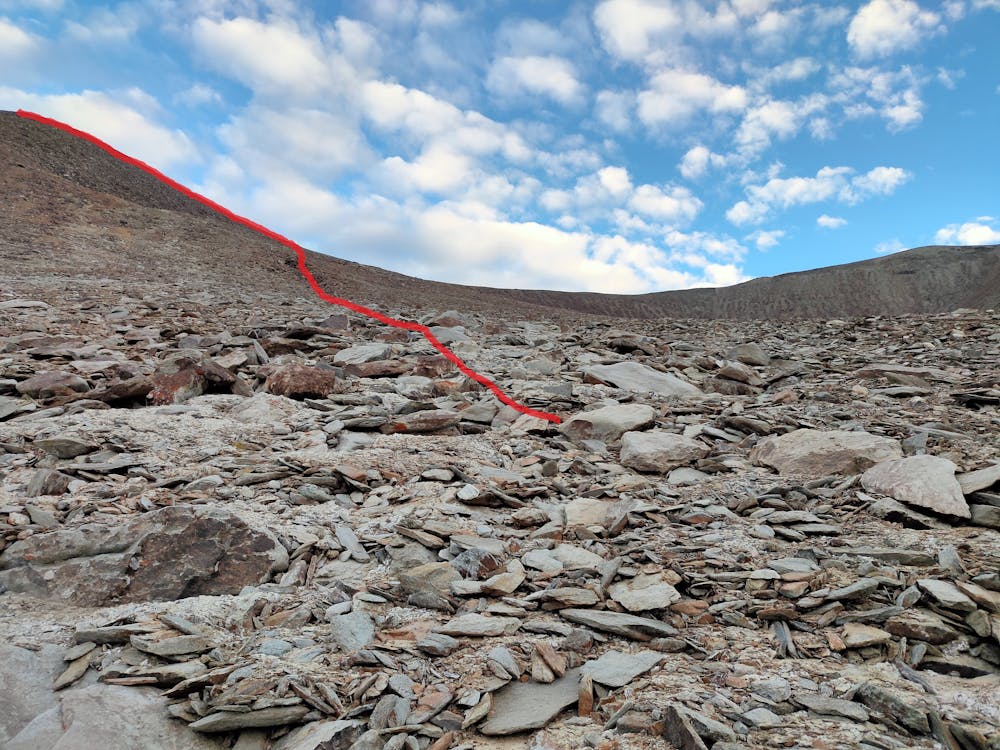
This is a typical cold desert moraine making it little tough to tackle soft sand walk along with hard moraine climbing mix.Navigation through the water gully is quite easier also on a new moon night to just get hold of the route straight from where you would park your vehicle or start from roadhead. The peak remains elusive till the last 300m and not seen from the starting point.The steep gradient which can be seen from the foothill of the peak is discouraging until you keep on negotiating till the very end and is safe to march on the stable moraine. A 100m part towards the top is little loose to be taken care to not get injured but is safe as it doesnt trigger any rock falls. Caution extreme wind speeds 30-40kmph carrying bony wind chills then the pertaining temperatures of the gully. A big RED FLAG for planning a days hike, compulsory prior acclimatisation needed to avoid getting flunked by the exhaustion wall while descending.Camping without acclimatisation is doable but the water scarcity or erratic water fresh streams shall pose a challenge except you get it loaded by ferring with local porters.Fresh snowfall shall add a challenge to descend the majority section of this route being rocky moraines. All the toiling on this route on the top is more worth then cursing it on the steps taken during the climb.A stellar of a route for Night Photography too. Depending upon the wildlife migration pattern during the course of the year you could be lucky to have glimpses of ibex,wild ass,snow leopards and according to local sources none of them would harm your existence out there on the route.
- •
- •
- •
- •
Difficulty
Extreme
Scrambling up mountains and along technical trails with moderate fall exposure. Handholds are necessary to navigate the trail in its entirety, although they are not necessary at all times. Some obstacles can be very large and difficult to navigate, and the grades can often be near-vertical. The challenge of the trail and the steepness of the grade results in very strenuous hiking. Hikes of this difficulty blur the lines between "hiking" and "climbing".
Extreme Exposure

Some trail sections are extremely exposed where falling will almost certainly result in serious injury or death.
Remoteness

Little chance of being seen or helped in case of an accident.
Best time to visit
Features
- Wildlife
- Picturesque
- Dog friendly
- Wild flowers
- Water features