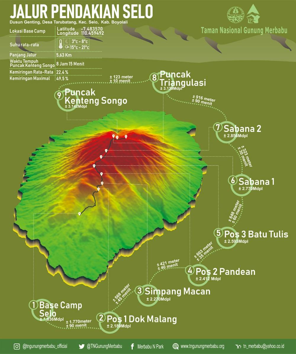
Mt. Merbabu 3122 masl
Starting point via Selo (Genting village), round trip
Hiking Moderate
- Distance
- 11 km
- Ascent
- 1.3 km
- Descent
- 1.3 km
- Duration
- 4-5 hrs
- Low Point
- 1.8 km
- High Point
- 3.1 km
- Gradient
- 21˚

This is a popular hiking route which is generally considered to be moderate. It's remote, it features high exposure and is typically done between May and September. From a low point of 1.8 km to the maximum altitude of 3.1 km, the route covers 11 km, 1331 vertical metres of ascent and 1334 vertical metres of descent.
Description
This is the most popular route and along the track you will be treated to beautiful views
Difficulty
Moderate
Hiking along trails with some uneven terrain and small hills. Small rocks and roots may be present.
High Exposure

Some trail sections have exposed ledges or steep ascents/descents where falling could cause serious injury.
Remoteness

Away from help but easily accessed.
Best time to visit
Features
- Summit Hike
- Forestry or heavy vegetation