Ecco la route 45 del Monferrato
San Salvatore Monferrato (24 km)
Mountain Biking Easy
- Distance
- 25 km
- Ascent
- 557 m
- Descent
- 557 m
- Duration
- 2-3 hrs
- Low Point
- 126 m
- High Point
- 250 m
- Gradient
- 5˚

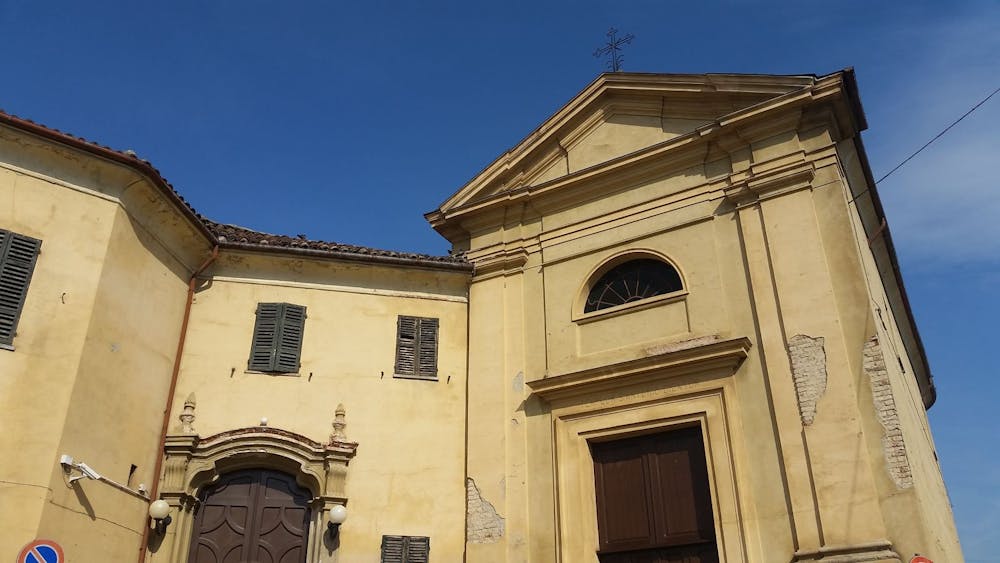
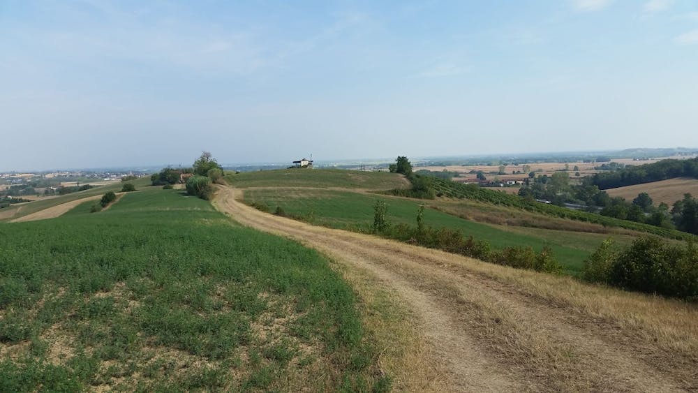
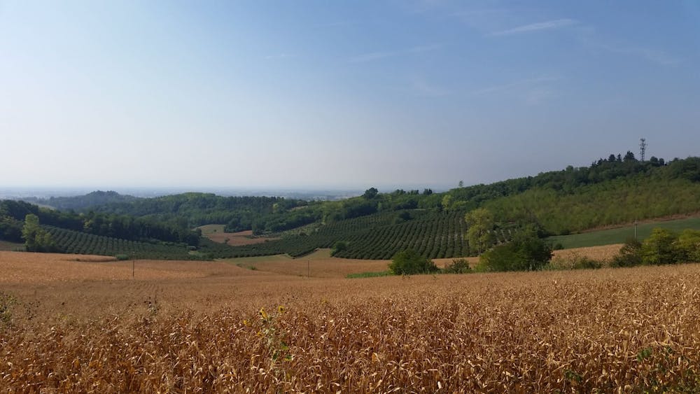
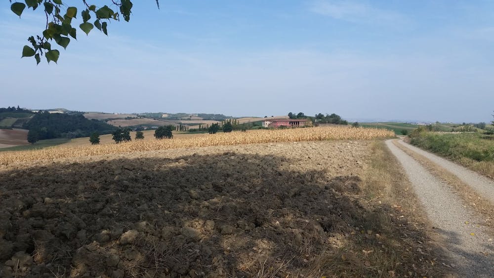
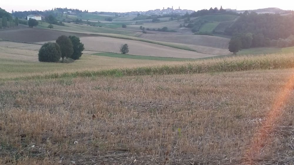
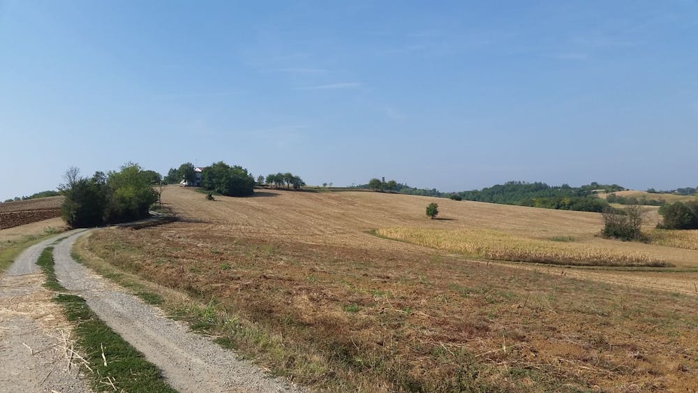
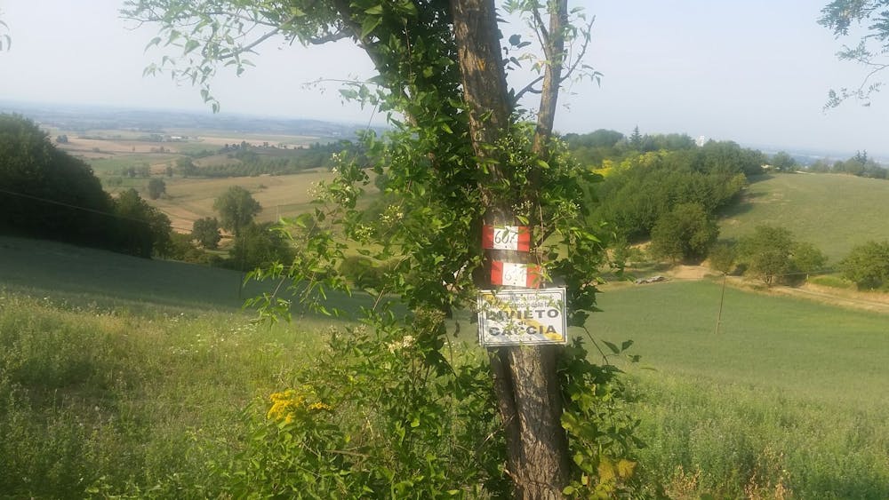
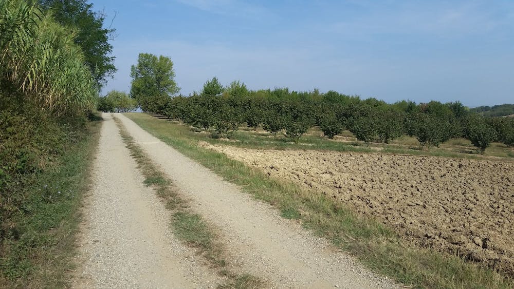
We call it Route 45, because it is a tribute to the 45th parallel North, which crosses much of this hilly area of Monferrato (UNESCO World Heritage Site) and does so at 6 different points, repeatedly placing the cyclist just halfway between the North Pole and Equator! The loop route is a balanced set of rapid ups and downs of hills where there are cultural elements, naturalistic aspects and beautiful views: so, to put it in the way we like it, the circle indeed the circles close.The start of the route is from one of the oldest palaces of San Salvatore Monferrato, or from Palazzo Carmagnola located in the homonymous square of the country itself. Along a short uphill stretch on Via Prevignano, we will pass next to the parish church of San Martino (XV century) and then, following the route, we will flank the church of San Siro (XVI century) on our right. After about 700 meters from the beginning, we turn left into Via Camurati where, near Villa Lingua - former headquarters of the General Staff during the Second War of Independence - begins a gravelly descent that will take us to the secondary road that connects San Salvatore to Alessandria, the lowest point of the path itself. In a few minutes the scenery changes dramatically, passing from the city context to gravel roads, green hills and poplar groves but ... the climb is immediately there, ready to wait, immediately around the corner, to claim its "hunger" for effort and its "fame" hilly typical of Monferrato. After having covered almost 2 km of gravelly hill paths immersed in nature, you return for a short stretch to the village to resume a new road that leads to the sanctuary of the Madonna del Pozzo (km 3.930), a small oasis of peace surrounded by greenery where you can stop a while and enjoy the magnificent view of the green hills that slope down to the Po Park. As you return to the uphill path that leads to the hamlet of Frescondino, you can again admire the valley towards the river Po from one of the highest points of the entire route and, immediately after, turning left towards the hamlet of Valparolo (at km 5.7400) we will cross the first of the 6 points crossed by the 45th parallel (km 6.080). The roads covered in this section are surrounded by farmsteads and vineyards, and it will not be difficult to cross a few tractors here and there, further proof of the strongly agricultural and rural vocation of the local community dedicated to agriculture. We leave the hamlet of Valparolo after a long tarmac descent surrounded by countryside and once we reach the provincial road towards Valenza (7.670 km) we turn first right and after 200 meters left, towards the hamlet of Fosseto. After almost 400 meters, a new gravel road uphill, surrounded by vineyards and fields stretched and tidy is ready to wait for us and at km 9.990, (at the height of the sign in the aqueduct) we will find a new point of passage of the 45th parallel. At the end of the gravel road, we will be ready to resume the asphalt road that leads to the center of San Salvatore, which is the same square where we started Carmagnola and where we can refresh and gather new energy for the second half of the path. From the centre of the village (km 11,200) we will take via Panza towards Casale Monferrato and, passing to the left of a long wall placed on the street, we will turn left into via Suanno, proceeding until the end of the descent. Leaving via Suanno behind us, we will turn right and follow the long stretch of road uphill at the end of which (km 12.400) we will find ourselves in via Frascarolo (the road that connects San Salvatore Monferrato to Lu) and at the stop sign we will go left towards Lu: note that to the right of the stop sign there is another votive chapel. The next 500 meters in the direction of Lu, will be covered on the ridge of the hills, an authentic watershed between the south side - towards the Alessandria plain to the left - and the hills of Monferrato Casalese - right - behind which, on clear days will be clearly visible the chain of the Maritime Alps. Exactly 100 meters before a beautiful orange house on the left, we will cover a long stretch in the open countryside, authentic and picturesque wilderness happily desolate, in which the village of Lu Monferrato will be the backdrop along with expanses of hazel groves on one side and vineyards on the other. After about 1100 meters, just before a farmhouse on the left, we cross the parallel North for the third time and then, at a junction after 200 meters, we turn right towards a dirt road. The panorama towards the Alps and the hills is not only incomparable, but also repays any efforts to get here and after passing on the left of a small hut with the Italian flag on the roof we arrive at a small group of houses, or Valdolenga, a village with a strong rural character. At this point (km 15.400) we will take the steep descent to the right and, after the underpass of the highway, we will turn right along the entire road until its conclusion uphill. In this last stretch of road, the 45th parallel will be crossed at km 17.200. Once you reach the top of the climb you will turn left to continue straight and return to San Salvatore Monferrato. At the first stop (km 19.00) we will notice on our left the presence of the old hospital Santa Croce (XV century) and turning first left, towards Casale Monferrato, and then right (after 100 meters), towards via Sottotorre, we arrive here at the park of the famous paleologist tower (sec. xv) with the characteristic pear-shaped hole, following the vertical signs. In the park equipped with the tower, in addition to seeing the surrounding landscape from another point of view, you can gather forces and fill the flasks to prepare for the last beautiful stretch of the path. Once you reach the top of the hill, where the historic tower is located, you can take the only paved road that starts from behind the tower to return (after about 400 meters) back on the original route and, at the end of the descent (19.900 km) we will turn left towards a gravelly stretch, in Molinara road. The route continues straight ahead and at 300 metres from the beginning of Strada Molinara it crosses the 45th parallel again for the fifth time. Near this point, skirting on the left a well-known farmhouse in the village, we will follow the natural continuation of the gravel road downhill to the right. This last stretch of gravel road (and then dirt road) in the middle of nature ends after almost 2 km in another low point of the path and once reached the asphalt road again (km 21, 8) we turn left towards the village of Fosseto. After another turn to the left, after 600 meters, we will follow the normal road signs indicating San Salvatore Monferrato, a village that we will reach for the final stop (in the center of the village) after almost 2.5 km, not before crossing the 45th parallel for the last time at km 24.200.
- •
- •
- •
- •
- •
- •
- •
- •
Difficulty
Easy
Mostly smooth and non-technical singletrack with unavoidable obstacles 2in/5cm tall or less. Avoidable obstacles may be present. Ideal for beginner riders.