Il circuito del Santuario della Madonna della Neve
Stazzano (21 km)
Mountain Biking Difficult
- Distance
- 20 km
- Ascent
- 677 m
- Descent
- 676 m
- Duration
- 2-3 hrs
- Low Point
- 210 m
- High Point
- 581 m
- Gradient
- 9˚

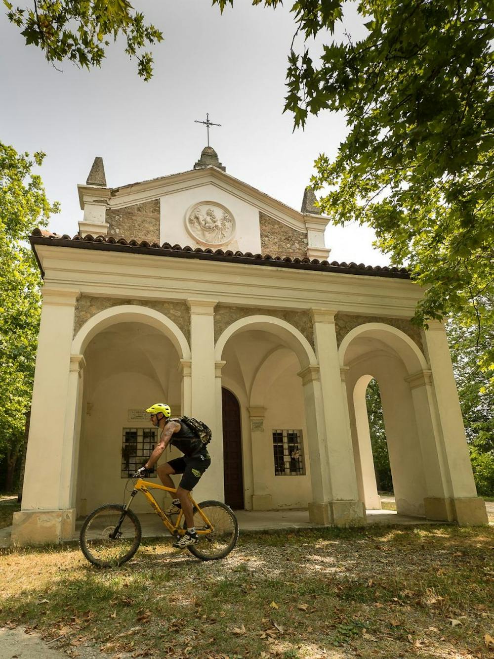
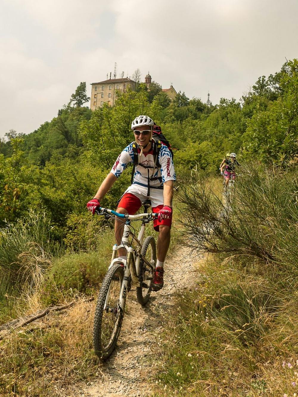
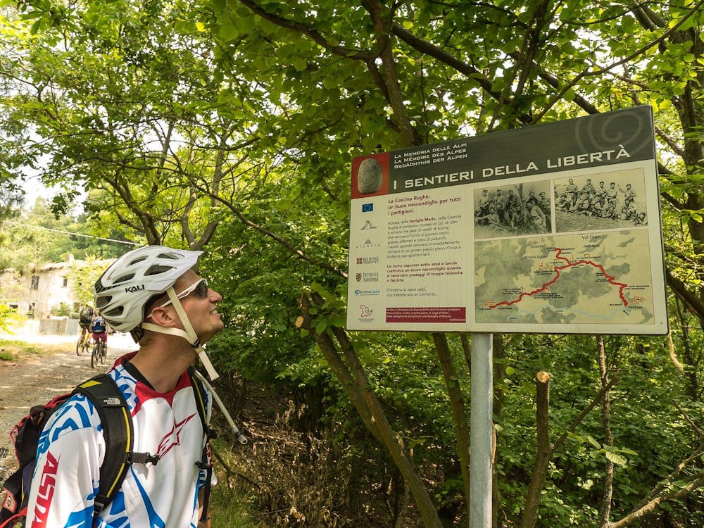
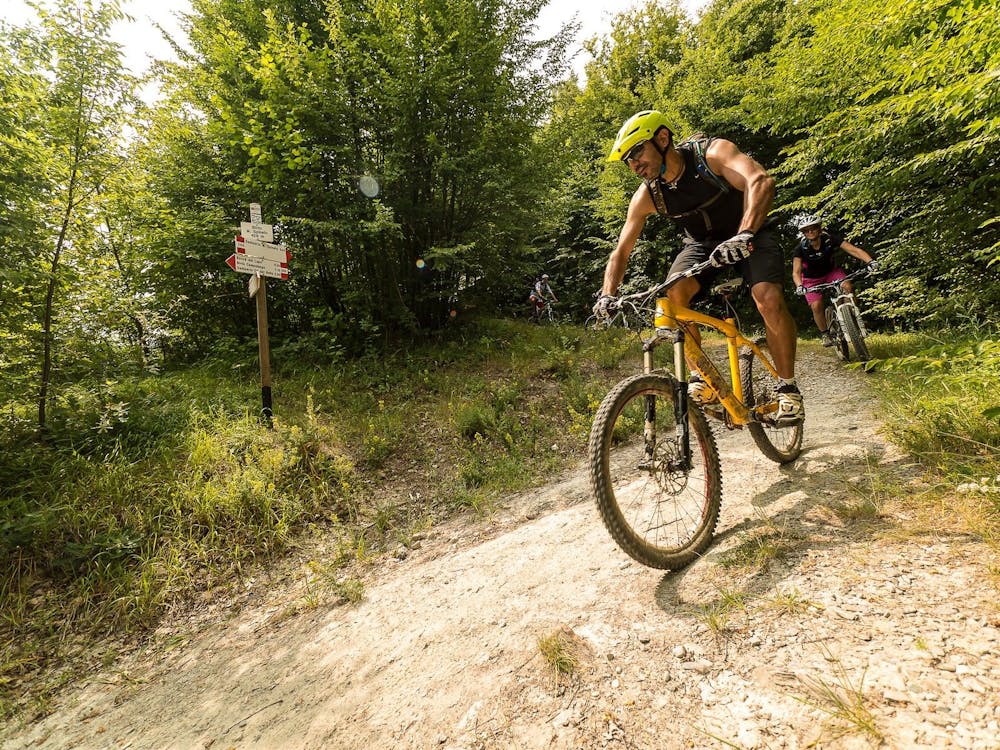
Fatigue is sacred. Like nature, which follows this itinerary. For experienced and even slightly trained bikers. But everything, then - you know - depends on the rhythm. And in any case the sacrifice will be repaid. On the saddle. From the car park where we left our car, near the historic centre of Stazzano (01), we cross the crossroads and continue uphill slightly. After less than 100 m we turn right, and then immediately right, facing the Oratory. We immediately turn left and climb on a steep asphalt road that leads to the Castle. We follow the CAI 200 sign taking the path that runs alongside the castle and goes into the woods. We continue on the path that alternates between steep and less steep stretches, always following the main path and ignoring the side deviations. When the path flattens out, we turn right onto the dirt road that quickly reaches the asphalt, which we follow uphill towards the Sanctuary of Madonna del Monte Spineto (02). At the fork we keep left, always uphill, quickly reaching the beginning of the Via Crucis. We follow it in its entirety, until we reach the entrance to the tunnel that passes under the sanctuary to lead to a first balcony, we turn left again to get to the one in front of its entrance, enjoying a magnificent view of Valle Scrivia and Val Borbera. On the left side of the facade there is a fountain to cool off, now we go back to the exit of the tunnel. Here we take the path, always with the CAI 200 sign, which descends to the left. The first section descends steeply and amusingly, then gradually flattens out until it joins a dirt road with a sandy bottom. We continue on the flat until we reach a crossroads, where we turn left uphill. Once we are uphill, we descend to reach the pass of Bocca del Lupo (03), we go straight on and at the next crossroads we keep the main road on the left. After a pleasant flat stretch we arrive at a crossroads where we turn right, going up a very steep ramp. At the top, we turn left along a farm and quickly descend on a pleasant dirt road, we go around the farm taking the gravel road that goes up on the right, at the next junction we keep the main road that continues to the left, arriving with a slight climb to Cascina Rughé (04), where we meet the signs for the Paths of Freedom, in fact, this area was the scene of the Resistance during World War II. At the next fork, turn left downhill and enter a beautiful wood along a beautiful forest road. After about 200 m we turn right on the flat, ignoring the deviation on the left downhill to Campolungo. At the next crossroads, we turn left for a steep ramp, we pass a farmhouse, from which we finally climb to descend quickly to the Sanctuary of Madonna della Neve or Cà del Bello (05). The sanctuary merits a stop to rest, rehydrate and cool down thanks to the fountain behind it. Now we leave taking the dirt road that continues from the back of the sanctuary, always following the sign CAI 200, we climb quickly and then climb up the hill just after skirting a large restored farmhouse on our right. At the next crossroads we continue our descent keeping to the left, the dirt road becomes asphalt once we enter the hamlet of Albarasca (06). We continue to descend and, having reached a fountain on our right, we turn left on a steep descent. The asphalt becomes a paved mule track and, leaving the group of houses, a dirt road with a sandy bottom. We head towards the ford area, following the dirt road that descends rapidly. At the first fork in the forest we keep left and continue to descend until we reach the narrow track that passes several times the narrow streams, for endless fun, especially during the summer where we can enjoy a cool otherwise unknown. The course is mangia&bevi, short uphill ramps followed by short dives on the fords, always following the path that runs through the woods and at a certain point continues on the left among the thick vegetation. The fun continues uninterrupted until we get out into the woods, we cross a dirt road with CAI 145: turn right we would climb towards Malvino and Bavantorino, we instead continue left quickly reaching the asphalt, near the cemetery of Coquello (07). At the junction on the main road, we turn left, finding a fresh fountain immediately on our left. We follow the road entering Sardigliano (08), we cross the village starting to climb in the direction of Stazzano, we climb near a sanctuary, and then descend quickly. In a few kilometers we return to our starting point.
- •
- •
- •
- •
Difficulty
Difficult
Mostly stable trail tread with some variability featuring larger and more unavoidable obstacles that may include, but not be limited to: bigger stones, roots, steps, and narrow curves. Compared to lower intermediate, technical difficulty is more advanced and grades of slopes are steeper. Ideal for upper intermediate riders.
Medium Exposure

The trail contains some obstacles such as outcroppings and rock which could cause injury.
Remoteness

Close to help in case of emergency.