Le colline degli Infernot
Vignale Monferrato (27 km)
Mountain Biking Difficult
- Distance
- 27 km
- Ascent
- 431 m
- Descent
- 431 m
- Duration
- 2-3 hrs
- Low Point
- 127 m
- High Point
- 282 m
- Gradient
- 6˚

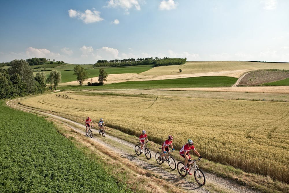
The route, which is part of the Unesco area of Monferrato Casalese, starts from the Proloco di via Rossi in Vignale Monferrato, a centre with a strong tourist and food and wine vocation thanks to the presence of various agritourism structures and wineries. The first part of the route is characterized by the presence of a long and steep descent on a gravelly stretch that requires special attention for the presence of furrows in the ground. At the end of the steep stretch we will reach the bottom of the Grana valley and for a few km the route will be entirely on the plain surrounded by the pleasant view of the Monferrato hills. Following the directions of the route, we will continue to pedal on a dirt country road where the human presence is only a distant mirage and after almost 10 km from our departure we will arrive at the second stage of our path: Camagna Monferrato. This very small and characteristic village still preserves a strong wine-growing tradition, testified by the presence of numerous vineyards and infernot (cellars dug by hand into the sandstone): they are the emblem that has made the territory unique and worthy of becoming the 50th Italian UNESCO World Heritage Site. In Camagna, visiting the small town, we recommend a visit to the church of Sant'Eusebio whose characteristic is the presence of a dome, designed by Crescentino Caselli, a pupil of Antonelli, famous for having designed the Mole Antonelliana. Continuing our path, we will leave the village and passing near the church of the Madonna we will arrive at the top of a hill, from which you can enjoy the view over the entire north-western Alps and the surrounding hills. From this point, following the dirt path, we will continue our walk for about 1 km, after turning left on a short stretch of asphalt about 150 meters, we will cross another stretch of dirt completely downhill, exactly when we have already covered 11.82 km. In the central part of our itinerary we will have to pay attention to the various right and left turns and at this point - at km 12.60 - we will turn left again (in the presence of a large tree) and go straight until we cross the provincial road that connects Conzano to Roncaglia (km 13.58). Turning right and going straight on the asphalt road for 600 meters (halfway along we will cross the state road that leads to Casale Monferrato) we will arrive at a well, turn left towards Stevani and after almost another km of asphalt road we will find on our right villa La Macinata (km 15.20). From this point we will return to a flat dirt track that we will cover for about 3 km proceeding straight until we return to the provincial road that leads, turning left and at the end of a long climb, the third stage of the path, or Frassinello Monferrato. The village, like the others already crossed is united by the presence of infernot that here too remember how Frassinello is also linked to a winemaking tradition but, wanting to change program, we could alternatively visit the historic medieval castle of the village a couple of kilometers from the center of the country. We are now almost at the end of our ride and now only about 5 km separate us from the arrival in Vignale Monferrato which will be easily accessible along the provincial road that separates it from Frassinello, following the signs. In the climb that leads us to Vignale we will still have the opportunity to admire the vineyards that are the splendid setting for this path from beginning to end. Once you get to your destination, you should visit the historic Palazzo Callori, home of the Regional Wine Shop of Monferrato, located in the upper part of the country from where we can admire again a beautiful view of Monferrato. By Ivan Reitano
Description
Please note - The posters present here are a valid support in the journey of this itinerary. During the route there are signs indicating the countries and names of some farms while, between km 15.20 and km 20 the natural references are unclear and a little 'misleading because of the nature of the territory that does not allow you to have the necessary information for the road to be covered, it 's always recommended to rely on a capable guide and the area, able to be updated on any changes in the conditions of the routes that may vary from the time when Piemontebike.eu has carried out investigations to verify and update.
Difficulty
Difficult
Mostly stable trail tread with some variability featuring larger and more unavoidable obstacles that may include, but not be limited to: bigger stones, roots, steps, and narrow curves. Compared to lower intermediate, technical difficulty is more advanced and grades of slopes are steeper. Ideal for upper intermediate riders.