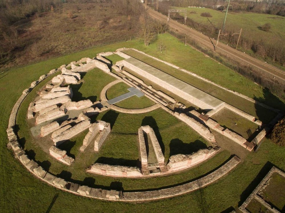
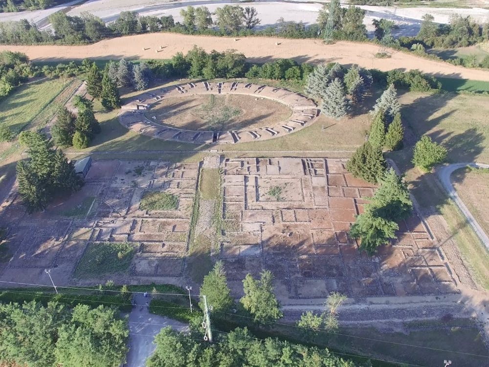
Libarna ed Alto Monferrato
Serravalle Scrivia (48 km)
Mountain Biking Difficult
- Distance
- 48 km
- Ascent
- 1.2 km
- Descent
- 1.2 km
- Duration
- 4-5 hrs
- Low Point
- 207 m
- High Point
- 487 m
- Gradient
- 7˚

Starting from the parking lot of the famous archaeological site of Libarna, (prestigious site of Roman origin) turn right in the direction of Serravalle Scrivia and continue straight after the first roundabout, you arrive at a first traffic light (Km 1.5). Along the road that runs alongside the railroad tracks will pass a second traffic light and at Km 2, 2 turn left and then turn right again in the direction of Alexandria, at the third traffic light (km 2.3).

- •
- •
- •
- •
- •
- •
- •
- •
- •
Description
At this point, we will follow the main road that crosses Serravalle to a final intersection (km 3.00) at which height, we will follow the road sign that will indicate the town of Monterotondo. Leaving the urban context behind us, we will start an uphill path, surrounded by beautiful vineyards and at km 4.7 we will follow again the road sign that indicates Monterotondo towards our left to finally reach the height of the small village (km 6.7) that will be crossed completely.
After turning left in the direction of Gavi (km 7.2) we will face a fairly challenging stretch of path up to Km 10.5 when we cross the road that will soon lead us to Gavi (turn right) country universally known for the production of the famous wine that takes the same name from the country.
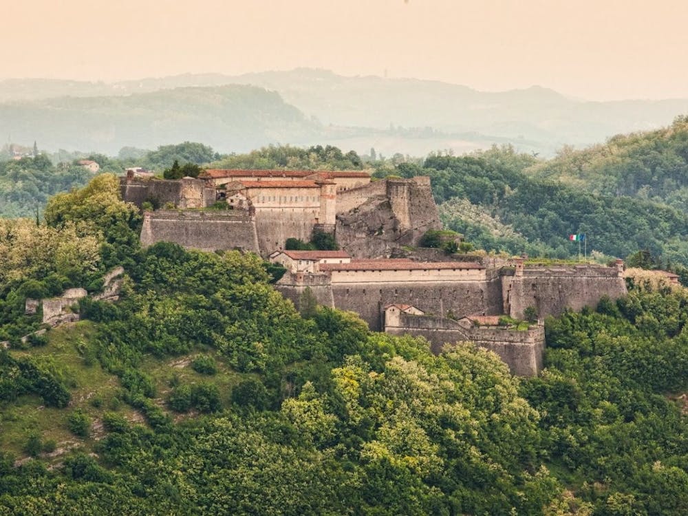
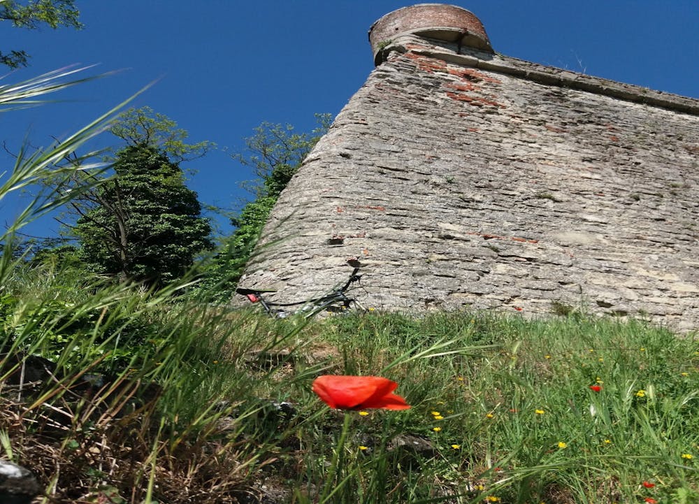
Shortly before entering the village, after about 400 meters we will find on our right a detour to the fort of Gavi, (historic fortress of ancient origin) from which (for those who will enjoy reaching the fortress) you can enjoy a splendid view of the surrounding hills. Once in Gavi and crossed the square, we will take and follow all Via Garibaldi until we meet (km 11.8) the signs indicating the villages of Mornese, Bosio, and Parodi. passing along Via delle Confraternite and Vico Portino (here you will find a well-preserved medieval fort) we will continue to follow the signs to Bosio and Mornese and at km 15 we will arrive in the small village of Alice di Gavi. After the main road that crosses the entire village, at a certain point (at km 16.4) we will follow the signs to turn left towards Carrosio and after crossing a small bridge, we will have a challenging stretch of about 4 km before turning right towards Voltaggio (km 20.2). The small village of Voltaggio (a small village with characteristic Ligurian features) is almost another 4 km away and once we reach the entrance to the village (km 24, 3 at a crossroads) we will continue for another km in the direction of Genoa, along the main road that runs alongside the town.
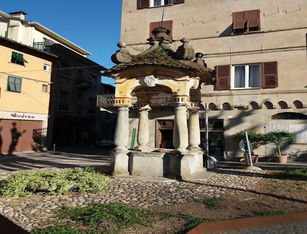
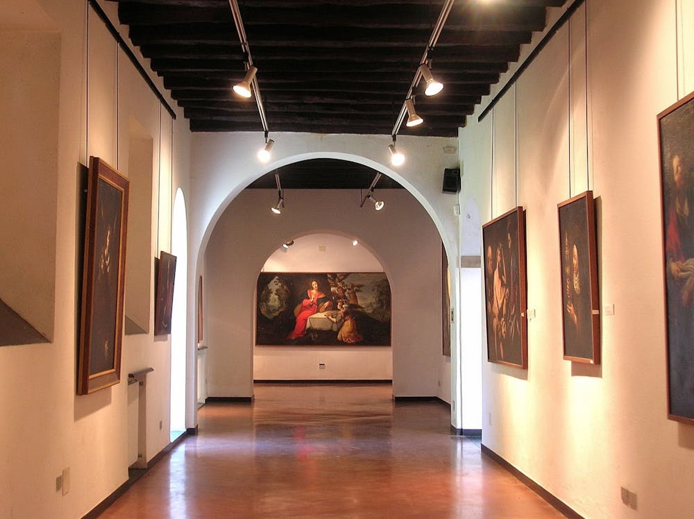
At a roundabout (km 25.7), we will turn on the first road on the right that will allow us to enter and learn more about the characteristic village of Voltaggio, along with its art gallery, churches, palaces and oratories (the famous and beautiful Pinacoteca dei Cappuccini is located just before the bridge on the right).
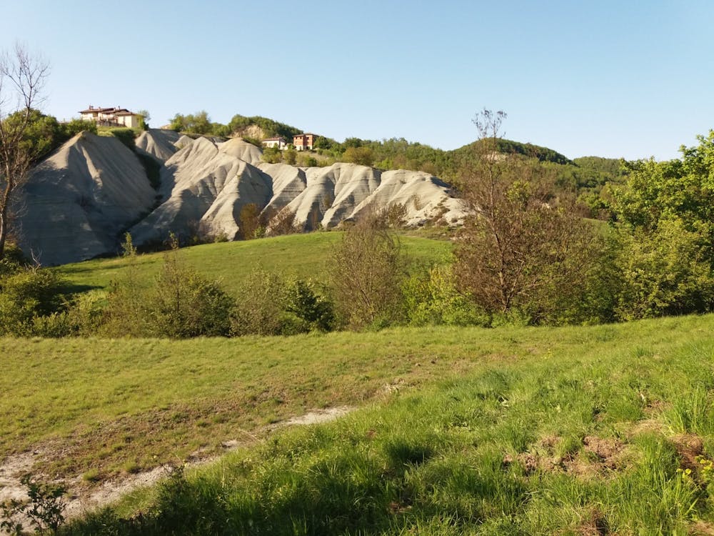
Crossed the country from south to north (Via de Rossi, Via Roma and Corso Mazzini) we will take the road already traveled previously in the direction of Carrosio (km 27.2). 31.00 km, near Carrosio we will follow the indication to the right that will lead us to the small village of Sottovalle and from here begins the most challenging uphill stretch of the entire route, the same stretch surrounded by a beautiful natural environment characterized by numerous gullies in this area.
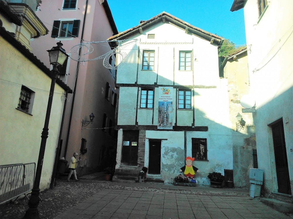
Without ever leaving the main road and after crossing the village of Sottovalle, we will arrive again in a flat stretch (km 39.4) on the road that, turning left leads us to Arquata Scrivia (very recommended visit of the Gothic medieval house). Entering the city (km 41.9) we will continue to stay on the main road following the signs for Serravalle Scrivia / Alessandria, along the city route of about 2 km. Finally, always following the signs to Serravalle Scrivia and with the city of Arquata behind us, (for a couple of km will be 'retraced the same stretch of the ancient Via Postumia) we return to the starting point located on our right, about halfway between Arquata and Serravalle Scrivia. by Ivan Reitano
Difficulty
Difficult
Mostly stable trail tread with some variability featuring larger and more unavoidable obstacles that may include, but not be limited to: bigger stones, roots, steps, and narrow curves. Compared to lower intermediate, technical difficulty is more advanced and grades of slopes are steeper. Ideal for upper intermediate riders.
Remoteness

Away from help but easily accessed.