Ferrata Ivano Dibona from Staunies pass to Hospitales
Cortina d'Ampezzo
A downward high-mountain ferrata pass through the Cristallo ridge from Forcella Staunies Pass to Hospitales restaurant.
Alpine Climbing Moderate
- Distance
- 9 km
- Ascent
- 203 m
- Descent
- 1.6 km
- Low Point
- 1.5 km
- High Point
- 2.9 km
- Gradient
- 22˚

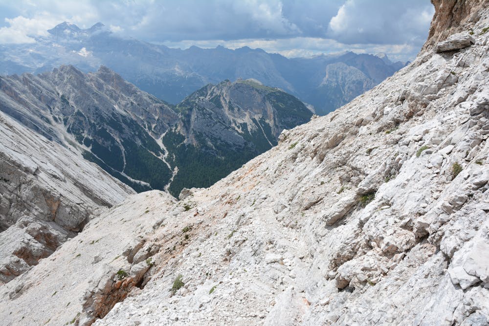
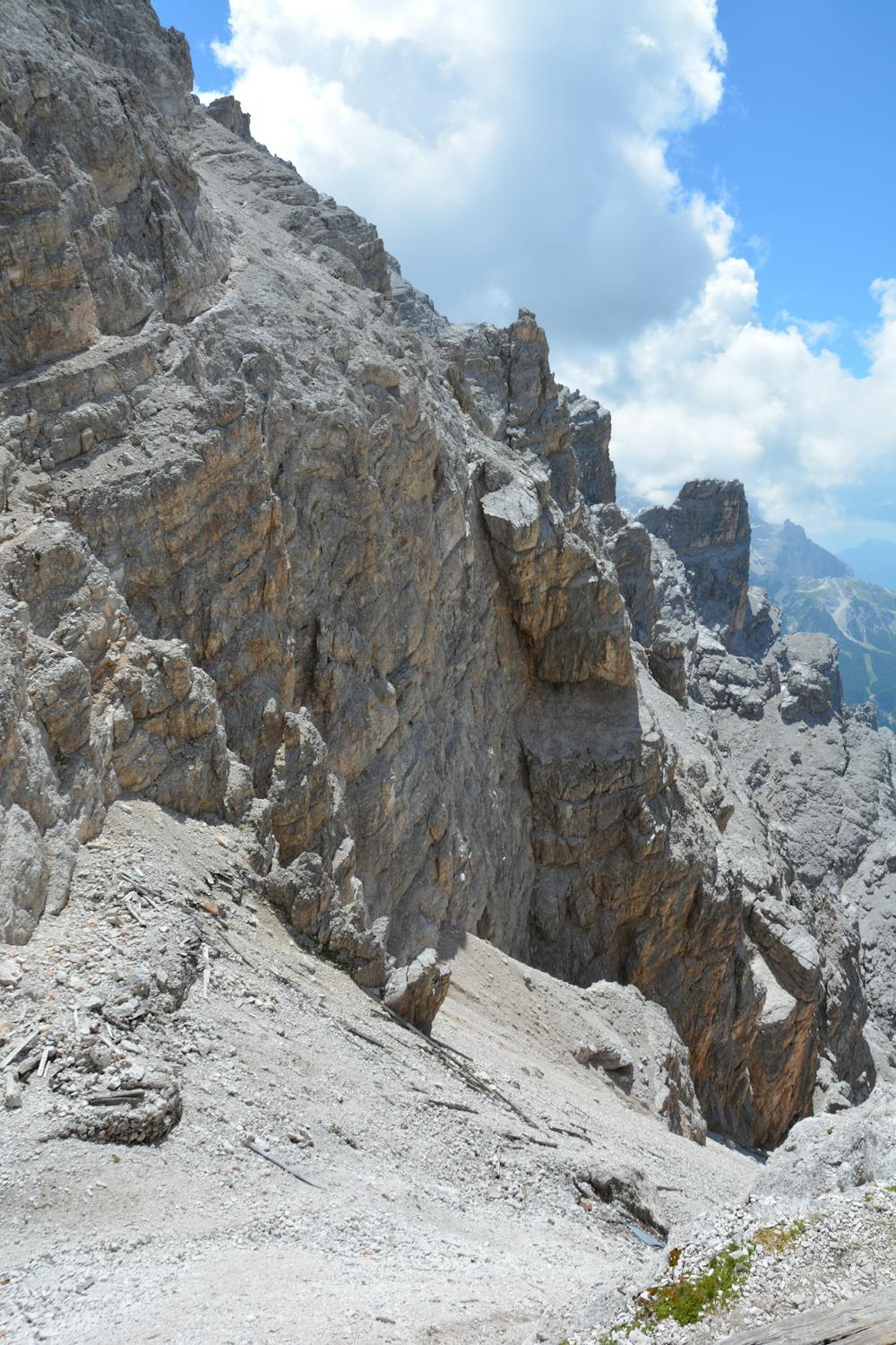
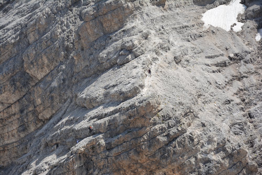
Although it is just a via ferrata - it is not a hike I put it under mountaineering as you need to have ferrata equipment and some experience and are moving in high exposure. I took an early bus from Cortina d’Ampezzo up to Rio Gere to take the 1st cable car up to the Forcella Staunies. The ride up was via an open ski/bike chair lift to the middle station of rifugio Son Forca and then in a tiny 2-person cabin car. After disembarking at the Staunies Pass top station I equipped my ferrata kit, said ‘ciao’ to a couple Italians, who were getting prepped up as well. I took a photo of the far away Grossglockner, as the weather was perfect. After that I started up the stairs towards the beginning of the ferrata that started with a ladder at the top of which I was surprised with a pile of snow. I climbed over the snow and soon there was another ladder that led me to a short tunnel that didn’t require me to put a headtorch on. After exiting the tunnel, I could see the famous suspended bridge – some 30 metres long. I crossed it without any issues – it was very stable – and climbed the angled ladder leading up to the Cristallino ridge. There I took a short detour to the summit of Cristallino to marvel at the views of the Cortina d’Ampezzo valley. After a short break on the summit I retraced my steps and continued down the ferrata with a sharp descent through two vertical walls – one secured with a ladder and the other with steel line. I reached the Forcella Grande pass, from where I met a couple of other tourists – some of them heading off north onto the Marino Bianchi ferrata. After a short stop at a ruin of barracks – the Buffa bivouac - I continued the ridge after a short ascent and now the ruins of fortifications became more visible. Following the crumbled path I reached a scree that you can take to return to rifugio Son Forca and passed it. Now the wilder and magically layered traverse started with remains of old WWI path literally sticking out of the wall. Soon the path became more levelled and I admired the angles of Pomagagnon slabs in front of me. Now I could hear thunder behind me and saw clouds moving in from the East – dark and already in the neighbouring valley. I increased the pace to get off the ridge path before the storm advanced and managed to reach the forest line just when it started raining. Now the zig-zagging path through the forest started and although slippery in the rain, it was easy to descent on it using walking sticks. As the storm was now above me I took the route out of the forest towards the Hospitale bus stop and ended my day there.
Difficulty
Moderate
May involve slightly more complex glacier hikes, easy but possibly long rock ridges and steep snow up to 45 degrees. Equivalent to PD, PD+
High Exposure

Much of the route is difficult to protect and a fall could be disastrous at certain points.
Remoteness
Little chance of being seen or helped in case of an accident.