1.1 km away
Sci 18

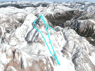
After snowfall, this is one of the most popular off-piste runs in Cortina d'Ampezzo.
Difficult Freeride Skiing
- Distance
- 2 km
- Ascent
- 1 m
- Descent
- 753 m
Black pista
Freeride Skiing Difficult

This is a popular freeride skiing route which is generally considered to be difficult. It's an unknown remoteness, it features unknown exposure and is typically done in an unknown time of year. From a low point of 1.8 km to the maximum altitude of 2.1 km, the route covers 1 km, 0 vertical metres of ascent and 305 vertical metres of descent.
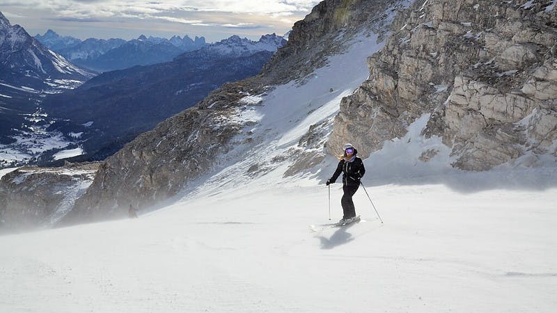
A difficult slope right under the "Pian de Ra Bigontina" lift. It is narrow between the woods and quite steep with the chairlift poles right in the middle of the slope. With a maximum slope gradient of 61%, it is ideal for expert skiers who want to show their skills.
Difficult
Serious gradient of 30-38 degrees where a real risk of slipping exists.
1.1 km away
After snowfall, this is one of the most popular off-piste runs in Cortina d'Ampezzo.
Difficult Freeride Skiing
7.5 km away

A great off piste run in Ra Valles, the first part is quite steep before entering the tree line. Parking a second car at the Olympia camp ground is a good idea so that you can quickly return to resort.
Difficult Freeride Skiing
7.6 km away

Nice, fun line on the sunny side of Ra Valles, you can recognise this colouir by a small rocky tower (the candle) which sticks out in the middle of the couloir.
Difficult Freeride Skiing
8.9 km away

A Tofana classic line for experienced skiers.
Difficult Freeride Skiing
8.9 km away
One of the most challenging routes in Cortina d'Ampezzo, it requires very good alpine skills as you have to climb up the challenging via ferrata to the top of mountain and be ready to ski down a very technical, steep and exposed descent. Needless to say, you need a safe snowpack.
Severe Freeride Skiing
6 routes · Freeride Skiing