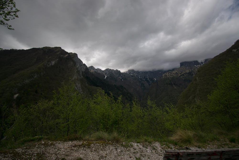
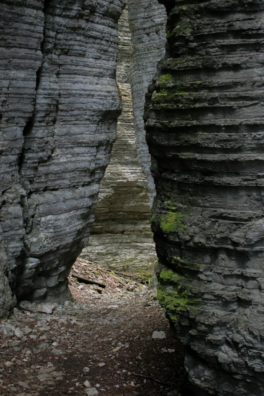
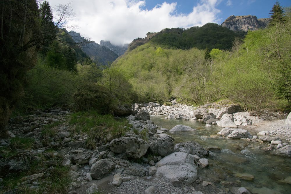
Forre della Val de l'Art
Ring around the high part of torrent "Ardo"
Hiking Difficult
- Distance
- 9.1 km
- Ascent
- 854 m
- Descent
- 855 m
- Duration
- 3-4 hrs
- Low Point
- 511 m
- High Point
- 977 m
- Gradient
- 19˚

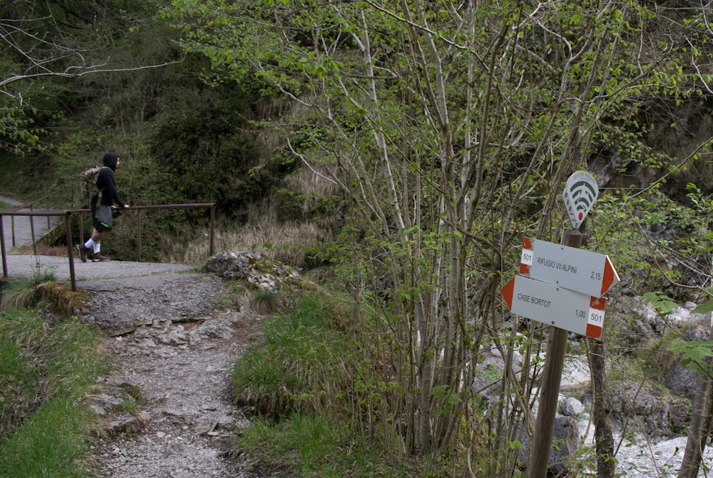
This is a popular hiking route which is generally considered to be difficult. It's remote, it features high exposure and is typically done between April and October. From a low point of 511 m to the maximum altitude of 977 m, the route covers 9.1 km, 854 vertical metres of ascent and 855 vertical metres of descent.
- •
- •
- •
- •
- •
- •
- •
Description
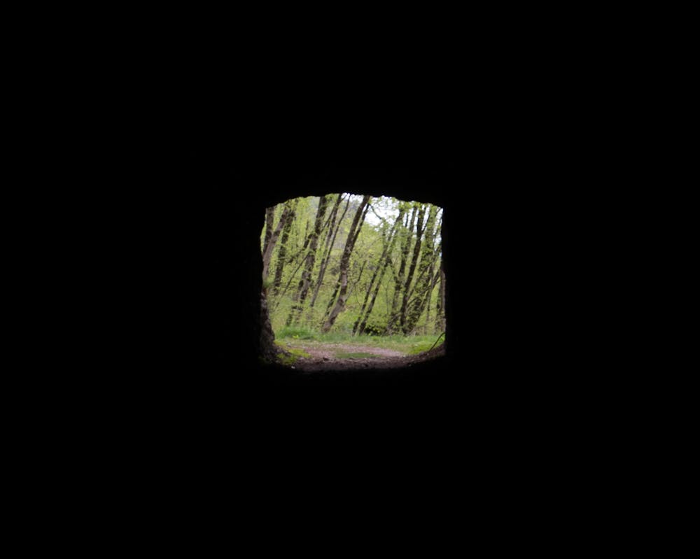
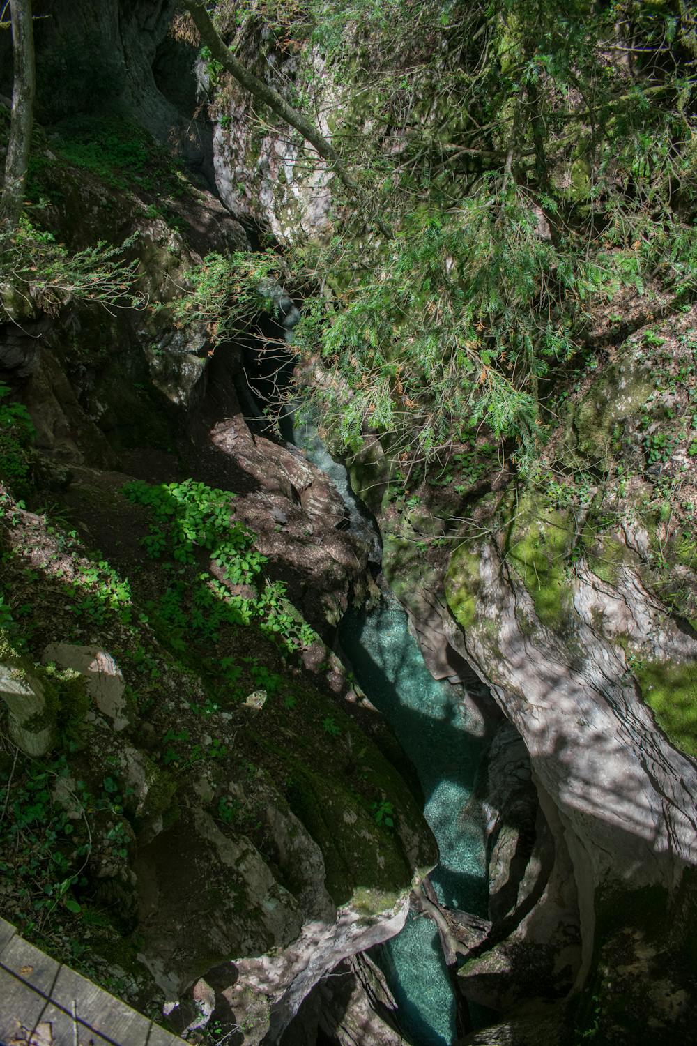
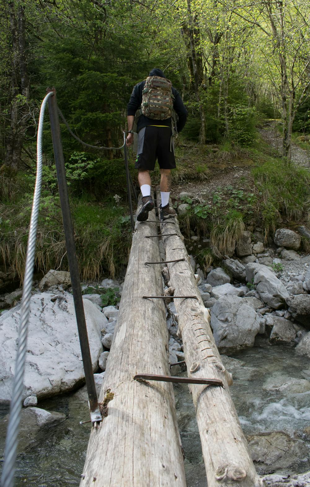
It's a route in the nature: woods, water, a little canyon and really few human traces from past times. There are some nice spots for photos. For the Canyon you need a camera tripod.
Difficulty
Difficult
Hiking trails where obstacles such as rocks or roots are prevalent. Some obstacles can require care to step over or around. At times, the trail can be worn and eroded. The grade of the trail is generally quite steep, and can often lead to strenuous hiking.
High Exposure

Some trail sections have exposed ledges or steep ascents/descents where falling could cause serious injury.
Remoteness

Away from help but easily accessed.
Best time to visit
Features
- Picturesque
- Forestry or heavy vegetation