Mortisa and the Volpera Caves
Cortina d'Ampezzo
Starting from the town centre, this easy walk explores traditional hamlets and an evocative forest.
Hiking Easy
- Distance
- 5.9 km
- Ascent
- 221 m
- Descent
- 218 m
- Duration
- 1-2 hrs
- Low Point
- 1.1 km
- High Point
- 1.3 km
- Gradient
- 11˚

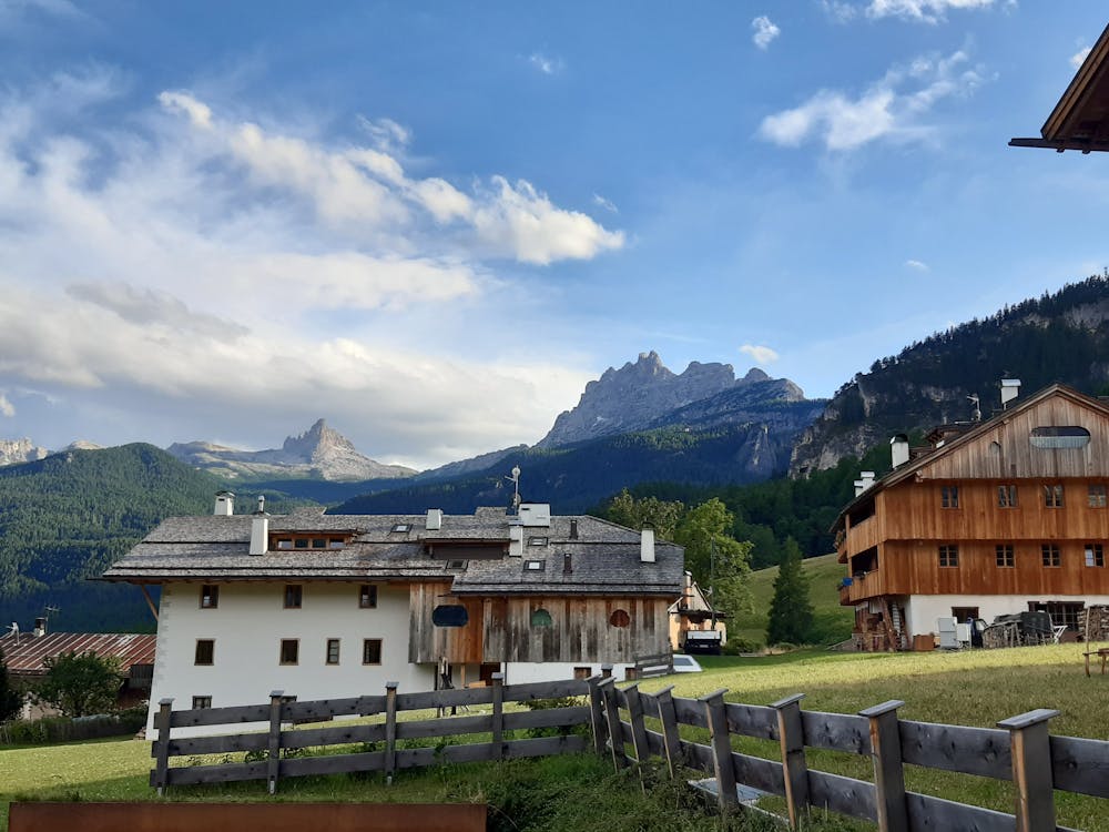
Start at the Crignes car park and take the asphalt road that runs uphill towards the like-named hamlet. Just a few hundred metres from Corso Italia, you will find yourself amidst extensive meadows with fine views over the town centre. When the road forks, keep left, and then take the next left, following the signs for Mortisa. Mortisa, or Mortija as it is known in the Ampezzo dialect, is a fascinating location with powerful ties to the past: grasslands, mountains, and a few traditional Ampezzo houses. Walk through the hamlet, and after the last houses you will find extensive pastures with views onto the mountains Cristallo, Sorapis and Antelao, and the start of a wide rough track, n° 428. Take the track that soon runs into the forest, where it remains a wide and easy path. The forest gradually becomes thicker, and you may see a number of wildlife species such as woodpeckers and squirrels. This forest is characteristic for its gigantic boulders that fell into it in distant epochs. Today, many of them have been colonized by trees or shrubs, and underneath there are some small caves. This area is famous for sport climbing and bouldering, and so it attracts many enthusiasts.
- •
- •
Description
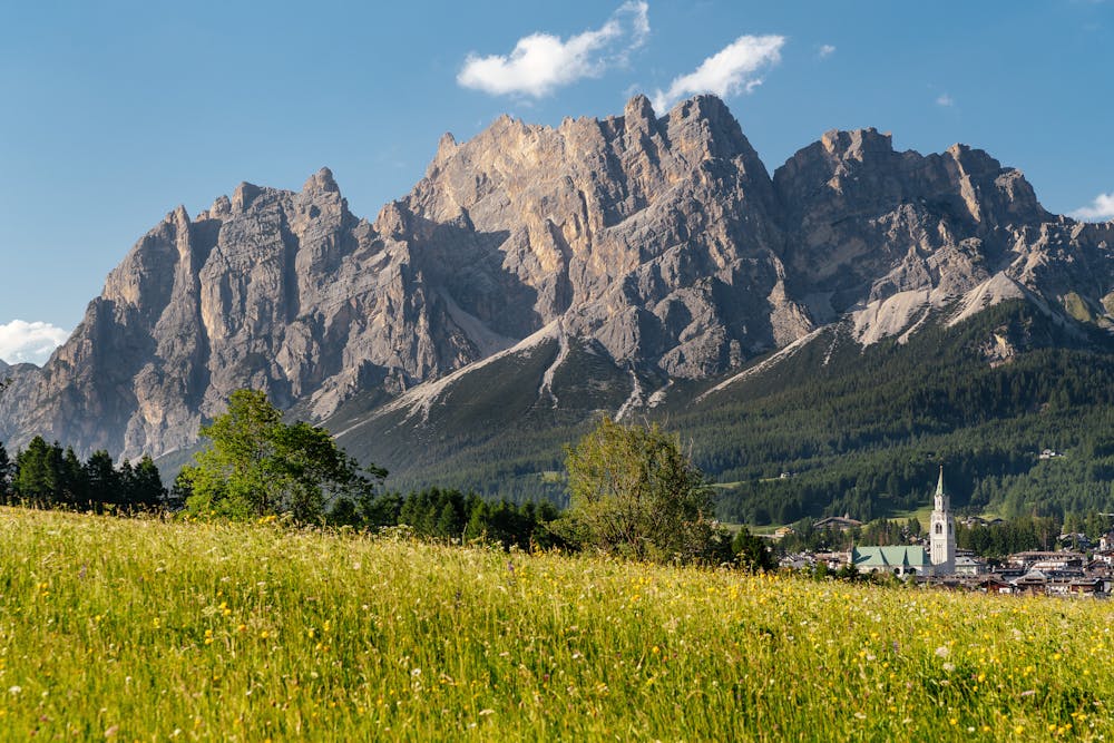
When you encounter track n° 451, take it turning left, and go downhill until you emerge from the forest in the hamlet Campo di Sotto, birthplace of Lucia, painter Titian Vecellio’s mother. Here, take the tarmac road to reach Campo di Sopra, enjoying the fine views of Cortina’s mountains. Walk through the entire hamlet until the road becomes a rough track, and continue on this, walking uphill towards a large pasture. Here the view opens to include the Tofane and Pomagagnon mountains, and the centre of Cortina with its bell tower. Carry on along this easy track, which crosses a bridge and then becomes asphalted, bringing you to the car park on Via del Parco. From here, walk along Via del Parco for another 5 minutes, and after crossing the Crignes bridge, you will return to the starting point.
By car - The Crignes car park is very close to the town centre, just beyond the Crignes bridge.
By bus - If you are not already in the town centre, reach Piazza Roma by bus, cross the road and go down the steps leading to the Crignes bridge. Cross it, and on your left you will see the car park, the starting point for the walk.
Difficulty
Easy
Walking along a well-kept trail that’s mostly flat. No obstacles are present.
Low Exposure

The path is on completely flat land and potential injury is limited to falling over.
Remoteness
Close to help in case of emergency.
Best time to visit
Features
- Wildlife
- Picturesque
- Forestry or heavy vegetation