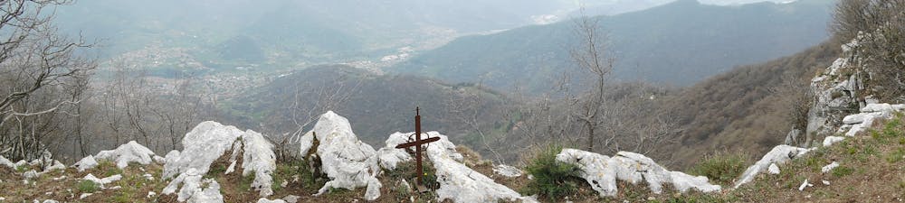
da Vigano San Martino al Monte Pranzà, passando per i prati alti
Parcheggio via Piave
Hiking Moderate
- Distance
- 12 km
- Ascent
- 859 m
- Descent
- 859 m
- Duration
- 3-4 hrs
- Low Point
- 356 m
- High Point
- 1.1 km
- Gradient
- 16˚

L'ascesa iniziale e' forte e mette alla prova. Il sentiero di cresta del monte Pranzà offre una certa esposizione, e non bisogna avvicinarsi troppo al burrone. Se fatto con accortezza, i sentieri sono tutti facilmente percorribili. Non per i cani che potrebbero fuggire. La zona è aperta alla caccia al cinghiale. Verso il ritorno si puo' proseguire per il sentiero dei prati alti senza ritornare a quello boschivo alto; entrambe si ricongiungono a valle.
Difficulty
Moderate
Hiking along trails with some uneven terrain and small hills. Small rocks and roots may be present.
Extreme Exposure

Some trail sections are extremely exposed where falling will almost certainly result in serious injury or death.
Remoteness

Away from help but easily accessed.
Best time to visit
Features
- Picturesque
- Summit Hike
- Forestry or heavy vegetation