Butterloch
Trentino-Alto Adige
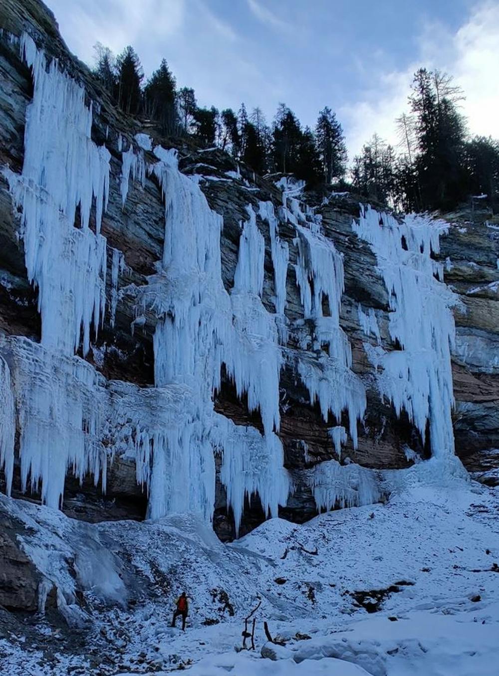
Eisklettern - Bletterbachschlucht
Alpine Climbing Extreme
- Distance
- 1.8 km
- Ascent
- 121 m
- Descent
- 121 m
- Low Point
- 1.4 km
- High Point
- 1.5 km
- Gradient
- 12˚

This is a popular alpine climbing route which is generally considered to be extreme. It's remote, it features medium exposure and is typically done between January and February. From a low point of 1.4 km to the maximum altitude of 1.5 km, the route covers 1.8 km, 121 vertical metres of ascent and 121 vertical metres of descent. You'll need crampons, quickdraws and 2 ice axes to complete it safely.
Description
Tourenbericht und Topo: https://www.suedtirolalpin.it/post/butterloch-eisklettern-bletterbachschlucht
Difficulty
Extreme
Long, committing and complex routes with difficult and sustained climbing on rock/ice and challenging route finding throughout. TD upwards.
Medium Exposure

The route features some exposed and/or difficult to protect sections.
Remoteness
Away from help but easily accessed.
Best time to visit
Equipment required
- Crampons
- Quickdraws
- 2 Ice Axes