Solarium
Alta Badia
Dolomites
Trentino-Alto Adige
Alpinklettern - Sas Ciampac
Alpine Climbing Severe
- Distance
- 6.4 km
- Ascent
- 627 m
- Descent
- 627 m
- Low Point
- 2.1 km
- High Point
- 2.6 km
- Gradient
- 35˚

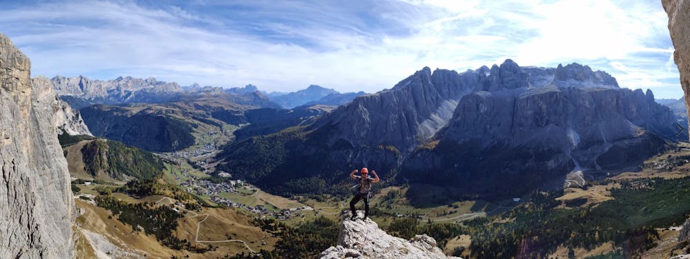
This is a popular alpine climbing route which is generally considered to be severe. It's very remote, it features high exposure and is typically done between May and October. From a low point of 2.1 km to the maximum altitude of 2.6 km, the route covers 6.4 km, 627 vertical metres of ascent and 627 vertical metres of descent. You'll need quickdraws, climbing shoes and wires and friends to complete it safely.
Description
Tourenbericht:
Difficulty
Severe
Steep, sustained and serious terrain on rock/ice. Routes will be long, exposed and possibly committing. D, D+
High Exposure

Much of the route is difficult to protect and a fall could be disastrous at certain points.
Remoteness
Little chance of being seen or helped in case of an accident.
Best time to visit
Equipment required
- Quickdraws
- Climbing Shoes
- Wires and Friends