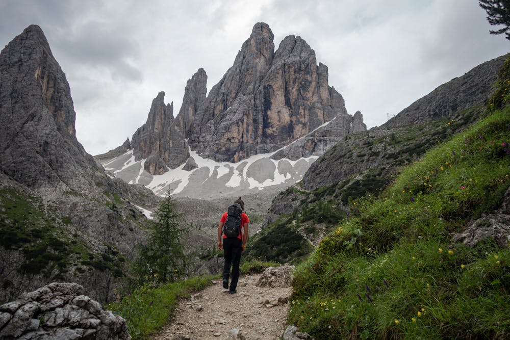
Zwölferkofel - Normalweg
Trentino-Alto Adige
Drasch Variante (IV)
Also in Belluno, Italy
Alpine Climbing Difficult
- Distance
- 8 km
- Ascent
- 1.7 km
- Descent
- 37 m
- Low Point
- 1.5 km
- High Point
- 3.1 km
- Gradient
- 31˚

This is a popular alpine climbing route which is generally considered to be difficult. It's very remote, it features high exposure and is typically done between June and September. From a low point of 1.5 km to the maximum altitude of 3.1 km, the route covers 8 km, 1659 vertical metres of ascent and 37 vertical metres of descent. You'll need quickdraws, climbing shoes and wires and friends to complete it safely.
Description
Tourenbericht und Routenbeschreibung: https://www.suedtirolalpin.com/post/zwölferkofel-normalweg
www.suedtirolalpin.com
Difficulty
Difficult
The beginning of truly technical terrain which might involve pitched climbing on rock and/or ice, exposed terrain and complex route finding in ascent and descent. Equivalent to AD, AD+
High Exposure

Much of the route is difficult to protect and a fall could be disastrous at certain points.
Remoteness
Little chance of being seen or helped in case of an accident.
Best time to visit
Equipment required
- Quickdraws
- Climbing Shoes
- Wires and Friends