Monte Castella and Amandola Loop
This magnificent route takes you to the foothills of Monte Amandola and offers a fabulous singletrack descent.
Mountain Biking Moderate
- Distance
- 34 km
- Ascent
- 1.3 km
- Descent
- 1.3 km
- Duration
- 3-4 hrs
- Low Point
- 432 m
- High Point
- 1.2 km
- Gradient
- 13˚

This most beautiful route is located in the heart of the Sibillini Mountains (Italian: Monti Sibillini) which are one of the major mountain groups on the Italic peninsula, part of the Apennines mountain range within the Parco Nazionale dei Monti Sibillini (Sibillini Mountains National Park).
- •
- •
- •
- •
Description
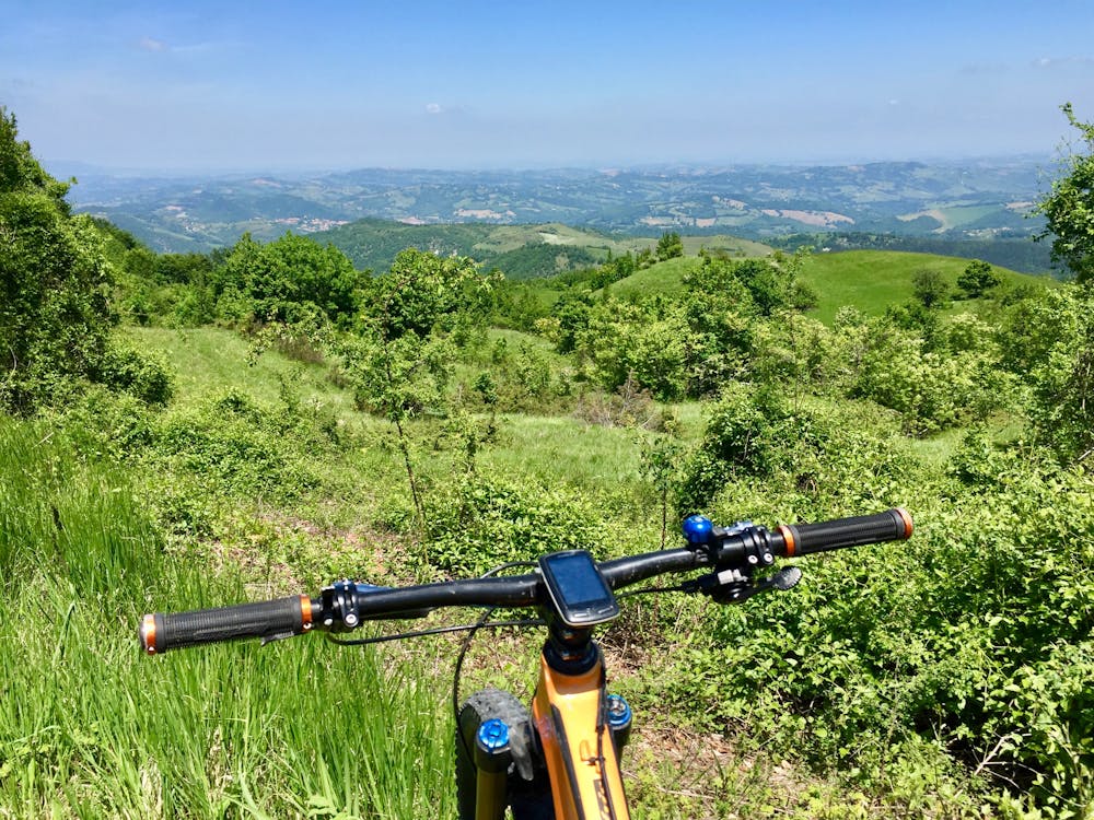
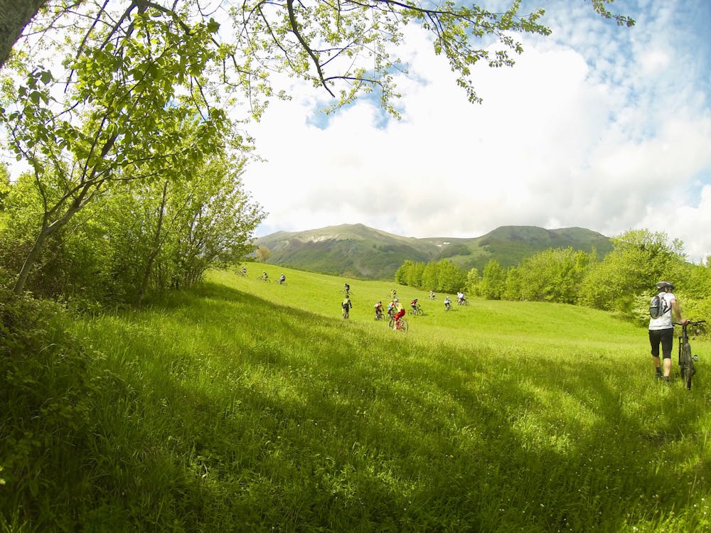
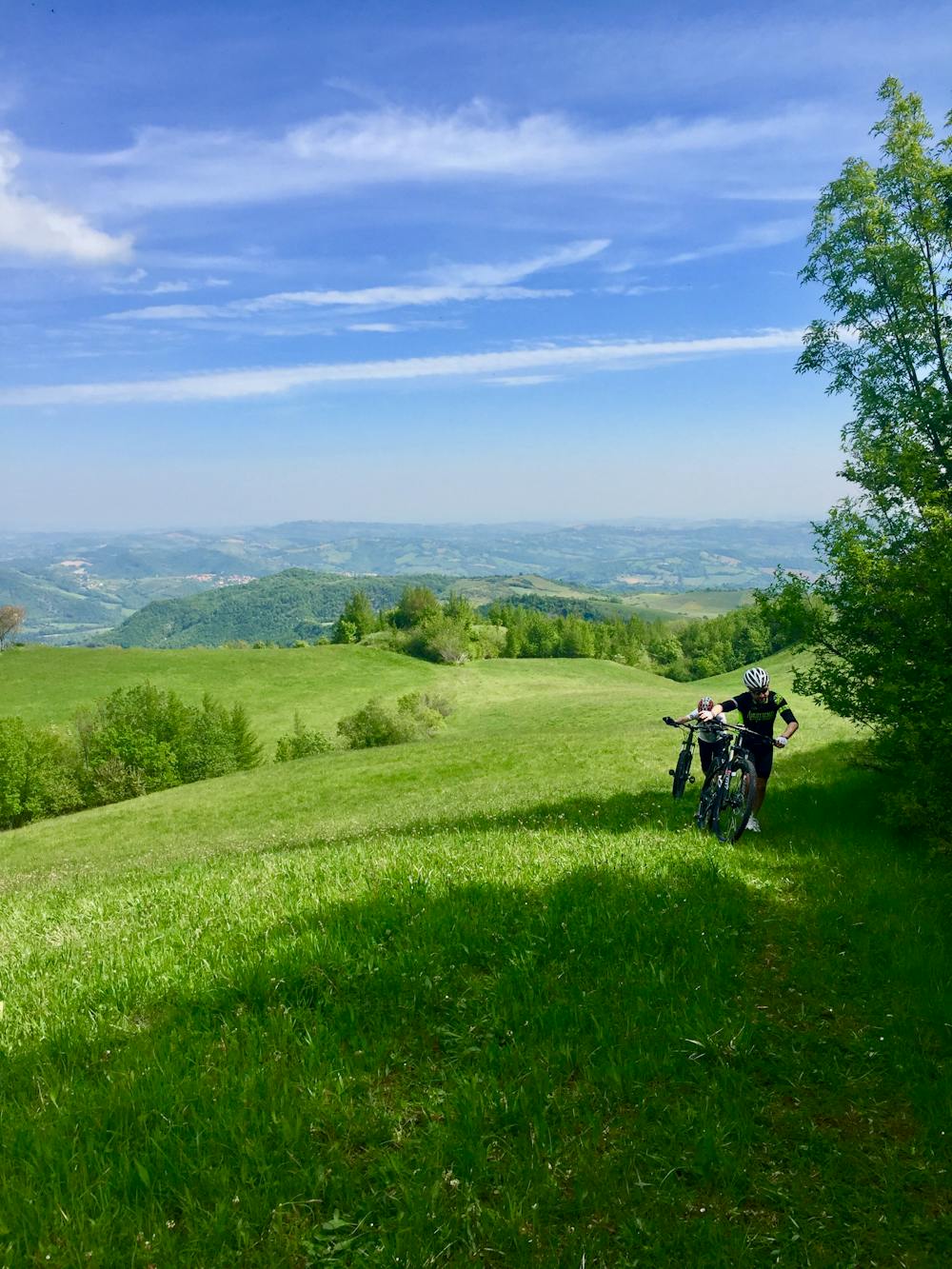
This is a route of two halves: the long but very scenic climb, and the fabulous, fun, and smile-inducing descent. The climb takes around three hours. It uses a mixture of tarmac road, white road, doubletrack, and singletrack through countryside usually reserved for poets to write about and artists to paint. You'll enjoy rolling mountainous hills spewing the most luscious green grass, brilliantly-bright blossoming broom, and precious purple orchids outlined by the dizzy, soaring heights of the mountain flanks to the north, south, east, and west. Occasionally, the view is interrupted as the trail meanders offroad through dense woodland. The majesty of Monte Amandola is directly ahead and in full glory, beckoning and luring in her manner and beauty.
Throughout the climb, the views, wildlife, flora, and fauna create a welcome distraction from the persistent ascent: you'll gain 800m over 20km to the Rifugio Citta di Amandola at the foothills of the summit of Monte Amandola. Make sure you stop at the rifugio (refuge) to refill water bottles from the drinking fountain and rest—by this point—some pretty tired legs.
Now it's time for the descent, the reason, and reward, for enduring and completing the previous three hours—and it will not disappoint!
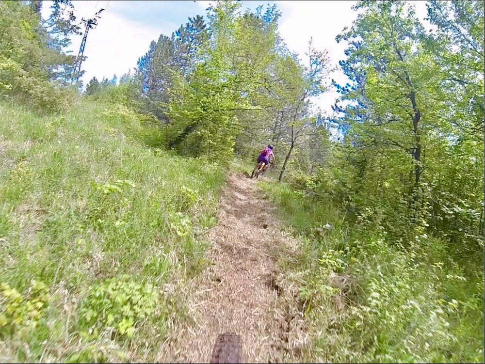
You will weave your way down the mountain on freshly-groomed singletrack meandering through forest and woodland, encountering the occasional open meadow. The same scenic views are ahead but this time due to the speed and flow of the trail, you will only have time to enjoy these by their aromas hanging in the air as you tear past.
The 10km of descent is only momentarily interrupted by short connecting road sections; otherwise, it provides long, fast. and flowy singletrack with frequent tight but fun bends weaving past rocks and trail-hugging trees, along with the occasional steep slide and stream crossing.
This descent is not particularly technical, which allows the flow to prevail. Yet it is so much fun, putting a smile on the face of every rider! There are some trail features which will require your concentration to negotiate: short, steep gullies, some rock gardens, and river crossings, but on the whole, the length of the climb is perhaps the most difficult part of this ride. That said, the three-hour climb is worth every second to enjoy this fun-fest of a descent.
Difficulty
Moderate
Mostly stable trail tread with some variability, with unavoidable obstacles 8in/20cm tall or less. Other obstacles such as rock gullies and steep sections may exist. Ideal for lower intermediate riders.
Medium Exposure

The trail contains some obstacles such as outcroppings and rock which could cause injury.
Remoteness

Little chance of being seen or helped in case of an accident.
Best time to visit
Features
- Flow
- Picturesque
- Singletrack
- In the forest
- Road sections
- Drops
- Roots
- Rock Rolls
- Rock Gardens