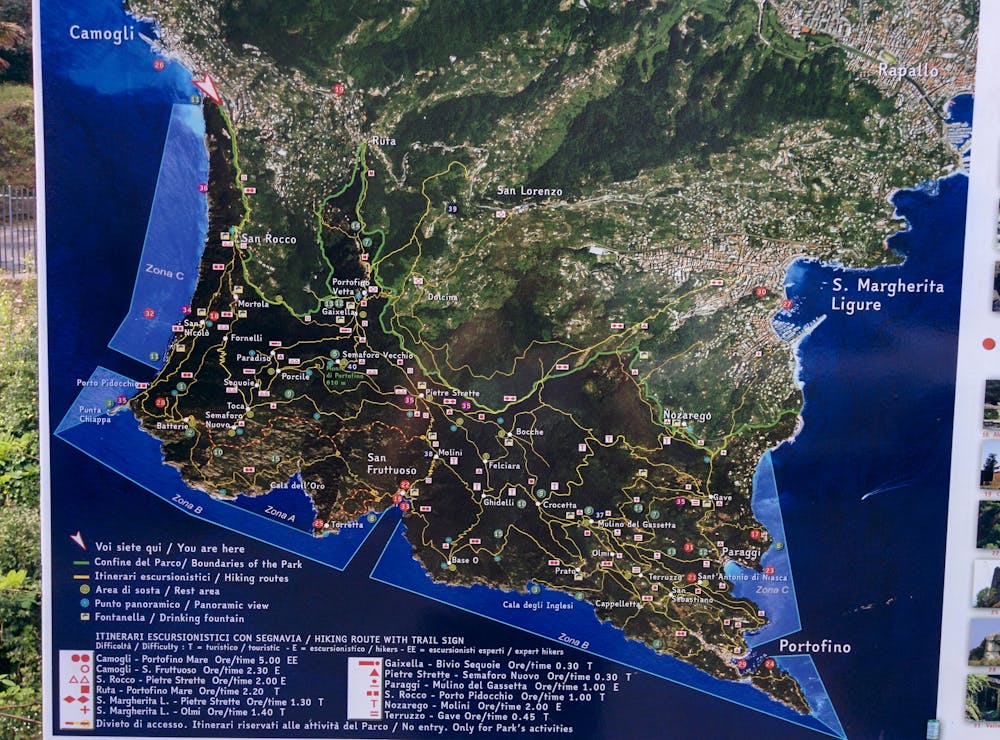
Camogli - San Fruttuoso - Camogli
One of the most panoramic routes in Liguria
Hiking Severe
- Distance
- 13 km
- Ascent
- 1 km
- Descent
- 1 km
- Duration
- 4-5 hrs
- Low Point
- 0 m
- High Point
- 460 m
- Gradient
- 16˚

Camogli - San Rocco - San Fruttuoso: http://www.parcoportofino.com/parcodiportofino/it/sanroccobatterie.page
- •
- •
- •
Description
- 2-3 hours
- Requires good hiking boots
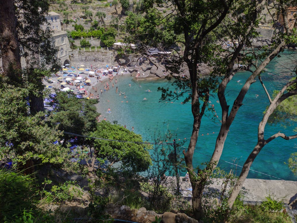
- Last water source in San Rocco, then there's a fountain in San Fruttuoso (not always water tastes good but it can be drank)
- Can be hot in full summer, particularly on rocky sections without trees and steep hills
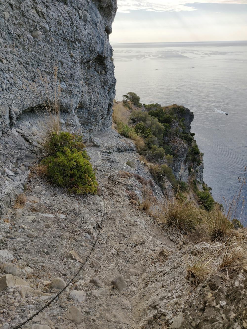
- Dangerous trail with exposed sections and chains
San Fruttuoso - San Rocco - Camogli: http://www.parcoportofino.com/parcodiportofino/it/sanroccopietresanfruttuoso.page
- 1.5-2 hours
- Steep and tiring first section, then easy trail going down
- Water source at the top of the first uphill section
- During early spring / late autumn, the downhill section could be cold as there is no sun
Difficulty
Severe
Hiking challenging trails where simple scrambling, with the occasional use of the hands, is a distinct possibility. The trails are often filled with all manner of obstacles both small and large, and the hills are very steep. Obstacles and challenges are often unexpected and can be unpredictable.
Extreme Exposure

Some trail sections are extremely exposed where falling will almost certainly result in serious injury or death.
Remoteness

Close to help in case of emergency.
Best time to visit
Features
- Picturesque
- Forestry or heavy vegetation