8 routes · Hiking
Stage 1 of the magnificent high alpine trail through Liguria.
Hiking Difficult

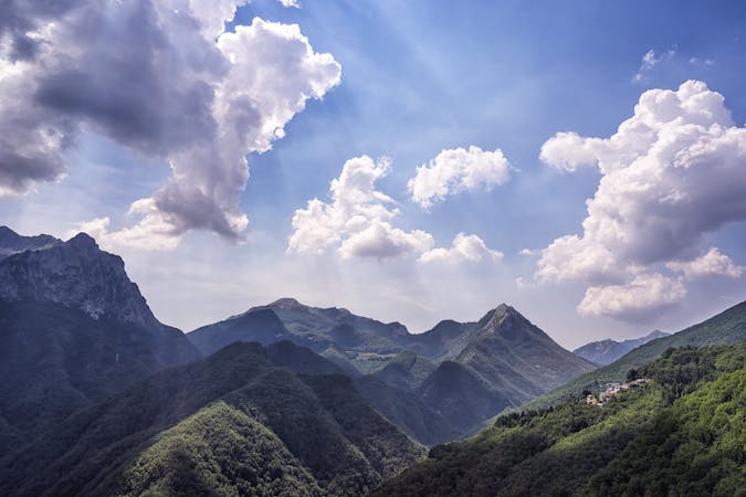
Starting in the seaside town of Ventimiglia, the trail immediately begins to climb up through olive tree terraces and vineyards to the ridge-line of the Ligurian Alps, passing Monte Carbone (442m) Monte Baraccone (515m) Monte Aballino (1016m) and Testa d’Alpe (1587m). Crossing the forest of Testa d’Alpe—a wild mix of pine, beech, fir, and oak—the trail takes you on a tour through one of the Alps’ richest areas of biodiversity. Along the way, you could discover anything from agile chamois to lime green ocellated lizards and soaring eagles. Part of the trail follows the exhilarating Sentiero degli Alpini, a military path from World War One that was carved directly in the flinty limestone rockface which stretches between the eastern slopes of the Pietra Vecchia (2,038m) and the Toraggio Mountains (1972m). Finish this stage in the Imperia province, staying in the small settlement San Bernardo di Mendatica, or detour south to the beautiful medieval town of Triora. Sources
Difficult
Hiking trails where obstacles such as rocks or roots are prevalent. Some obstacles can require care to step over or around. At times, the trail can be worn and eroded. The grade of the trail is generally quite steep, and can often lead to strenuous hiking.

Some trail sections have exposed ledges or steep ascents/descents where falling could cause serious injury.
8 routes · Hiking