Grigna settentrionale
varied track, between woods and rocks in a symbolic mountain of Lecco
Ski Touring Difficult
- Distance
- 12 km
- Ascent
- 1.3 km
- Descent
- 1.3 km
- Duration
- 6-7 hrs
- Low Point
- 1.4 km
- High Point
- 2.4 km
- Gradient
- 40˚

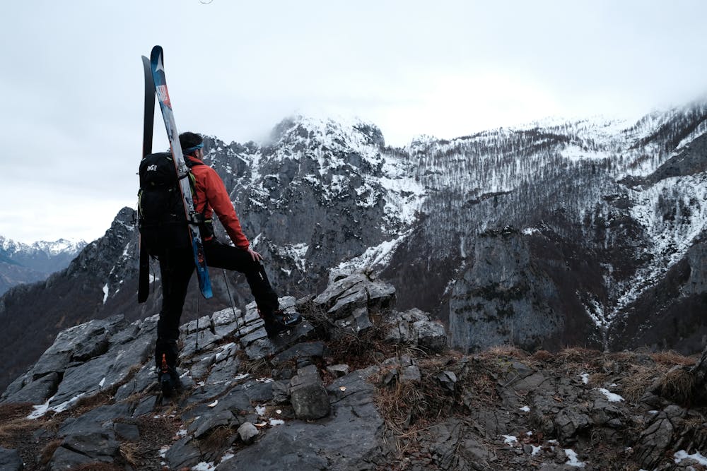
Very long and varied climb, which traces the path number 25 "della ganda" from Cainallo to the top of the northern Grigna where the Brioschi hut is located. In particularly favorable years, you can start with your skis on from the parking lot, but more and more frequently you need to bring your skis for a few stretches. Today (February 2, 2020) it was necessary to carry skis on the shoulders for about an hour. Follow the path up to the crossroads that leads to a fork in the road, at this point turn left remaining on a false level following the signs for the Brioschi refuge. Once at the huts of Moncodeno continue along the path until you reach the Bogani refuge (former Capanna Monza). From here go up the most obvious ridges, paying attention to the crevasses that are created due to the cavernous nature of the Grigna. You can also overcome the last stretch, more sloping, with your skis on, making numerous uphill curves. The descent can be performed with many variations, it is advisable to follow the ascent track at least in the first few times, to avoid ending up in crevasses.
Difficulty
Difficult
Serious gradient of 30-38 degrees where a real risk of slipping exists.
Medium Exposure (E2)

As well as the slope itself, there are some obstacles (such as rock outcrops) which could aggravate injury.
Remoteness

Close to help in case of emergency.
Best time to visit
Features
- Alpine
- Couloir
- Ski Mountaineering
Equipment required
- Skins
- Ice axe
- Crampons