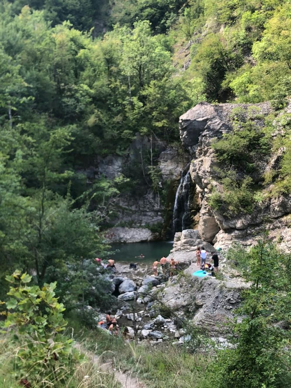
Anello monte Osero cascate del Perino
Excellent for a dip in the waterfalls at the end of the route
Hiking Difficult
- Distance
- 12 km
- Ascent
- 711 m
- Descent
- 711 m
- Duration
- 3-4 hrs
- Low Point
- 594 m
- High Point
- 1.3 km
- Gradient
- 10˚

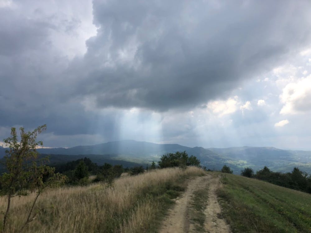
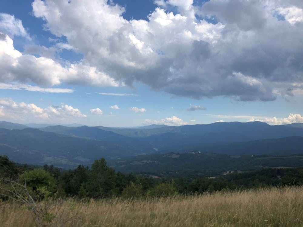
Bellissimo percorso per un tuffo in acqua a fine camminata. Il cammino è un po' accidentato, soprattutto nelle sezioni in mezzo al bosco e vicino alle cascate che soffrono ancora dopo qualche frana. Nessun pericolo di caduta, bisogna solo stare un po' attenti nel superare gli ostacoli. Se il vostro obiettivo è quello di terminare con il relax alle cascate, l'ovvia direzione è quella che prevede la salita attraverso il bosco tra Calenzano e il monte Osero, nonostante ciò, consiglierei il percorso contrario passando prima dalle cascate e finendo con la discesa attraverso il bosco perché molto più morbida rispetto ai tratti molto sassosi sull'altro versante. ATTENZIONE: niente acqua potabile sul percorso
- •
- •
- •
Description
Beautiful path for a dip in the water at the end of the walk. The path is a bit bumpy, especially in the sections in the middle of the woods and near the waterfalls that still suffer after some landslides. No danger of falling, you just have to be a little careful in overcoming obstacles. If your goal is to finish with relaxation at the waterfalls, the obvious direction is the one that involves the ascent through the woods between Calenzano and Mount Osero, despite this, I would recommend the opposite route passing first from the falls and ending with the descent through the woods because it is much softer than the very stony sections on the other side. ATTENTION: no drinking water on the route
Difficulty
Difficult
Hiking trails where obstacles such as rocks or roots are prevalent. Some obstacles can require care to step over or around. At times, the trail can be worn and eroded. The grade of the trail is generally quite steep, and can often lead to strenuous hiking.
Low Exposure

The path is on completely flat land and potential injury is limited to falling over.
Remoteness
Close to help in case of emergency.
Best time to visit
Features
- Dog friendly
- Water features
- Forestry or heavy vegetation