Zweiter Sellaturm - Messner (V+)
Dolomites
Val Gardena/Alpe di Siusi
Campitello-Mazzin-Col Rodella
Trentino-Alto Adige
Alpinkletterroute von Reinhold und Günter Messner 1968
Alpine Climbing Severe
- Distance
- 2.2 km
- Ascent
- 303 m
- Descent
- 303 m
- Low Point
- 2.2 km
- High Point
- 2.5 km
- Gradient
- 35˚
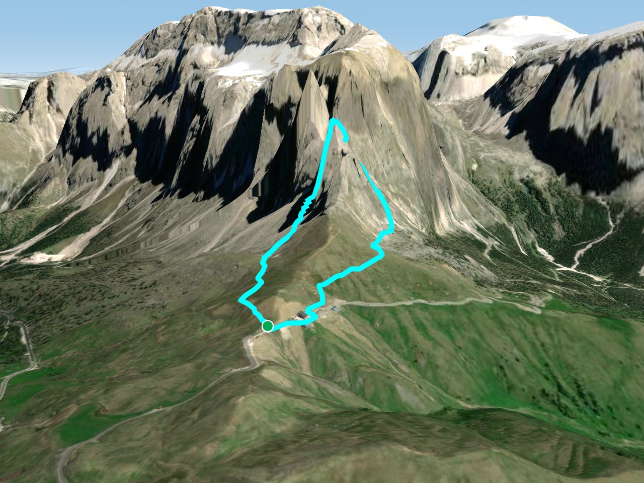
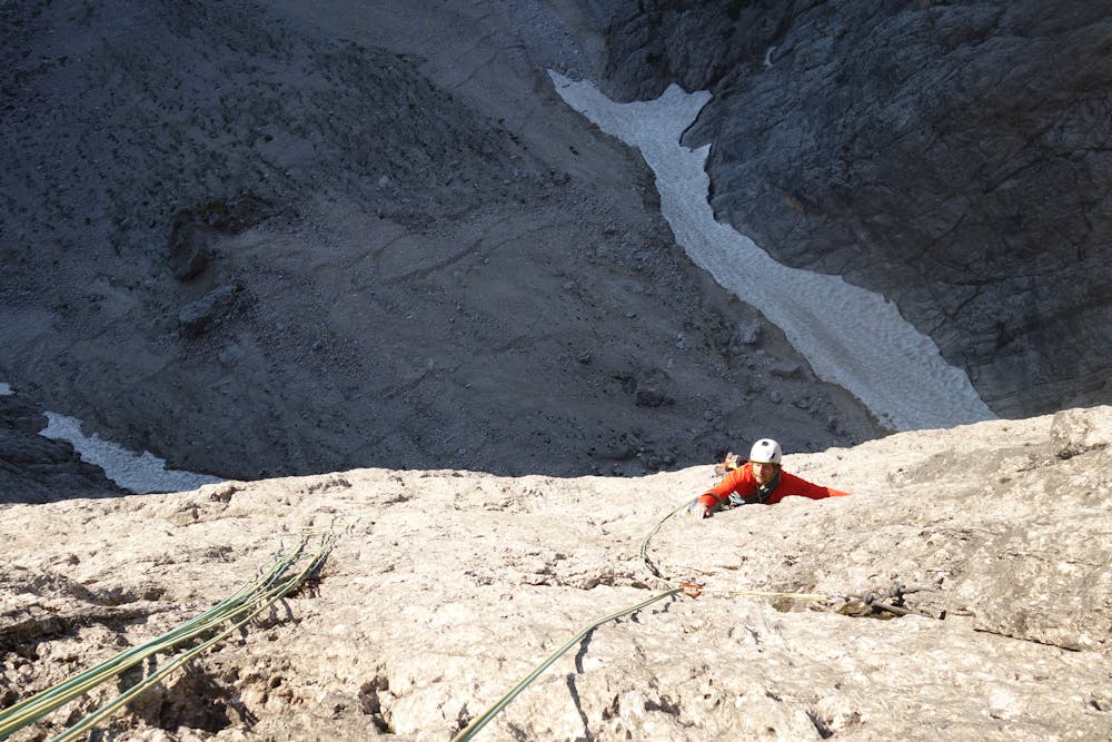
This is a popular alpine climbing route which is generally considered to be severe. It's very remote, it features high exposure and is typically done between June and September. From a low point of 2.2 km to the maximum altitude of 2.5 km, the route covers 2.2 km, 303 vertical metres of ascent and 303 vertical metres of descent. You'll need quickdraws, climbing shoes and wires and friends to complete it safely.
Description
Tourenbericht und Topo: https://www.suedtirolalpin.it/post/2-sellaturm-messner
Difficulty
Severe
Steep, sustained and serious terrain on rock/ice. Routes will be long, exposed and possibly committing. D, D+
High Exposure

Much of the route is difficult to protect and a fall could be disastrous at certain points.
Remoteness
Little chance of being seen or helped in case of an accident.
Best time to visit
Equipment required
- Quickdraws
- Climbing Shoes
- Wires and Friends