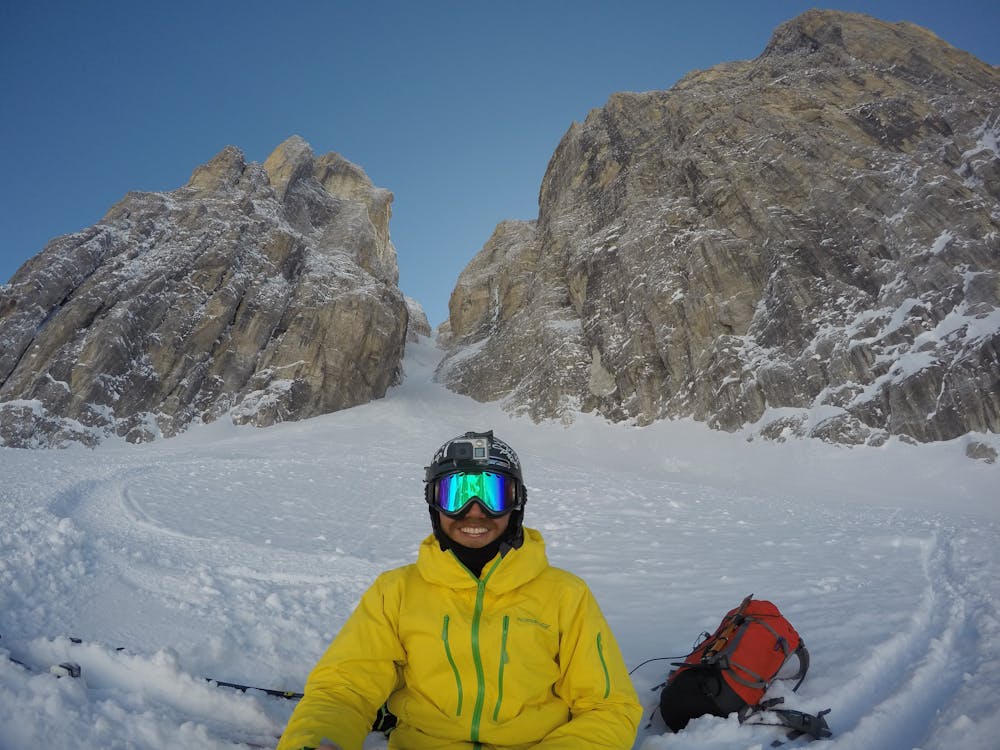
Canalone Neri
Trentino-Alto Adige
Linea storica, uno dei Canali più famosi in Dolomiti
Freeride Skiing Severe
- Distance
- 1 km
- Ascent
- 37 m
- Descent
- 855 m
- Low Point
- 2.2 km
- High Point
- 3.1 km
- Gradient
- 66˚

This is a popular freeride skiing route which is generally considered to be severe. It's very remote, it features low exposure (e1) and is typically done between March and May. From a low point of 2.2 km to the maximum altitude of 3.1 km, the route covers 1 km, 37 vertical metres of ascent and 855 vertical metres of descent. It's graded 5.1 and Labande grade 5. You'll need skins, ice axe and crampons to complete it safely.
Description
900 m di lunghezza e pendenza quasi regolare in media attorno ai 50 gradi. In base alle condizioni può essere utile un chiodo da ghiaccio e un cordino
Difficulty
Severe
Steep skiing at 38-45 degrees. This requires very good technique and the risk of falling has serious consequences.
Low Exposure (E1)

Exposure is limited to that of the slope itself. Getting hurt is still likely if the slope is steep and/or the snow is hard.
Remoteness

Little chance of being seen or helped in case of an accident.
Best time to visit
Features
- Couloir
- Glacier
Equipment required
- Skins
- Ice axe
- Crampons