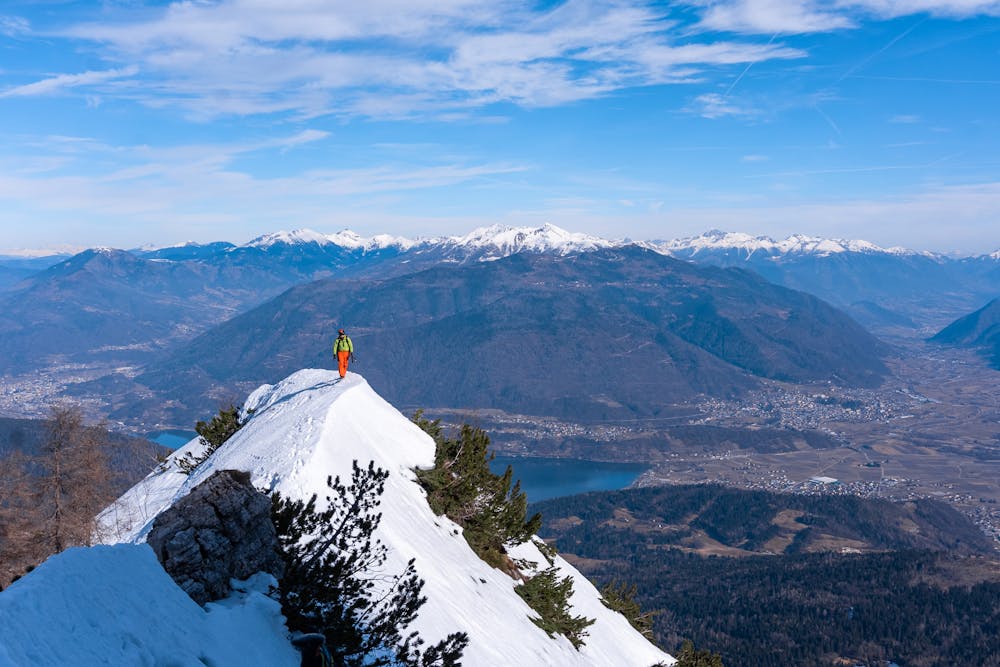
Becco di Filadonna Winter Mountaineering
Trentino-Alto Adige
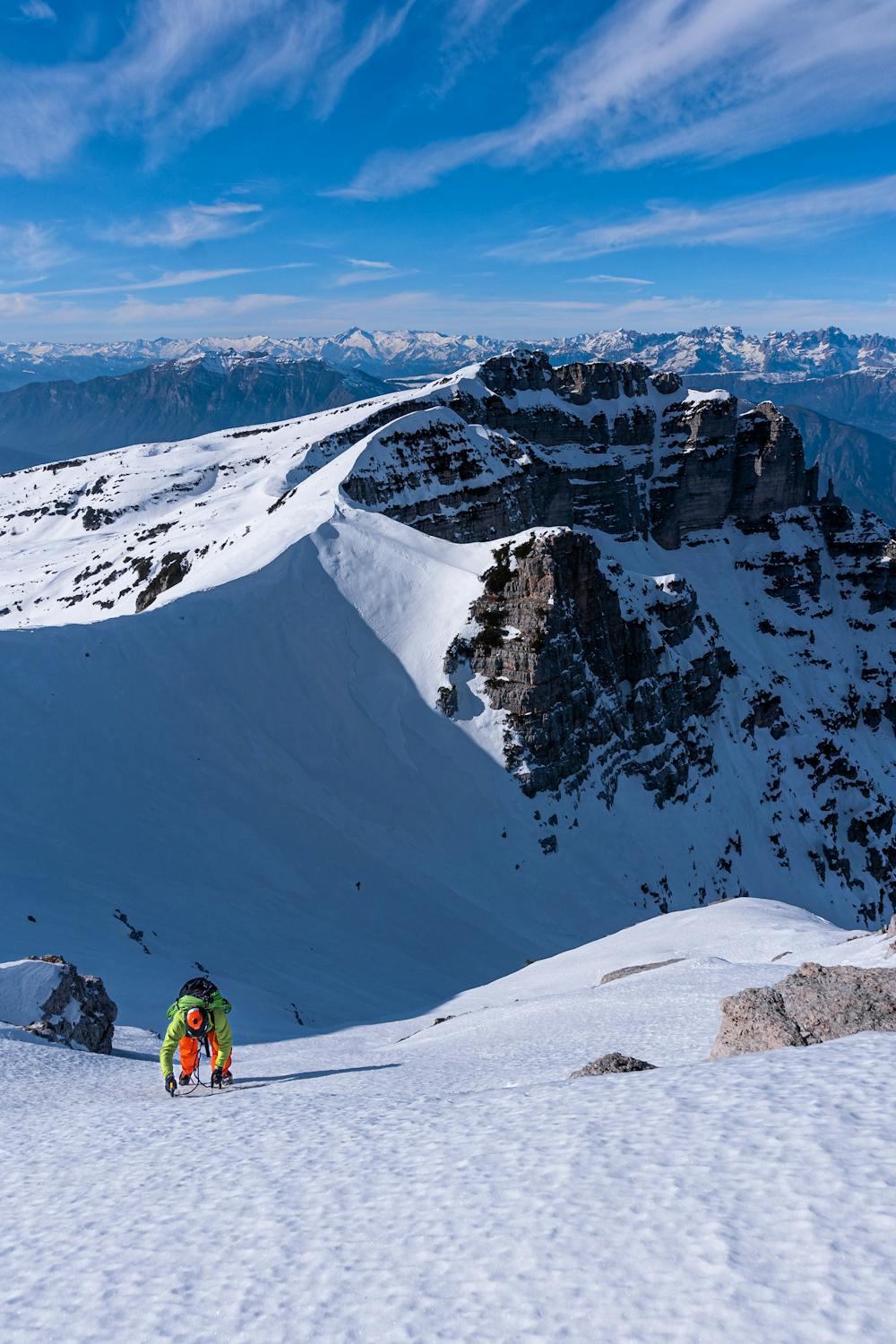
Very steep North Face with hard snow and ice (crampons and ice axes needed!!!) and with 1000 meters of drop, descent in circle from an easy path.
Hiking Extreme
- Distance
- 10 km
- Ascent
- 1.2 km
- Descent
- 1.2 km
- Duration
- 3-4 hrs
- Low Point
- 995 m
- High Point
- 2.1 km
- Gradient
- 27˚

Starting from Malga Doss da Bugo (also called Malga Faè) you take the path that leads to "Bivacco Vigolana" (E445). At the opening of the second valley (check map for reference) proceed straight up the canyon aiming for the top of the mountain.

Description
Once reached the top follow the ridge while descending on a plateau (many times you can see a trace or even footprint also in winter time). Arrived at a little pass called "Bus de le Zole" you begin the descent in direction of Rifugio Casarotta.
While descending you find a first path crossing that leads to Mount Spilech (don't take it, continue on your right) and after 250 meters you find a second path crossing in direction of Rigugio Paludei (E432; don't mind the signs "closed path" cause it's completely walkable). Once you arrive on a large forest road proceed on it in direction of Malga Dos Alto or Malga Dos da Bugo to return to the starting point.
Difficulty
Extreme
Scrambling up mountains and along technical trails with moderate fall exposure. Handholds are necessary to navigate the trail in its entirety, although they are not necessary at all times. Some obstacles can be very large and difficult to navigate, and the grades can often be near-vertical. The challenge of the trail and the steepness of the grade results in very strenuous hiking. Hikes of this difficulty blur the lines between "hiking" and "climbing".
Extreme Exposure

Some trail sections are extremely exposed where falling will almost certainly result in serious injury or death.
Remoteness

Little chance of being seen or helped in case of an accident.
Best time to visit
Features
- Alpine
- Summit Hike