6 routes · Mountain Biking
The first leg of the incredible 6-day crossing of the Western Alps.
Mountain Biking Difficult

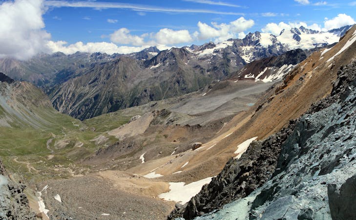
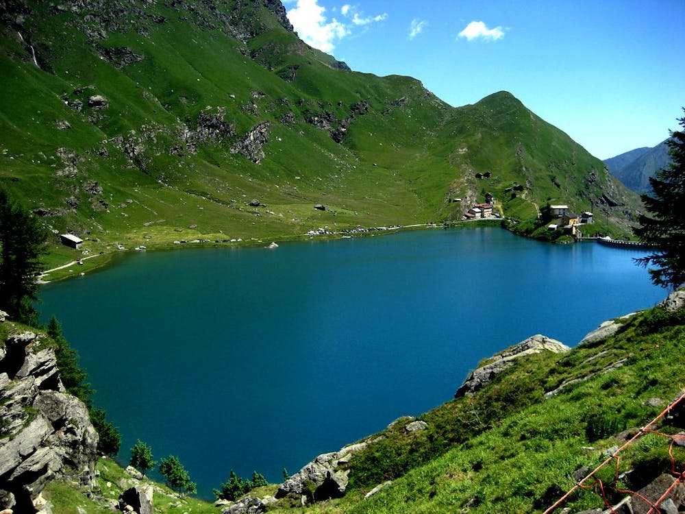
Beginning at Susa train station, leave the town in the direction of Urbiano, following signs for “Rocciamelone.” Brace yourself for a steep start as you climb up and around part of the 3535m Rocciamelone mountain on terrain that gets progressively more challenging. The asphalt surface quickly changes into gravel, and then at around 2000m, the path is no longer ridable. You will have to walk for several kilometres, passing the Capanna Sociale Aurelio Ravetto hut at around 2500m, where you can stop for a breather. After the hut, you will have another short burst of pushing until you come to Colle Croce di Ferro, where you begin a technically demanding stone slab descent to the beautiful Lago di Malciaussia, which is the highlight of the day’s ride. After the lake, you continue to descend down to the village of Usseglio.
Difficult
Mostly stable trail tread with some variability featuring larger and more unavoidable obstacles that may include, but not be limited to: bigger stones, roots, steps, and narrow curves. Compared to lower intermediate, technical difficulty is more advanced and grades of slopes are steeper. Ideal for upper intermediate riders.

Some trail sections have exposed ledges or steep ascents/descents where falling could cause serious injury.

Away from help but easily accessed.
6 routes · Mountain Biking