Fra Sesia e Po
Trino (64 km)
Mountain Biking Easy
- Distance
- 64 km
- Ascent
- 139 m
- Descent
- 139 m
- Duration
- 4-5 hrs
- Low Point
- 98 m
- High Point
- 144 m
- Gradient
- 1˚

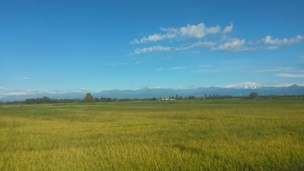
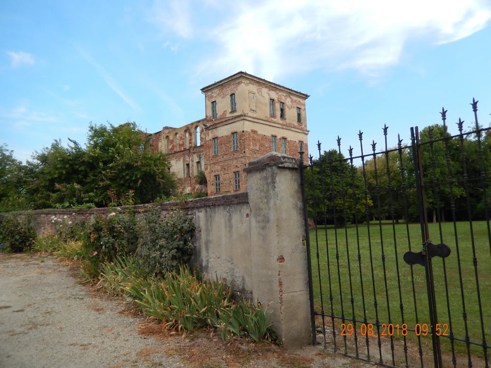
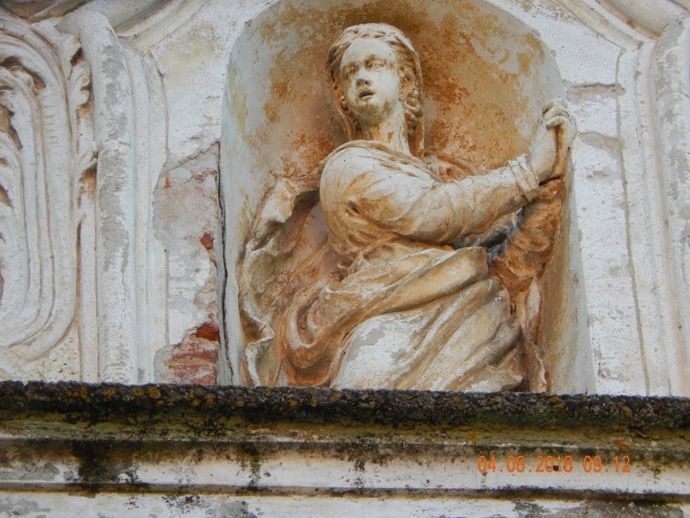
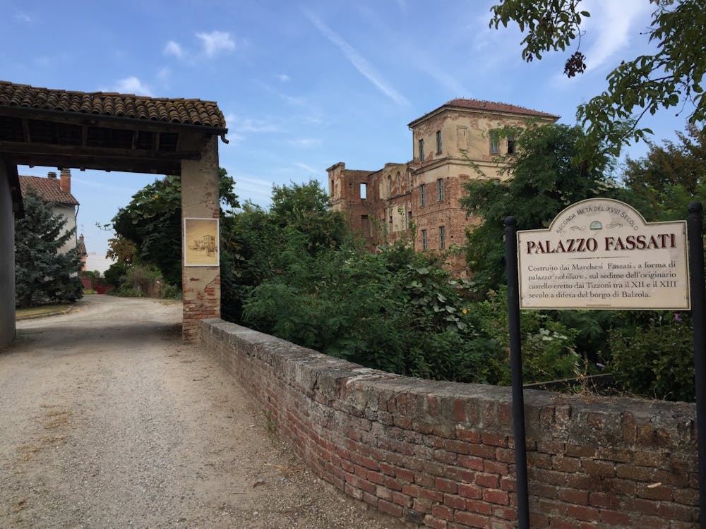
Description of the route Along the rice fields, passing through the typical farmsteads once populated by the peasants and now often in ruins, you can follow the gravel roads used for threshing rice along the embankment of the Sesia near the confluence of the two rivers. Stages of the route and points of interest Departure from Trino Vercellese, from Piazza Garibaldi: Exit the square, turn right and pass in front of the Bar, at the traffic lights turn left and continue to the underpass of the SS455, immediately after turn left on the dirt road that runs along the state road, you pass the visible roundabout of Trino and turn into the second dirt road (white road), continuing you pass in front of a ruined chapel and after about 600 m. turn right and enter Robella at the crossroads with the SP20 in front of the church, turn left, continue until the next crossroads and turn right towards "Torrione" (a typical example of a farmhouse used by the peasants, with a military building of great value, but in a poor state of preservation), we go down for 400 m. up to the church to take a look then we return to our footsteps and at the intersection, turn right initially paved and then Bianca, we are always on this road, leads us to "Rive" we enter following the directions of the road, in the main street we turn right and pass in front of the church, leaving the village we turn into the first road on the right, after two bends turn left and continue past the railway until you reach a farmhouse and turn immediately behind it, at the next farmhouse turn left, you arrive on the SP25 turn left you go to "Villanova" and always on asphalt you reach "Motte De Conti", you pass in front of the castle and half ruined in the main square, then turn right out of the village and after the bridge over the "canal Bona or Marcova", take the second road on the left, you arrive on the embankment of the "River Sesia", turn right and continue passing under the bridge and take the SS596 dir, turn left and, after the bend and before the level crossing turn left on dirt road, and continue until it begins the asphalt, after a few meters turn left on the bridge of the canal Stura (!) from here you arrive on the embankment that runs along the river Po and then at the gates of Casale Monferrato, at the end of the embankment turn right and go near the level crossing turn left on an asphalt road that crosses the SP31 bis leads us to Casale Popolo. Continue on the main road that crosses the country in the direction of Balzola, pass the church and after about a km. and the last houses of the Canton Corno in the left bend turn right on the railway Cavalca, the road becomes Inghiaiata (white) after 2 km. about and without any detour you get to Balzola in front of the church, take a look at the remains of Palazzo Fassati (also known as Castello Vecchio) then head towards the square and turn right, then turn right again in the first small street that passes in front of the rice mill and on the other side of Palazzo Fassati, here begins a dirt road, stay on without deviating, you arrive on the SP24 turn left and we go to take on the right the white road with indication Cascina Morabina, we continue and cross the SS455 and we enter in Trino Vercellese passing in front of the cemetery, we arrive to the traffic light and after the Bar to turn left and we arrive in Piazza Garibaldi, our point of departure.
- •
- •
- •
- •
Difficulty
Easy
Mostly smooth and non-technical singletrack with unavoidable obstacles 2in/5cm tall or less. Avoidable obstacles may be present. Ideal for beginner riders.
Medium Exposure

The trail contains some obstacles such as outcroppings and rock which could cause injury.
Remoteness

Close to help in case of emergency.